This is the Google (Earth) archive | Back to Main
tobearchived after 6 years
Posted on Monday, September 17, 2012

After exactly 6 years (first post) its time to archive this blog. I've had a great time keeping a trail of my online journeys over these past 6 years and it served me well in my worldly travels, but its time for a new itinerary. I will keep the content up for the Google but I won't be posting here anymore. If you're interested in staying connected, follow me on Twitter @tobedetermined until I find a new home to share my current and future travels.
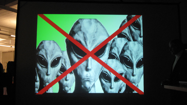
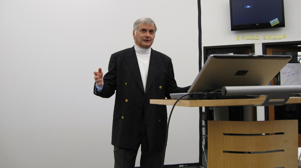
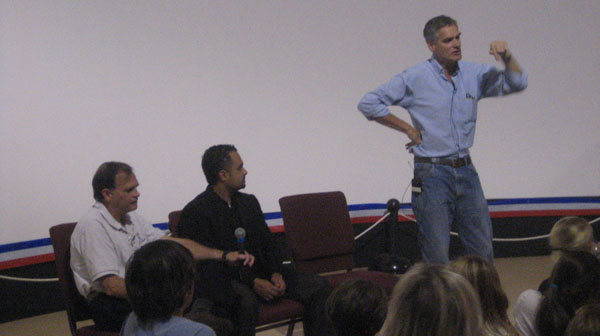
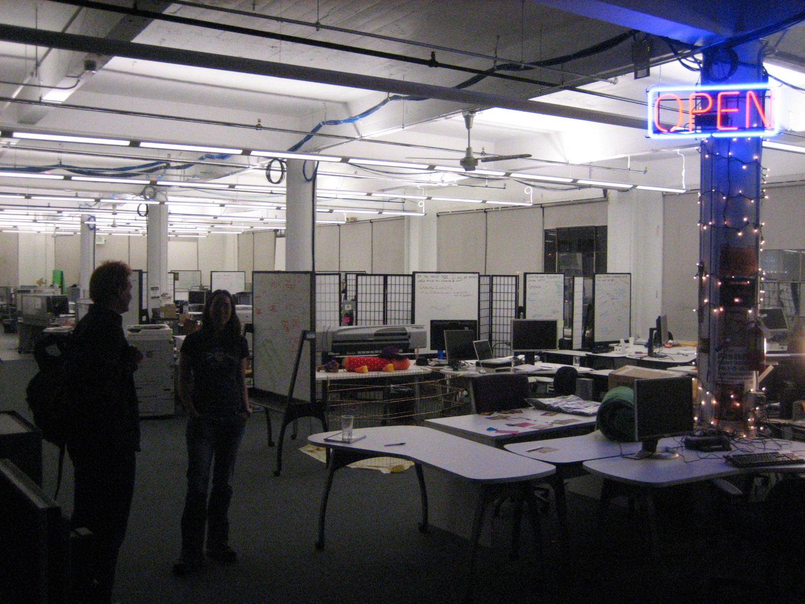
Nicholas Carr at Google Atmosphere
Posted on Saturday, October 31, 2009
Eating Your Own Dogfood
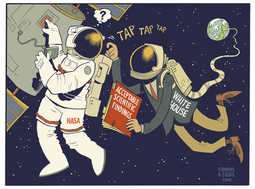
Posted on Thursday, January 15, 2009

Its a question that has stuck with me for a while: how to get NASA to eat its own dogfood. (((and what would that actually mean in the context of a space agency?)))
(((btw, the 3 ((( thingie I stole from Bruce Sterling's Beyond the Beyond blog. Its like meta discussing your own blogpost...)))
There are different takes on this, and not having had the time to think things completely through sofar (and suspicious whether I'll have it in the near term), i'll just post some thoughts here and plan to come back to it at a later stage and possibly in a different shape and form. (((FYI, I find my twitter updates these days greatly outnumber the number of blogposts I manage to write and am happy about actually going live (there is an increasing number of unfinished blog posts in my movabletype blog webapp), so for all you ~50 readers of this blog, if you're really interested in my irregular updates and ramblings, why don't you take the red pill and subscribe to my twitter feeds on tobedetermined and NASA_Ames_Web because that's where you'll find an up-to-date and engaged research record of implementing the ideas that have been floating around on this blog since 2006, i.e. moving towards a merger of outer space and cyberspace...because make no mistake: its happening, and its happening right here, at NASA Ames Research Center.)))
Part I: eating your own dogfood is a term commonly used in the sofware business when employees of a company use their own tools and thereby create a feedback loop wherein the builders of tools also get to be the users of those same tools, leading to a much faster iterative usability loop and a very efficient way to speed up the evolution of a tool. From what I heard, Google even uses the term 'dogfood' for their internal products. In the case of NASA, one tool in case that would greatly benefit from people eating their own dogfood is its web publishing and communication tool, commonly known as The CMS.
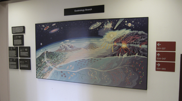
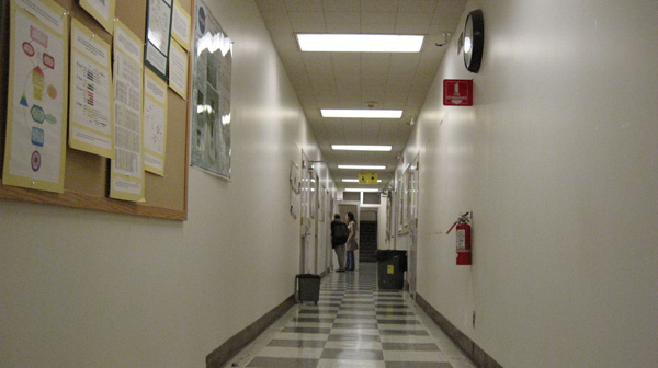
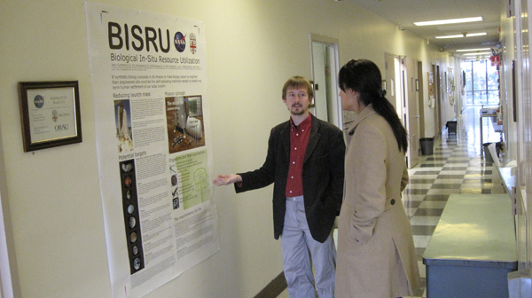
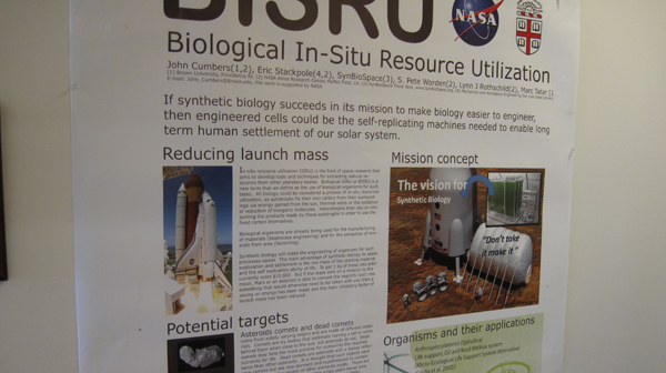
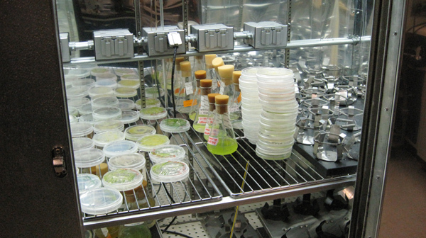
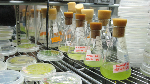
Part II: Following a talk on synthetic biology a month or so ago at the Long Now series, I finally managed to get a tour of the labs here at Ames where scientists work on the future of space exploration. In particular, John Cumbers, Graduate student synthetic biology from Brown University, showed me and Delia Santiago around at his office and labs where he works on cultivating and studying organisms for potential application in space exploration (think: biological fuel generation, etc). The underlying objective here is that space exploration will not get anywhere if we stay stuck in the paradigm of carrying everything we need from the Earth. Launch costs are prohibitively expensive if we need to prepare for a trip by taking every bit of consumable with us upon embarking on the trip (((the Columbus metaphor comes to mind but I am going to skilfully navigate around this outdated metaphor))).
John is particularly interested in applying synthetic biology in realising Biological In Situ Resource Utilization (BISRU), something that has the potential to get us to places where we can build on our own consumables "off the land". One example he gave was testing it out on a comet 2 years away from Earth, with a 2 year return cycle. The labs here at Ames are fascinating, GATTACA comes to mind but in a different context.
The field of synthetic biology is still so new there are no good text books on the subject (((here's a good primer))). They do have conferences about it though.
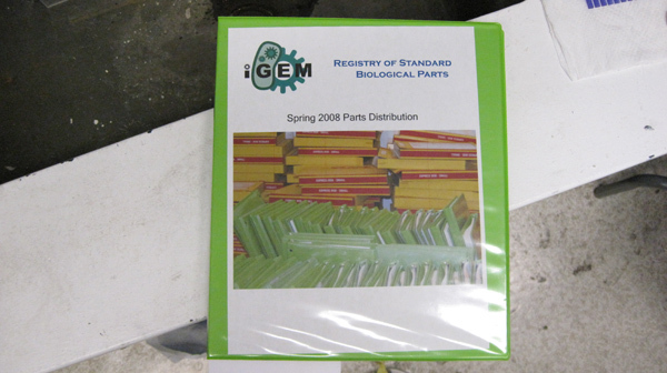
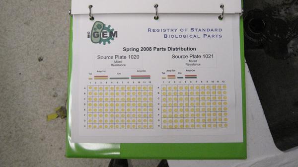
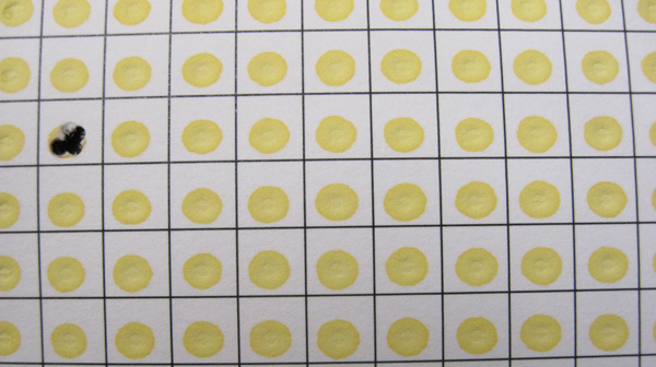
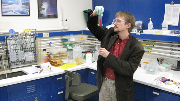
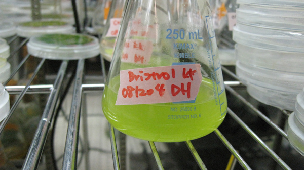
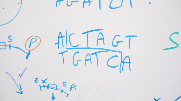
Below are some images I made while following John around (more at Flickr). Most interesting, the book with the yellow dots is actually a real-life catalogue of genetic building blocks, called the 'Registry of Standard Biological Parts'. Whoever is building genetically engineered organisms can use a piece of pre-fab genetic code from this catalogue by dipping a pipet on the yellow spot, thereby subtracting some specific DNA sample. Its like LEGO, but the biological version of it. Welcome to the future...
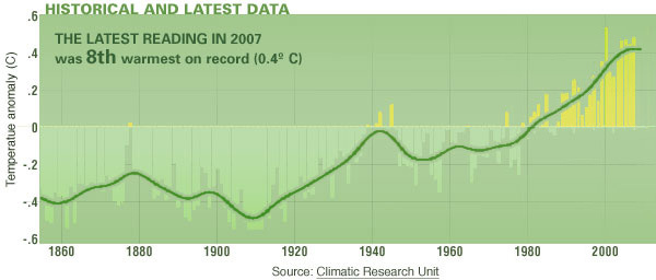
Some Numbers from Michael T Jones' talk at AGU '08
Posted on Sunday, December 28, 2008
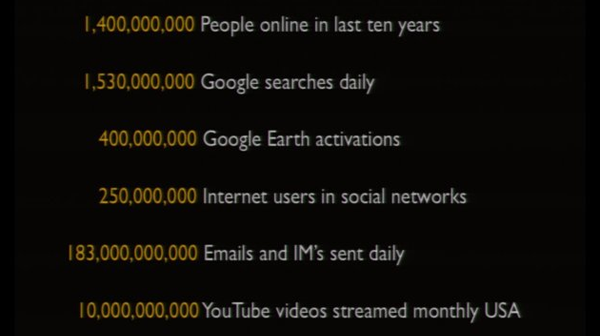
75 sweet minutes of Michael T Jones (Chief Technology Advocate @ Google) at the AGU earlier this month.
On the Move...
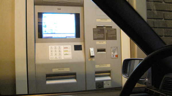
Posted on Friday, December 19, 2008
...Nothing beats having a Drive-Through-ATM when you're on the move...(hoping to run into a drive-through-bathroom soon...)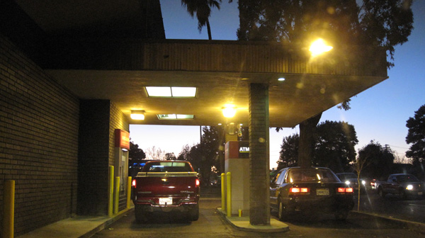
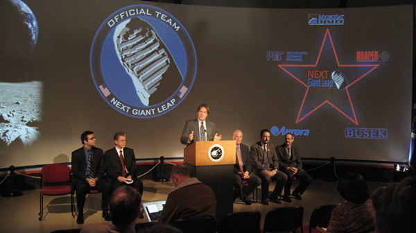
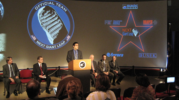
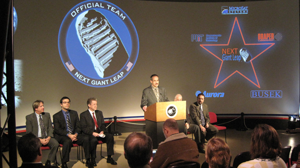
GLXP Mystery Team Reveals Itself at NASA Ames
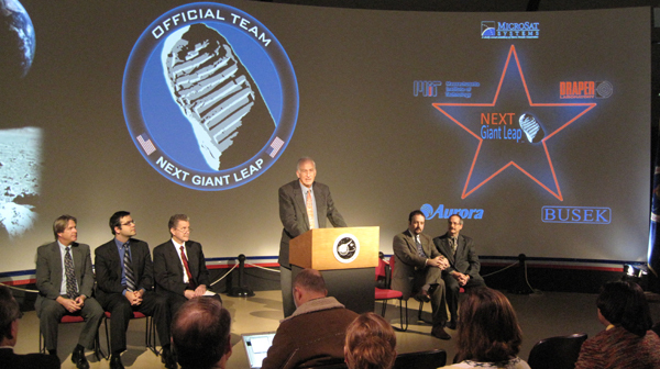
Posted on Wednesday, December 17, 2008
Earlier this morning, the GLXP Mystery Team revealed its identity here at the NASA Ames Research Center. From top to bottom its Gary Martin (Director of NASA Ames' New Ventures and Communications Directorate [aka Code V]), Will Pomerantz (X PRIZE Senior Director of Space Projects), MSI president John Roth Michael Joyce (Leading the now-not-a-mystery-team-anymore-but-called-Next-Giant-Leap team), and one of my favorite NASA astronauts Jeffrey Hoffman. More on the unveiling at CNET and more on the team's partners at the NGL website.
Another Peak Into the Future
Posted on Tuesday, December 9, 2008
Some of the sensors I blogged about in this post will likely come out of the Small Spacecraft Division here at Ames. (Click on the bottom image for a full-res closeup)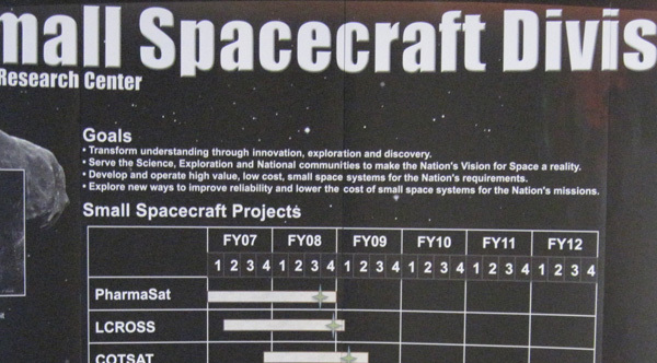
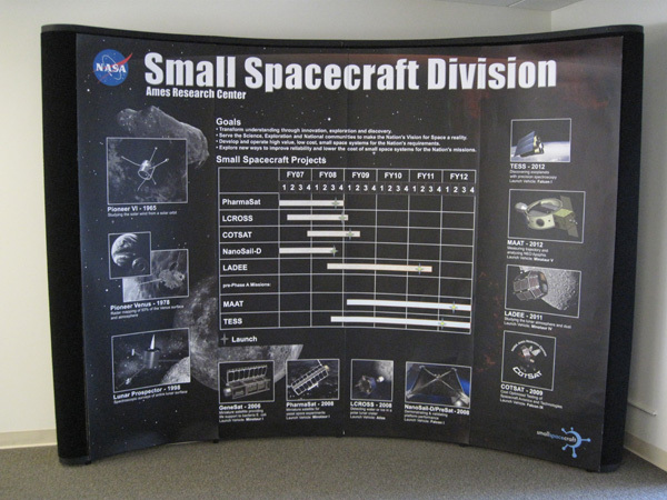
Click for full res version
Web Meets Out-Of-This-World
Posted on Thursday, December 4, 2008
2 days ago I watched another two 30min. videos from last month's Web2.0 Summit 'Web Meets World'. One an interview with Al Gore, the other one an interview with Michael Pollan. Given this year's theme 'Web Meets World', both interviews revolved around discussions on how best practices and business models from the web and software world could be applied to re-invent and/or re-invigorate other industries 'in the real world': the outdated energy industry in Al's talk, the dysfunctional food industry in Michael's talk.
Reading a book on the Django Web Application Framework last night, I realised this question just as much applies to the space industry. Its something I remember Pete Worden (our current NASA Ames Center Director) being pretty vocal about back in 2006. Teaching at the ISU Summer Session in Strasbourg, he made a strong case for the need for standards to facilitate innovation in the space industry. Standards for the data coming back from space, standards for the telecommunication protocols used in space, standards in launch and operational systems. And since he's been here at NASA Ames, he spearheaded an initiative to implement that kind of modular thinking in the actual physical design of a spacecraft, the Modular Common Spacecraft Bus (image above). Its an ubergizmo-worthy system design that can be used both for orbiter missions as well as for lander missions and that was recently selected by Odyssey Moon as their preferred platform to take a shot at the Google Lunar X-Prize.
I can see down the road a satellite gathering data somewhere in the Solar System is conceptually not that different from say a network of smartphones tied into a sensor network, or a webcam streaming images live on the web. Read for example what the Google Lunar X prize has in its competition guidelines in order to win the Grand Prize:
MOONCAST: The Mooncast consists of digital data that must be collected and transmitted to the Earth composed of the following:
High resolution 360º panoramic photographs taken on the surface of the Moon;
Self portraits of the rover taken on the surface of the Moon;
Near-real time videos showing the craft’s journey along the lunar surface;
High Definition (HD) video;
Transmission of a cached set of data, loaded on the craft before launch (e.g. first email from the Moon).
Teams will be required to send a Mooncast detailing their arrival on the lunar surface, and a second Mooncast that provides imagery and video of their journey roaming the lunar surface. All told, the Mooncasts will represent approximately a Gigabyte of stunning content returned to the Earth.
In the end, its all the same. Input devices (in this case: satellites) feed into the web, the web as platform extracts (collective) intelligence out of this data (if you're lucky), the network delivers the data/media to its users/consumers, and voila: Web Meets Out-Of-This-World. Its already happening (yes, it is). Or as one of my favorite quotes from William Gibson goes:
The Future is here, its just not evenly distributed yet.
We’ve built this spaceship...
Posted on Tuesday, December 2, 2008
...but we really don’t know where it will take us.” The last sentence in this indepth NYT article on Google and privacy concerns.
Participatory Impacting the Moon
Posted on Sunday, November 23, 2008
A probe released from Chandryaan-1 impacted the moon last week (more & images). A nice dress rehearsal for the LCROSS mission which is looking for lunar impact next year (LCROSS is developed here at NASA Ames). Didn't see any realtime coverage though. No live spacecraft images coming online as it is heading towards impact...so there is still the 'innovative/surprise factor' up for grabs for LCROSS. Like @MarsPhoenix grabbed it for the twitter platform.
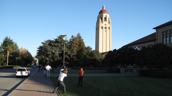
Autumn in the Valley (today's pitstop #7)
Posted on Sunday, November 16, 2008
How big a change from autumn in Amsterdam, where its probably raining cats and dogs right now. Weather here in the Valley has been perfect today, feels like summer with beautiful trees. Below are a few snapshots I took from the Hoover Tower on Stanford campus yesterday while attending the Open Source unconference, co-organised by a former NASA Ames collegue. The view is towards Southbay, with Palo Alto on the left of the image, and NASA Ames in the middle, noticable by the big hangers (click panorama image to enlarge). More images here. Google map with locations of all pitstop posts embedded below.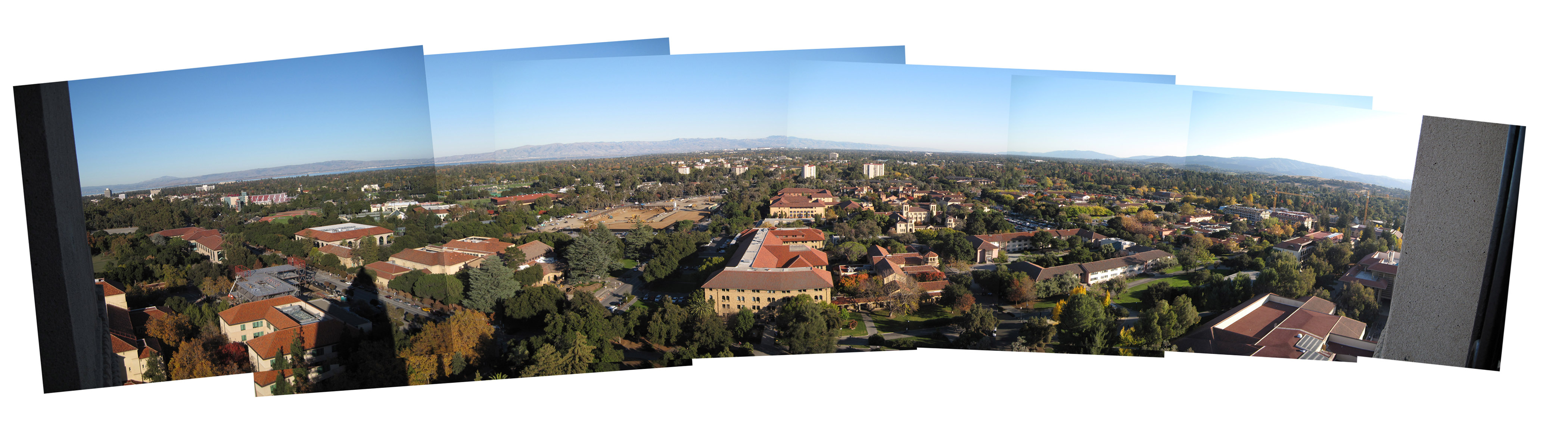
View Larger Map
A Google For Government
Posted on Friday, November 14, 2008
A Google for Government? Ha! Why not a Google for Galaxy?

Dinner TV: Where Games and SETI Collide
Posted on Wednesday, November 12, 2008
As a follow up to the previous post, I just found this informal dinner talk between Will Wright and Jill Tarter organised by SEED. Its embedded below, from the looks of it in the code served to you from the servers of Amazon's Web Service...![]()
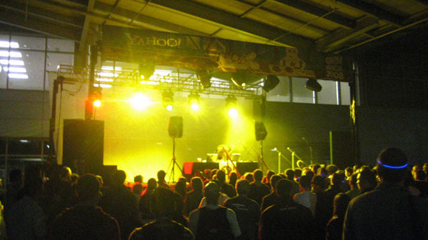
Every Full Moon in San Francisco
Posted on Wednesday, November 12, 2008
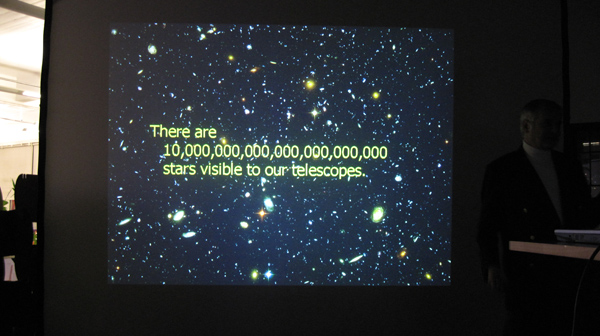
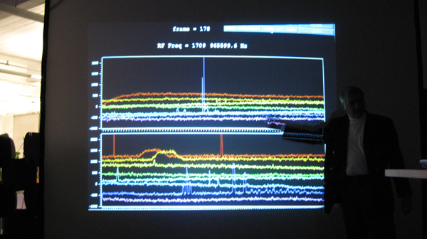
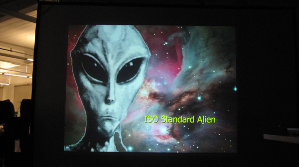
Finally had a chance to go up to the city again yesterday to listen to a talk at Colab's Luna Philosophie. This time it was Seth Shostak, senior astronomer at the SETI Institute here in Mountain View, giving us earthlings a glimpse of when we can expect to discover alien life out there. And to my surprise, he was pretty confident it would be possible within 25 years. Looks like it ties in nicely with either his remaining career (his joke) or with the timeline of the Singularity. Btw, in case you're wondering, the city really did turn pink from where I was sitting on the top of the Marriot before heading over to the Yahoo Brickhouse for the talk (click the widescreen for a full res version). Some more images are here.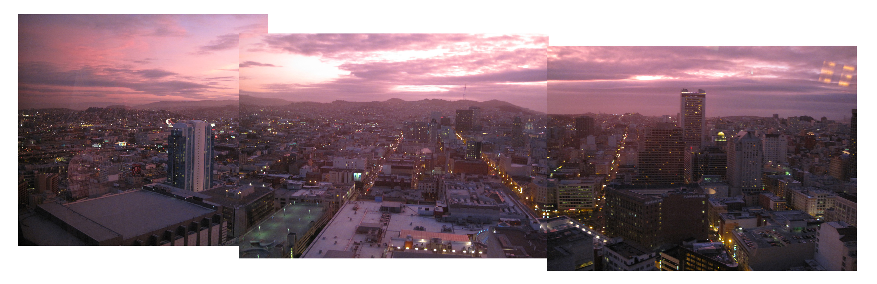


The Web as Platform...for the Exploration of Outer Space
Posted on Monday, November 3, 2008
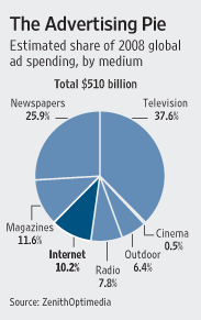
Can't wait to see NASA increase government's piece of the cake here (more on the pie chart at O'Reilly Radar and the originating post entitled '1,000 Web API's' over at ProgrammableWeb). I mean, if the New York Times is able to open up their platform (see for example their Open NYT blog and their developer site), shouldn't NASA be able to do the same? There is already a lot of NASA data out there on the web, but its scattered over as many different websites. Bringing everything under one easy-to-use platform (think: developer platforms from the likes of Google, Yahoo, Microsoft, Amazon etc.) would be a great achievement. And it would make perfect sense, given the nature and the amount of data NASA gathers through its sensors (images, videos, temperature readings, what have you...media equals data equals media these days right?). NASA as a service oriented agency providing the sensors and the resulting platform of data for scientists and anybody with an Internet connection to tap into for scientific research and participatory exploration (earlier post). I can't start to think what types of innovation would result from that. The ease of availability of data (for machines) being one of the biggest 'competitive' advantages in the web3.0 [sic] years ahead. Reminds me of a hack on an image I made back in the days of my thesis embedded below. 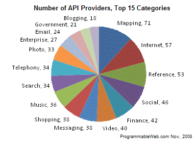
First Images of the Earth from Chyandrayaan-1
Posted on Monday, November 3, 2008
And quite exquisite ones as well (see earlier post). Click the images for full res. More from the Indian Space Research Organisation (ISRO) at this Press Release from last friday 31st October 2008. More on Chyandrayaan-1 at its own website. (all links via)

Building The Interface To the Planetary Sensor Web
Posted on Thursday, October 16, 2008
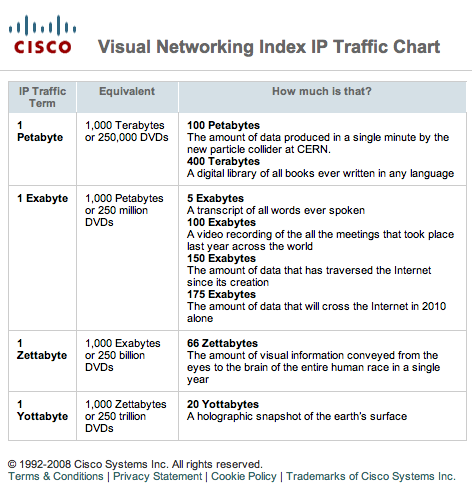
JPL launched it newly designed website today, including a dedicated site on global climate change with the telling subtitle 'NASA's Eyes on the Earth' (CNN has more). In these times of endless stock exchange graphs, stats and scares, its great to see a similar data vis design pattern emerge with the early steps towards a planetary sensor web user interface (if only we could swap the trend in above graphs with the NYSE). Sofar it seems satellite data is not really fed real-time (at least not in an all encompassing & comprehensive way) but I'm sure we'll get there, including open API's for everyone to leverage the sea of space based sensor data about the state of our planet (and beyond). On a related note, O'Reilly just released a Radar report on Where2.0 with a great introduction by Tim O'Reilly.

Fly Me To The Moon
Posted on Sunday, October 12, 2008
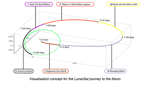
Just finished reading a great book written by Edward Belbruno on his design of advanced trajectories called "Weak Stability Boundary Trajectories". Trajectories that helped save several spacecraft stuck in Low Earth Orbit, like the Japanese Hiten spacecraft. He gives a beautiful description of how a theoretical mathematician enters the space industry (at JPL) and comes up with a highly innovative way to think about trajectory design and gravitational fields. Basically, it comes down to using the gravitational fields of the Earth and Moon to have a "ballistic capture" into Lunar orbit. One of the metaphors he uses is the wave surfer. Be too slow, and the wave passes you by. Be too fast, and the wave won't catch up with you. In Belbruno's case, he is talking about gravitational attraction (not exactly waves [at least, not it his case], but the metaphor still works to explain the idea). Brings back memories of 10 years ago when I was working as part of my thesis on a mission that was planned to take one of these fuel-efficient trajectories to the Moon (image above was my script to use onboard cameras to film the Earth during the 90-day Lunar transfer based on trajectory design by Robin Biesbroek, the green circle is the moon's orbit around the Earth). Beautiful to read how innovation in space exploration happens. And he even manages to bring Vincent van Gogh's Starry Night into his conceptual framework (podcast with Belbruno at The Edge).
Nova Spivack Talks about Role of Media in Future Global Brain
Posted on Friday, October 10, 2008
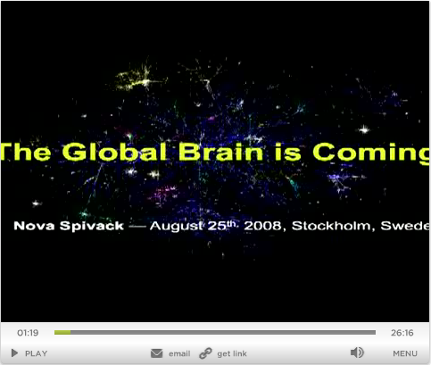
In reference to my previous post, this is what I call an INSPIRING start of a 3-day weekend ;-). Nova basically calls it my favorite talk out of all the talks I have given (more videos from GRID08). I hope whoever gets to decide on where to spend the money for SEC. 407 408 of the NASA Authorization Act 2008 takes the time to listen to his insights:
SEC. 407. PARTICIPATORY EXPLORATION.(a) In General- The Administrator shall develop a technology plan to enable dissemination of information to the public to allow the public to experience missions to the Moon, Mars, or other bodies within our solar system by leveraging advanced exploration technologies. The plan shall identify opportunities to leverage technologies in NASA's Constellation systems that deliver a rich, multi-media experience to the public, and that facilitate participation by the public, the private sector, and international partners. Technologies for collecting high-definition video, 3-dimensional images, and scientific data, along with the means to rapidly deliver this content through extended high bandwidth communications networks shall be considered as part of this plan. It shall include a review of high bandwidth radio and laser communications, high-definition video, stereo imagery, 3-dimensional scene cameras, and Internet routers in space, from orbit, and on the lunar surface. The plan shall also consider secondary cargo capability for technology validation and science mission opportunities. In addition, the plan shall identify opportunities to develop and demonstrate these technologies on the International Space Station and robotic missions to the Moon.
(b) Report- Not later than 270 days after the date of enactment of this Act, the Administrator shall submit the plan to the Committee on Science and Technology of the House of Representatives and the Committee on Commerce, Science, and Transportation of the Senate.
A Sobering Presentation from the Valley At The Start Of A 3-day Weekend
Posted on Friday, October 10, 2008
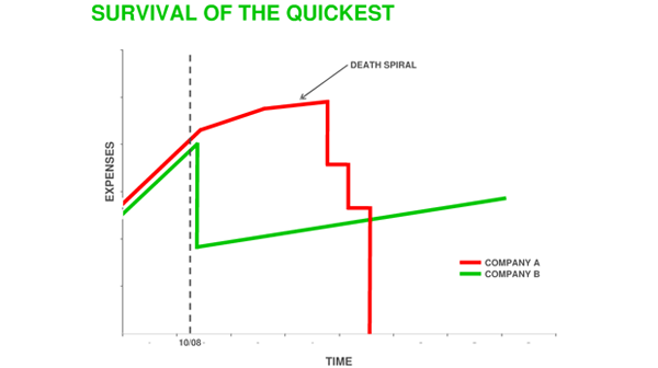
A presentation by Sequoia Venture Capital on how to survive the times ahead.
Software, The Final Endless Frontier
Posted on Tuesday, October 7, 2008
From a post by Vint Cerf in the series on Google's 10th anniversary:
A box of washing machine soap will become part of a service as Internet-enabled washing machines are managed by Web-based services that can configure and activate your washing machine. Scientific measurements and experimental results will be blogged and automatically entered into common data archives to facilitate the distribution, sharing and reproduction of experimental results. One might even imagine that scientific instruments could generate their own data blogs.I wonder when small sats finally turn into soap boxes. Vint continues:
These are but a few examples of the way in which the Internet will continue to surround and serve us in the future. The flexibility we have seen in the Internet is a consequence of one simple observation: the Internet is essentially a software artifact. As we have learned in the past several decades, software is an endless frontier. There is no limit to what can be programmed. If we can imagine it, there's a good chance it can be programmed. The Internet of the future will be suffused with software, information, data archives, and populated with devices, appliances, and people who are interacting with and through this rich fabric.Read the whole post here.
Nicolas Carr at The Colbert Report
Posted on Thursday, October 2, 2008
Besides the book, the interview refers to an article Carr wrote in the Atlantic entitled: "Is Google making us stupid" (via). I don't know about that, but Steve's mockery of continuous partial attention is something I see here a lot. Everybody is constantly checking their email and IM's on their iPhones: in meetings, at seminars, during lunch... The full Colbert episode is also available at Hulu but its US only, and the video expires in a week or 2.
Google's TechTalks Inspire NASA Ames
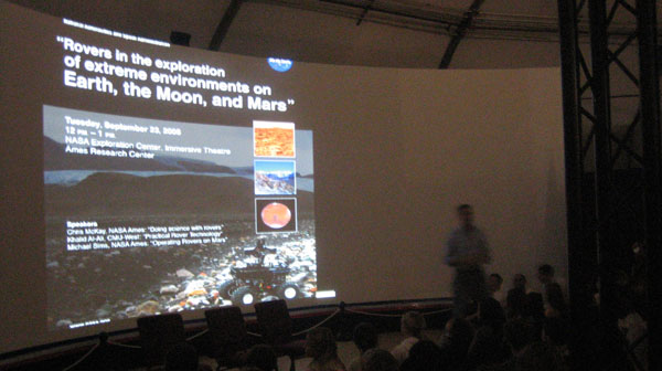
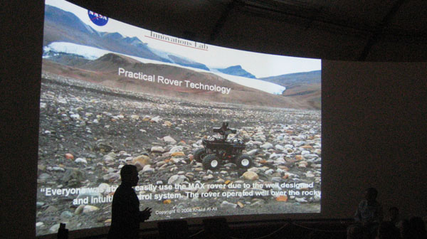
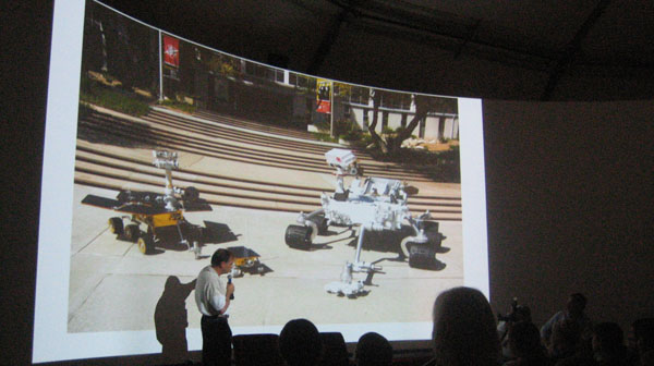
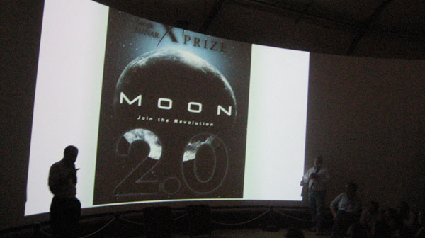
Posted on Sunday, September 28, 2008
Chris McKay (Planetary Scientist @ NASA Ames), Khalid Al Ali (Director of Research at Carnegie Mellon University (CMU) West), and Michael Sims (Research Scientist @ NASA Ames) came together in the NASA Ames Exploration Center last wednesday to talk about the latest developments in robotic surface exploration. Fascinating talk and photos. From what I hear, an audio(?) recording is forthcoming. I hope we get to see more of these talks down the road (and hopefully also the videos integral on the web, in the same spirit as the above mentioned TechTalks).
Space Agencies and Golf Courses (today's pitstop #4)
Posted on Friday, September 26, 2008
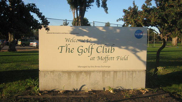
There's something about space agencies and golf courses. Haven't quite figured it out but might have something to do with the average age of the workforce ;-) Its surprising to see how similar in setup the golf courses at ESA/ESTEC and NASA Ames are. Both have a bar, both are a favorite after hours hangout (at Ames, happy hour at the t-1 is on thursdays), both seem to have a core group of regulars (and both are behind the security gate). At ESA/ESTEC, the bar and golf course are better embedded inside the center layout though, making it a more easily accessible place whereas at Ames, you have to drive all around the airfield to get to the bar. Below are the maps of the centers and their golfcourses.
View Larger Map
View Larger Map
10 Bucks Well Spend
Posted on Wednesday, September 24, 2008
Following on from yesterday's syndication of Tim O'Reilly's keynote at the NY Web2.0, I just finished watching the documentary he has been pointing out on several of his keynotes: A Crude Awakening: The Oil Crash. Buy it on itunes from their website and have a peak into the future of post cheap oil society. Quite informative...
Tim O'Reilly's Call to Action
Posted on Tuesday, September 23, 2008
And it ain't throwing sheeps. From last week's Web 2.0 Expo in New York entitled "Web Meets World".
(via)
Your 47 Minutes of Zen
Posted on Wednesday, September 17, 2008
A video from Nova Spivack's panel at DEMO Fall '08 on the Future of the Web, among which former Division Chief of Computational Sciences at NASA Ames (and now head of Research at Google) Peter Norvig (older & excellent mp3 interview with Norvig). All good stuff!
(via)
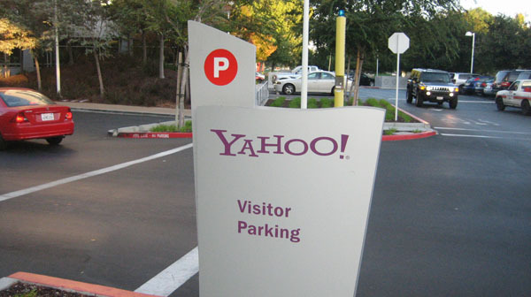
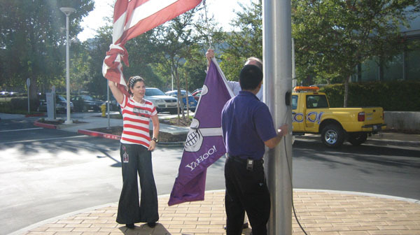
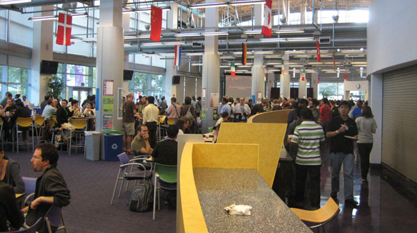
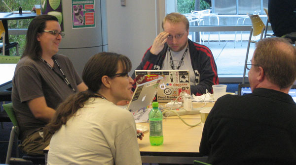
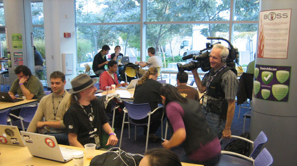
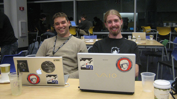
Yahoo Hackday 2008 (today's pitstop #3)
Posted on Saturday, September 13, 2008
My First Yahoo Hackday. Not much hacking myself, mainly getting a glimpse of Yahoo hackculture at this stage, but Ames was well represented by NASA's Planetary Content hackers Matt Hancher (left) and collegue.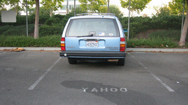

tobedetermined.org Extended Credo
Posted on Monday, September 1, 2008
Update: A post over at O'Reilly Radar by Nat Torkington reminds me of another quote I've used in the earlier days of this blog. It's a (famous) quote from William Gibson: The future is here, its just not evenly distributed yet. In his post, Nat refers to another quote from Gibson that brings the overarching point home:
One of the things our grandchildren will find quaintest about us is that we distinguish the digital from the real, the virtual from the real. In the future, that will become literally impossible. The distinction between cyberspace and that which isn't cyberspace is going to be unimaginable. When I wrote Neuromancer in 1984, cyberspace already existed for some people, but they didn't spend all their time there. So cyberspace was there, and we were here. Now cyberspace is here for a lot of us, and there has become any state of relative nonconnectivity. There is where they don't have Wi-Fi.
Having a 3-day weekend does have its benefits (like in: having an extra evening behind your computer?). Think I just stumbled upon something like an extended credo for this blog (beyond tobedetermined.org: A blog about outer space, cyberspace, their common future and all that is leading up to it... ). I started gathering some quotes that resonated with me over the years and ended up with this list (read from top to bottom, in that order):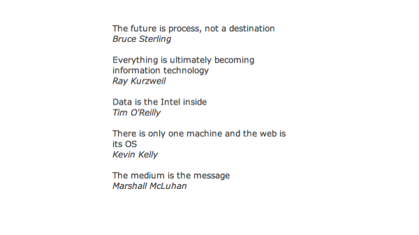
I am sure there are more out there that would fit this list, so if you have any suggestions pls let me know.
Wow!
Posted on Thursday, August 28, 2008
Ubiquity for Firefox from Aza Raskin on Vimeo. More at Mozilla Labs (via).
Trading Routes 2.0
Posted on Thursday, August 28, 2008
Haven't been very active with blogging recently. Partially this is due to my other backchannel recently opened on twitter where I every now and then post URLs I would otherwise probably post here (even more are at my del.icio.us or my FriendFeed). Anyway, life at NASA Ames continues at an ever speeding pace, moving ahead with our mission to properly weave space into the fabric of our digital "global brain". One link that stayed with me over the weekend is this GigaOM article talking about how new cables carrying internet traffic are indicators of future economic activity (how is that for a comparison to the stale 'Columbus' metaphor to space exploration):
This leads me to my conclusion: Building new cables is the equivalent to adding new roads, new shipping lanes, or flights. The undersea fibers of today are what sea trading routes were in the past—an indicator of future economic activity and a subsequent boom.
Welcome, Interplanetary Internet. Oh, and the image above? Well, there is a planet-finding mission called Kepler of which the Science Operations Center will be based here at Ames. This was on the door of their Deputy Principal Investigator David Koch.
On Rocks and Clouds
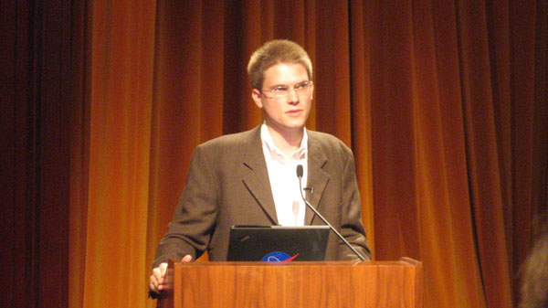
Posted on Thursday, August 21, 2008
Chris Kemp kicked of Code I (IT Directorate) here at Ames. This is going to be good!
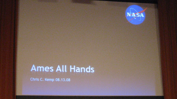
Posted on Wednesday, August 13, 2008
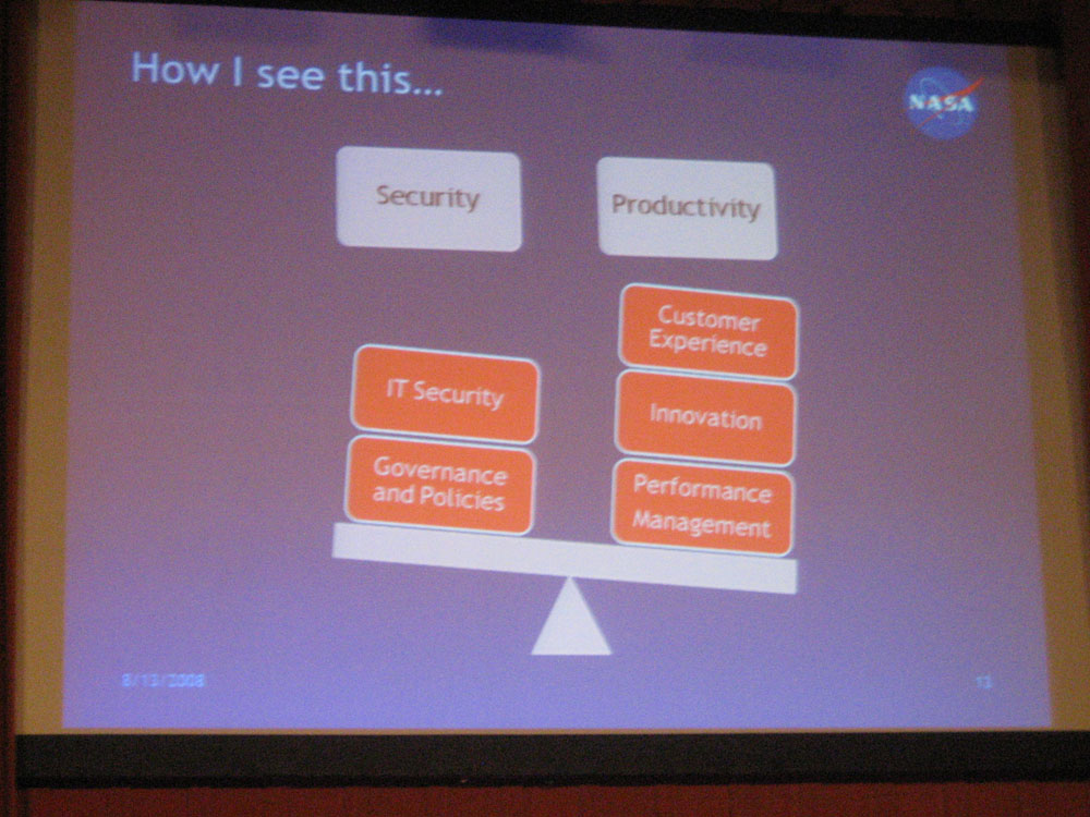
In other news:
- A good interview with Jeff Stibel on the 'perceived' parallels between the Internet and the brain
- Cyber attacks preceeded bombs in Georgia. Which makes me want to go back to a commercial I saw one of the first weeks I arrived in the US: Airforce: Air : Space : Cyberspace. This completely brings home the topic of this blog. Moving up from Air into Space and beyond, you enter...Cyberspace. If you want a challenge: be a cyber warrior.
- Google Maps didn't have any info on Georgia (I noticed that myself as well, and wondered what was up). Now Google is saying they just didn't have data there.
- Is Google a media company? Many seem to think so, including Tom Foremski:
For the past four years I've been saying that Google, Yahoo and many other large Internet companies such as AOL, and eBay are media companies. They publish pages of content with advertising around it.The fact of owning or not owning the content is a red herring. Either way, Google publishes pages of content with advertising around it. How is that not a media company?
GOOG is not a technology company. What technology can you buy from Google? I can buy a database from Oracle--that's a technology company. I can buy microprocessors from Intel--that's a technology company. What technology can you buy from Google?
Google is a technology-enabled media company. It won't create its own content. It mostly scrapes its content from the Internet, or collects it from users of Youtube, etc, and sells advertising around it. How it gets its content is not important, it is still a media company.
Summer 2008
Posted on Friday, August 1, 2008
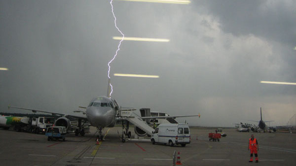
Back from a week of Internetless holiday on the island of Korcula (above photo was at Koln airport just before we were told we could board the plane ;-). Catching up here are a few relevant tidbits:
- The Economist's commentary on NASA's 50th anniversary provides a sharp dissection of NASA's past, present and future. Its the most sensible story on space and NASA I've read in a long while. As always, the comments are worth reading too, if only to see how space proponents bring their arguments into gear to downplay the article's 'hammer on the nail' analysis
- Sanfran article of the week about twitter, relationships, and the bay area working spirit
- Missed OSCON, but here's a 37min intro and Tim Oreilly's comments
- A great discovery: this TED video by kevin kelly. I especially like his McLuhan Reversal analogy. Have to watch it again.
S3 Outage Effects
Posted on Tuesday, July 22, 2008
Interesting. S3 goes out, and suddenly all over the web you'll see images disappearing, avatars evaporating and webshops go down.
Btw,for those who have the time to follow twitter feeds, and/or(?) are interested how we are gonna re-vamp NASA Ames' presence on the web (starting with the Ames page in the nasa.gov portal) we just added a new fly on the wall.
The Stone Age Didn't End Because of a Shortage of Stones
Posted on Sunday, July 20, 2008
Bruce Sterling comments inline on this passionate call by Al Gore for the US to become carbon fuel independent in 10 years.
Time to put some solar panels on my roof here in Palo Alto. Or wait, wasn't I first gonna spend 2 weeks flying around Europe for my holiday, buy the iPhone and upgrade my car (from what I hear SUV's come cheap these days).
Could this be the "Moonrace" of the 21st century?
We need you. And we need you now. We're committed to changing not just light bulbs, but laws. And laws will only change with leadership. On July 16, 1969, the United States of America was finally ready to meet President Kennedy's challenge of landing Americans on the moon. I will never forget standing beside my father a few miles from the launch site, waiting for the giant Saturn 5 rocket to lift Apollo 11 into the sky. I was a young man, 21 years old, who had graduated from college a month before and was enlisting in the United States Army three weeks later.I will never forget the inspiration of those minutes. The power and the vibration of the giant rocket's engines shook my entire body. As I watched the rocket rise, slowly at first and then with great speed, the sound was deafening. We craned our necks to follow its path until we were looking straight up into the air. And then four days later, I watched along with hundreds of millions of others around the world as Neil Armstrong took one small step to the surface of the moon and changed the history of the human race.
We must now lift our nation to reach another goal that will change history. Our entire civilization depends upon us now embarking on a new journey of exploration and discovery. Our success depends on our willingness as a people to undertake this journey and to complete it within 10 years. Once again, we have an opportunity to take a giant leap for humankind.
Too Funny
Posted on Friday, July 18, 2008
God, did I miss Jon Stewart when he was on holiday. Watch this from the beginning and be ready for an apotheosis starting 07:20 (btw, I believe Hulu is only available for American viewers).
Edge 250
Posted on Thursday, July 17, 2008
Alan Turing's suggestion, to build a disorganized machine with the curiosity of a child, made more sense. Eventually, "interference would no longer be necessary, and the machine would have ‘grown up’." This was Google's approach. Harvest all the data in the world, rendering all available answers accessible to all possible questions, and then reinforce the meaningful associations while letting the meaningless ones die out. Since, by diagonal argument in the scale of possible infinities, there will always be more questions than answers, it is better to start by collecting the answers, and then find the questions, rather than the other way around.And why trace the connections in the brain of one individual when you can trace the connections in the mind of the entire species at once? Are we searching Google, or is Google searching us?
More at 'Engineer's Dreams' by George Dyson (Edge 250)
Yup
Posted on Thursday, July 17, 2008
Wading through +2k unread posts in my list of RSS feeds (Bruce Sterling's Beyond the Beyond).
Its You They're After
Posted on Saturday, July 12, 2008
The best analysis on Google's Lively I've read sofar comes from RealityPrime: Its not so much about giving people a nice virtual world to play with, its providing a new interface to harvest new and previously untapped user behaviour. Which reminds me of an excellent article I was send the other day on the near future of advertising, a must-read.
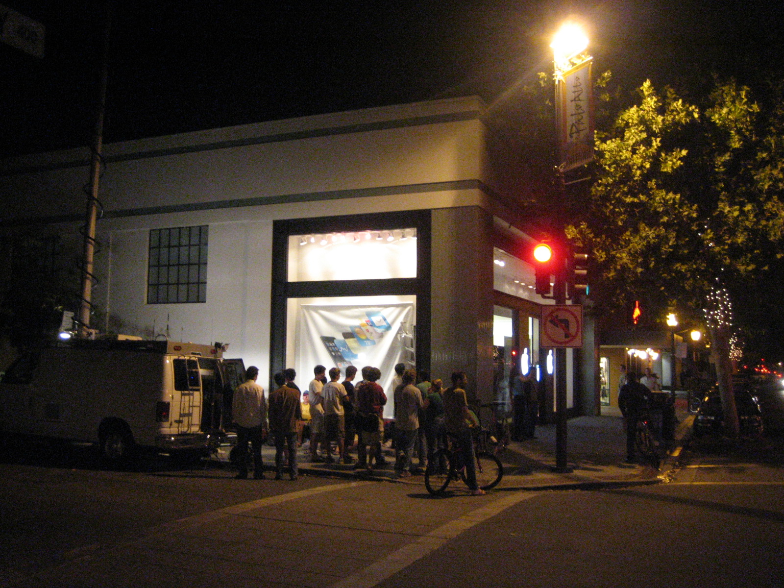
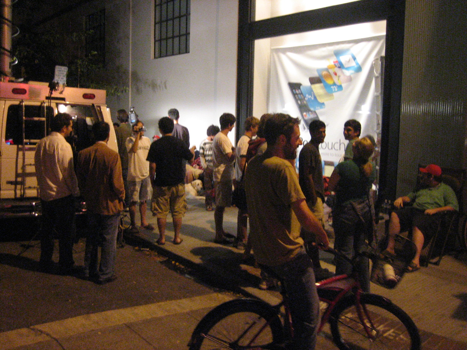
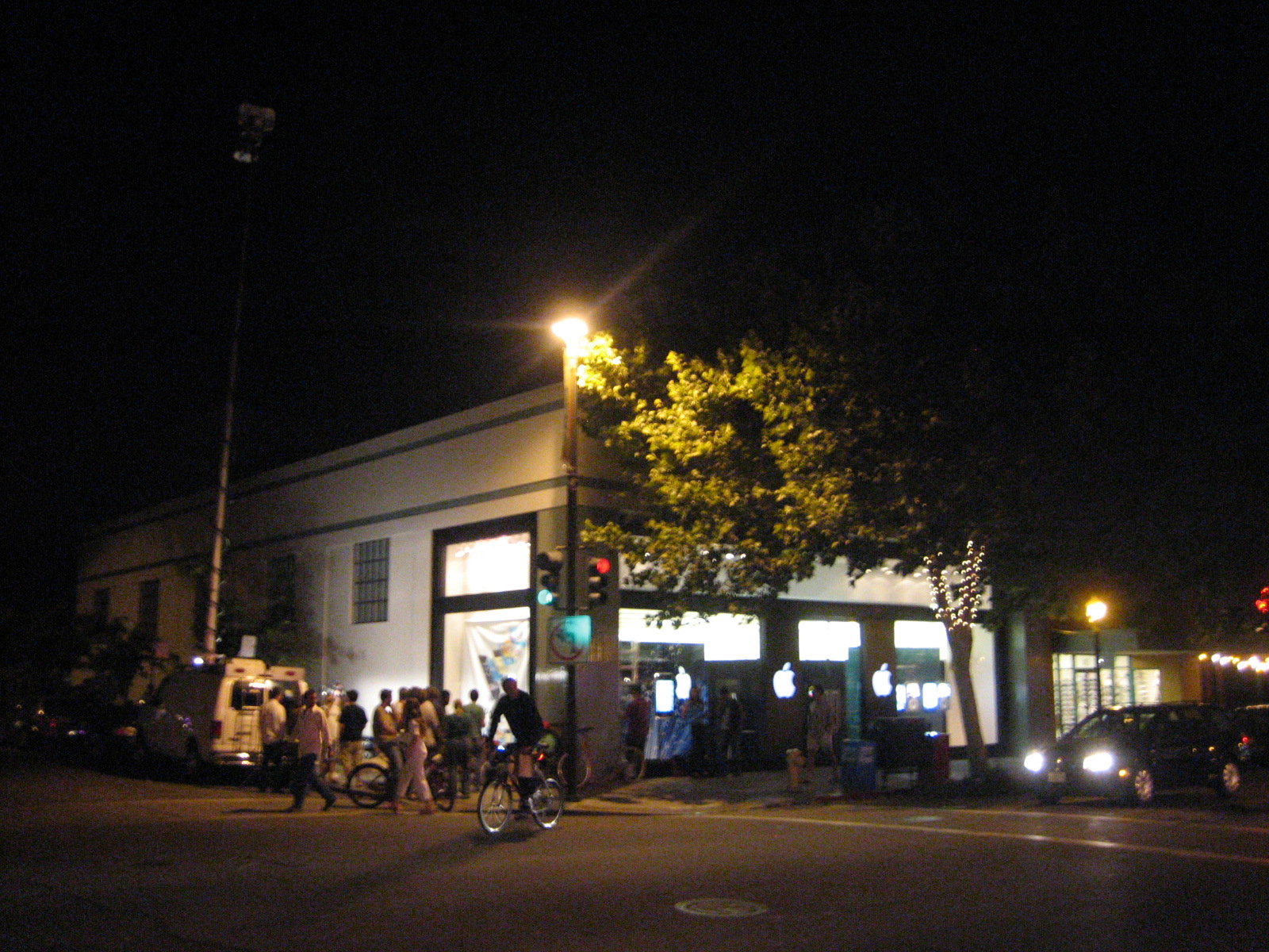
Its iPhone Time in Palo Alto
Posted on Friday, July 11, 2008
Just around the corner from where I live there is the Apple store on University Avenue. Not too big a crowd, mostly Stanford students playing guitar hero while the press anxiously awaits whats to come. I decided to opt for a roundtrip to Amsterdam instead, an alternative which also doesn't come cheap these days. But first its Mechanicrawl this saturday up in the City.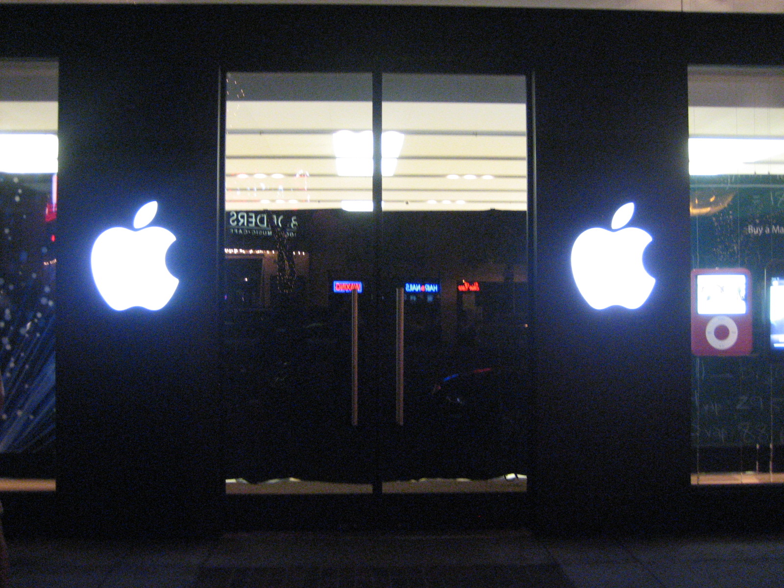
Robots Get Better Every Day
Posted on Wednesday, July 9, 2008
A couple of quotes from an article in the Washington Post entitled 'U.S. Finds It's Getting Crowded Out There' (via):
The cost of manned space exploration, which requires expensive measures to sustain and protect astronauts in the cold emptiness of space, is a particular target."The manned space program served a purpose during the Apollo times, but it just doesn't anymore," says Robert Parks, a University of Maryland physics professor who writes about NASA and space. The reason: "Human beings haven't changed much in 160,000 years," he said, "but robots get better by the day."
Another one:
In its assessment, Futron listed the most significant U.S. space weakness as "limited public interest in space activity."
Hmm, it looks like us humans are a real show stopper when it comes to pushing the borders of reality further into outer space. Perhaps we should consider targeting robots instead of humans with the US civil space PR machine. Once they are on equal par with us, they'll probably be much more enthused and equipped to go into outer space. And after all, our race already had its 15 minutes of fame wouldn't u say? An add campaign targeted at robots...hmm...: "Space, The Final Webservice"
The One Computer
Posted on Friday, June 27, 2008
Kevin Kelly re-iterates his earlier thoughts (a must-read) in the latest edition of Wired (via). Still makes sense to me. And guess who's heading all of this?
Windy Hill Overlooking the Bay Area
Posted on Thursday, June 26, 2008
![]()
Click to Enlarge
Last weekend I finally found what I was looking for the first few weeks I arrived here: on top of a hill, a place to at the same time overlook the Pacific on one side and the Bay Area on the other (Thanks Deborah!). If you look closely, you can see the City (SF) in the far end of the Peninsula (follow the Bay to the left, the City is just visible before the hills start) and Stanford in front (the tower). At the end of the Bay (to the right), you can see the large windtunnels of NASA Ames. Further to the right is San Jose.
To make things easier, see below for the exact location on Google Maps from where I made the panorama.
And the folks in the image....uhm...they happened to be there as well ;-)
View Larger Map
What Union Square Ventures Likes To Invest In
Posted on Thursday, June 26, 2008
'Merging of cyberspace and real space' (amongst others). Below slide is taken from the same Techcrunch post. Nice signal overshoot.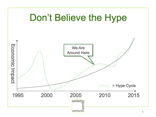
Steve Jobs Down the Road From Here Back In 2005
Posted on Tuesday, June 24, 2008
WorldWind presentation at the Yahoo Brickhouse (revisited)
Posted on Friday, June 13, 2008
The video of this presentation came online at the Yahoo Developers Network (via).
As we come to rely on computers to mediate our understanding of the world...
Posted on Wednesday, June 11, 2008
Nicolar Carr looks ahead. Searchblog responds. I definitely like Nicolas' point of view. Whereas the conservatism standpoint never seems to win, he makes a good point about the influential nature of media beyond what they carry (the medium is the message, or first we shape the tools, then the tools shape us). The deep reading he talks about seems on the web more to revolve around 'deep experience'. For example my first encounters with Google Earth definitely carried some element of 'deep experience' that would not have been possible weren't it for the Internet. I'm sure there's more on the way where that came from.
Friday Afternoon Yawns
Posted on Saturday, June 7, 2008
OgleEarth is on the ball with his critique on Walt Disney Park's layer in Google Earth being 'the next best thing to being there'. Reading it, I recognise I am reading my own unexpressed yawn about it (without having had a look at it myself I do admit, but that tells it all I guess). A virtual Disneyland devoid of people, and no possibility to take a ride, WoW!? If only I had some time to go back to the enthusiasm while working on UGO, but for some reason, its not that attractive at the moment. Even with the ability to bring it into the browser, which is pretty cool yes, apart from the techno fetish, there's at the moment not much occasional inspiration to throw time at Google Earth (apart from learning the javascript GE API implementation perhaps). Has anybody heard anything about Second Life lately btw?
On a more enthusiastic note, I attended the Google I/O conference 2 weeks ago here at Moscone West. Now that was exiting! Not so much from a Google Tech or developers point of view (albeit that was pretty inspiring too, mostly diving into the Google App Engine, on which I had my first encounter with the GE browser plugin), but more from a cultural real people point of view. Apparently they brought Google culture over from the Googleplex to the conference center. I lost my camera in the meantime so can't show you my pictures of all the beanbags, free food, and other goodies, but man, that's a sweet company culture (and flickr tags are there to prove it). And a young crowd too.
I recognised the same kind of culture here at Yahoo HQ earlier this week where we were sitting in on a meeting on the upcoming Yahoo Hackday. Working at a place where the coffee corner closes 30 minutes after lunch has been served (that's around 2:00pm folks), and where the cappucino comes out of a prefab instant-make coffee-crap-machine, I am all for Google joining the ranks here on the NASA Ames premises. And I certainly hope some of their culture bleeds over the fence into Ames, which I'm sure it will (not sure if i'll be around to witness it though as they only start building in 2013).
As usual, these high profile Google announcements draw quite a bit of cynical critisism from the likes of Bull's rambles, Valleywag and ZDNet but that's as yawn inspiring as the Disney layer in Google Earth.
My two cents for the weekend: Ask not what Google or Yahoo! can do for you, but what Google/Yahoo! culture can do to your space program.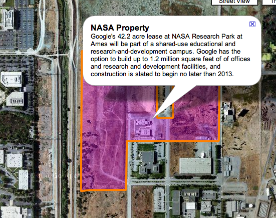
(see it in google maps, or, if you really really want to, in Google Earth)
View Larger Map
WorldWind presentation at the Yahoo Brickhouse in SF
Posted on Thursday, May 22, 2008
One of these events which makes me remember why I moved down here from Amsterdam: a presentation on NASA's open source 3d browser at the Yahoo Brickhouse in downtown San Francisco. Great place, great talk, great people. More pictures are at my Flickr. For some reason, I have a hard time finding some more info on the Brickhouse on Yahoo's properties. Weird how they not have a full YBH page up there. Anyway, the video of the talk should become available on the Yahoo Developers Network somewhere next week I was told. I'll update as soon as its up.
Mike Griffin at Googleplex (June 2007)
Posted on Saturday, May 17, 2008
Finally got a chance to see the recording of Mike Griffin's talk at the Googleplex last year. Informative talk. $55 a year per US citizen goes to NASA, out of an average 8k$ yearly tax bill. That's actually more than I'd expected.
World Wide Telescope Released
Posted on Thursday, May 15, 2008
Yep, its here (given the page design you'd mistake it for a Mac site just for a second). Ever since I upgraded to Mac OSX 10.5 (aka Leopard) last week my Parallels XP virtual machine is in a permanent state of reboot so I haven't had a personal interaction with WWT yet, but from the reviews of it over at OgleEarth and The Earth Is Square, it seems to be a pretty nifty application.
Can't wait to get my NASA Macbook Pro exchanged for a proper PC...
The Geoweb Is Evolving
Posted on Wednesday, May 14, 2008
Straight from Burlingame at the Where2.0 conference, John Hanke and Jack Dangermond talk about Google and ESRI working together. Note that there's two space agencies in above image (considering NOAA is not) and a couple of NASA contractors.
Some views to enjoy (until I get back to posting regularly)
Posted on Tuesday, May 6, 2008
Its busy times here at Ames...
What do you want NASA2.0 to be?
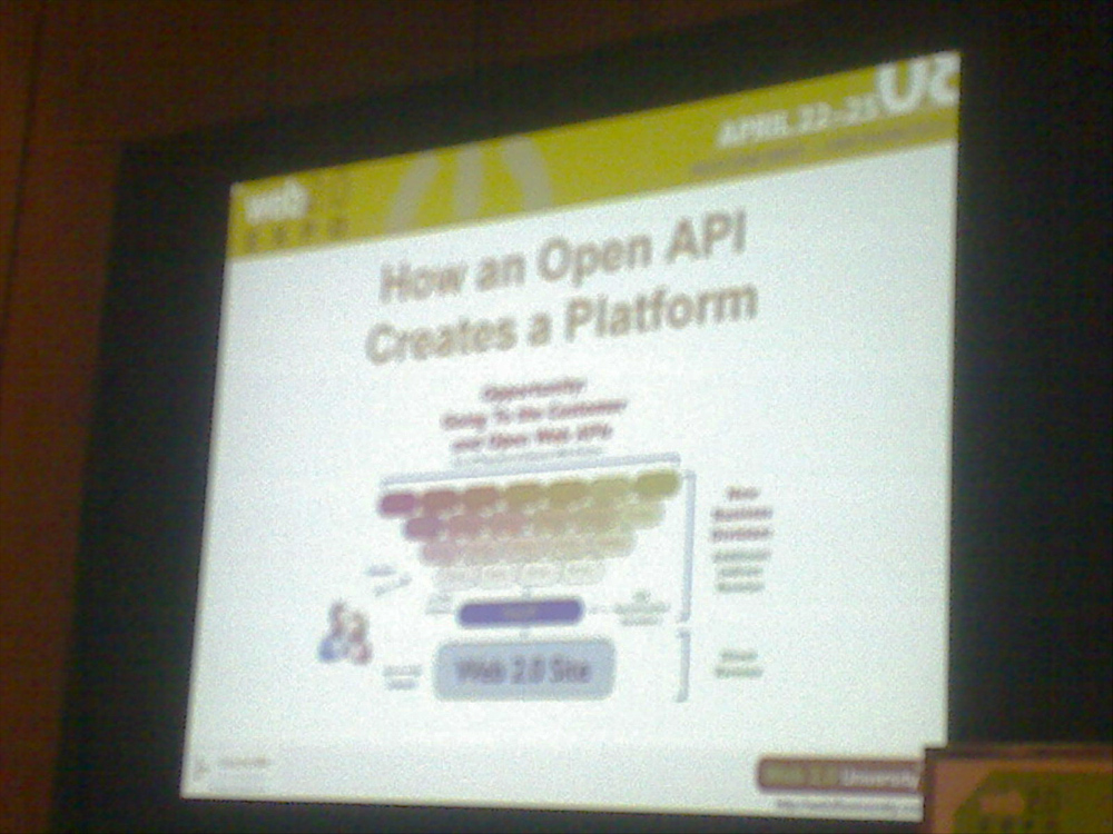
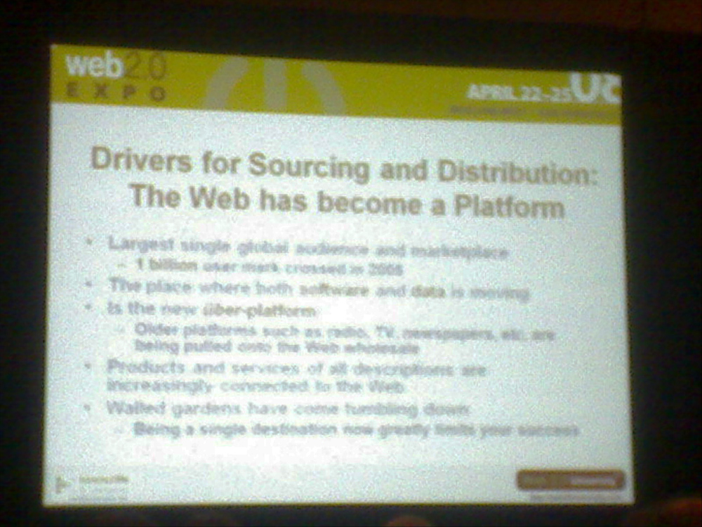
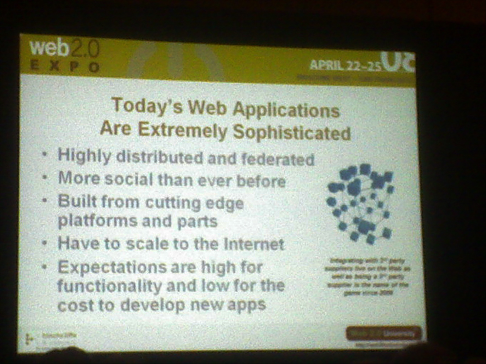
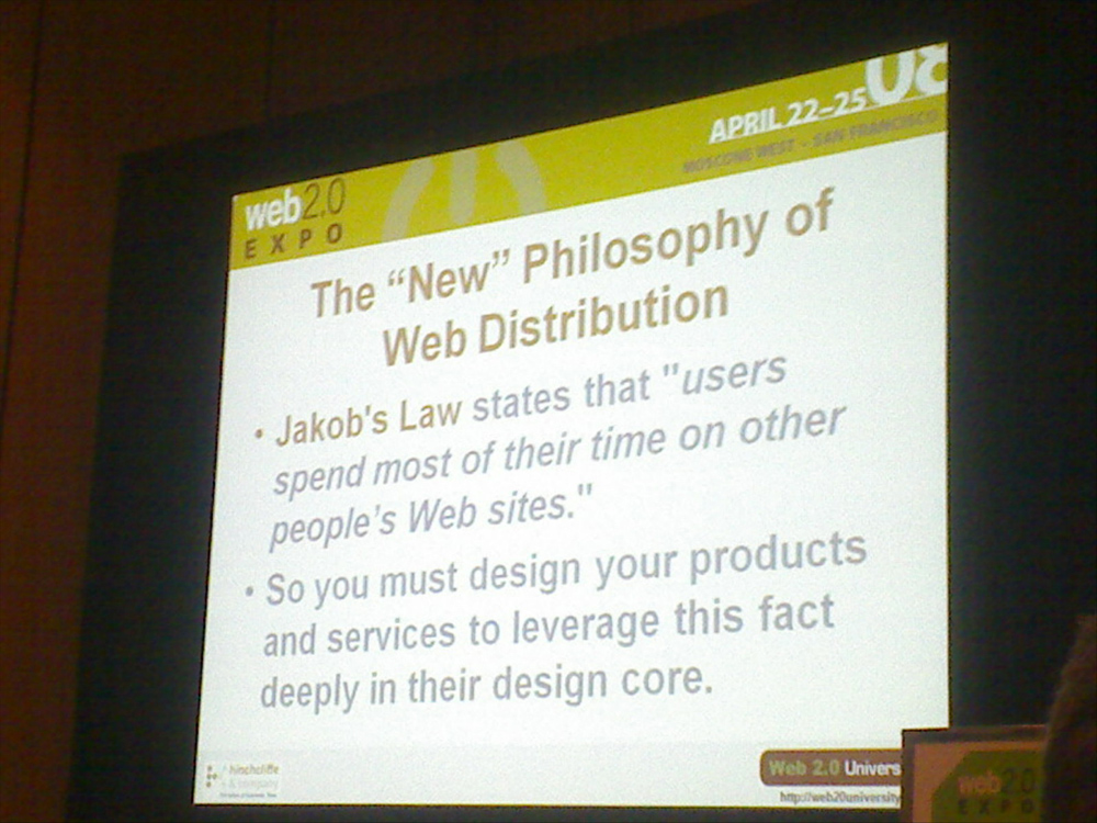
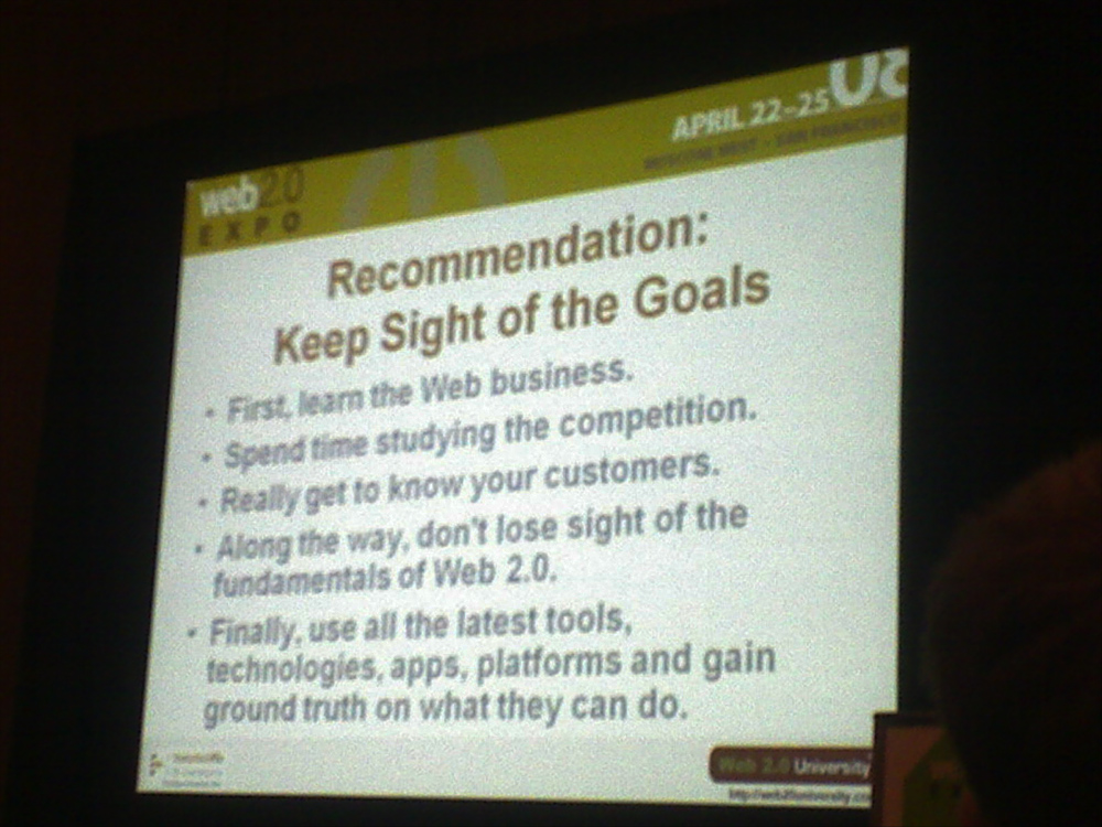
Posted on Wednesday, April 23, 2008
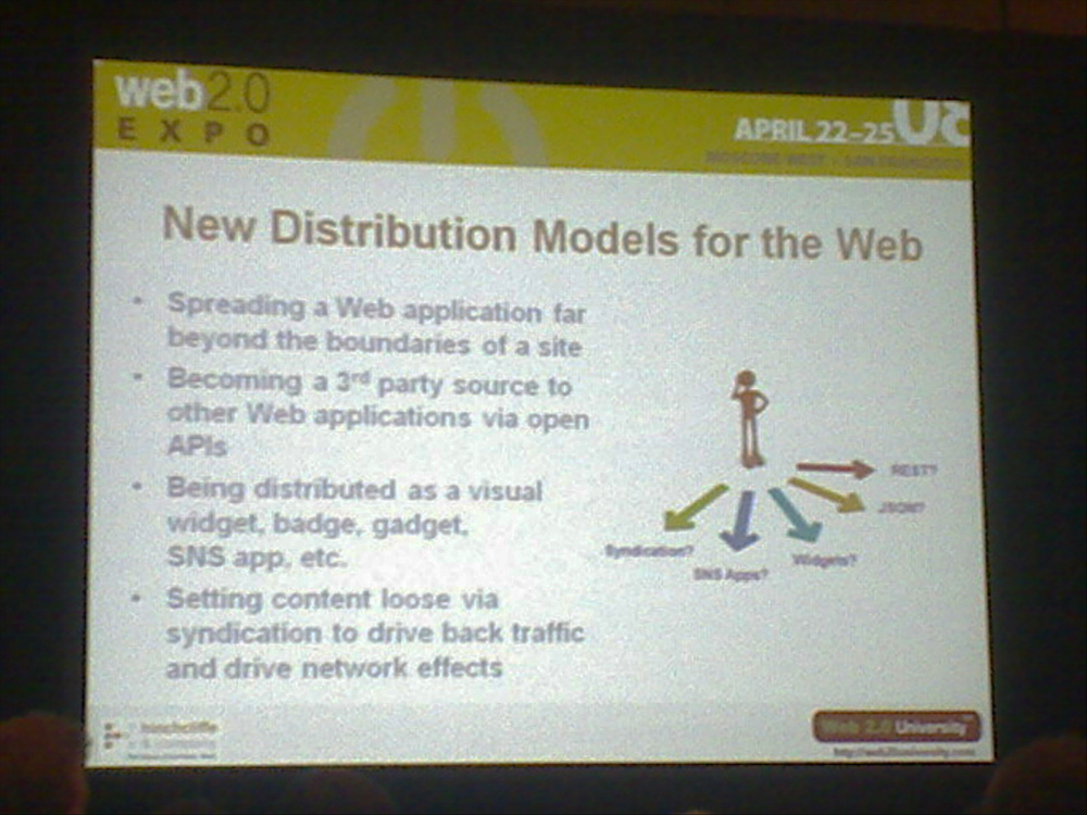
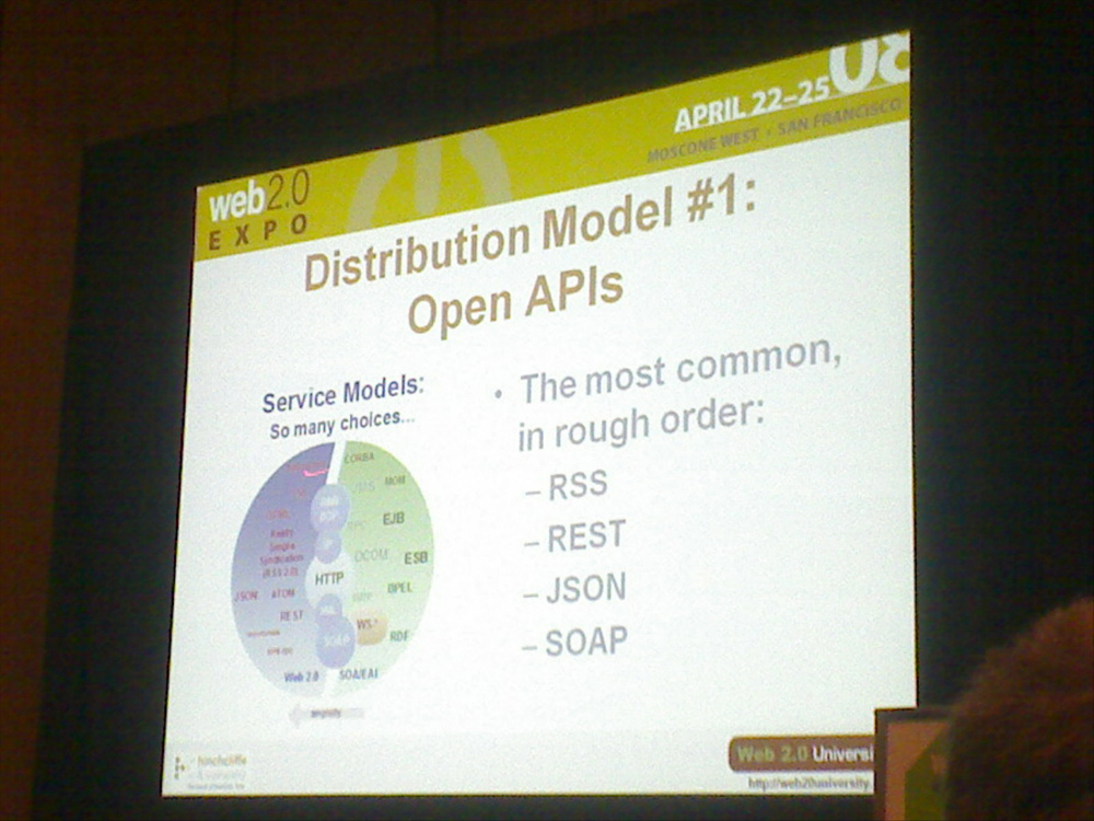
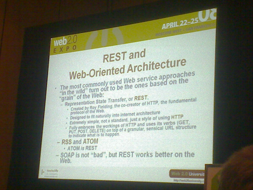
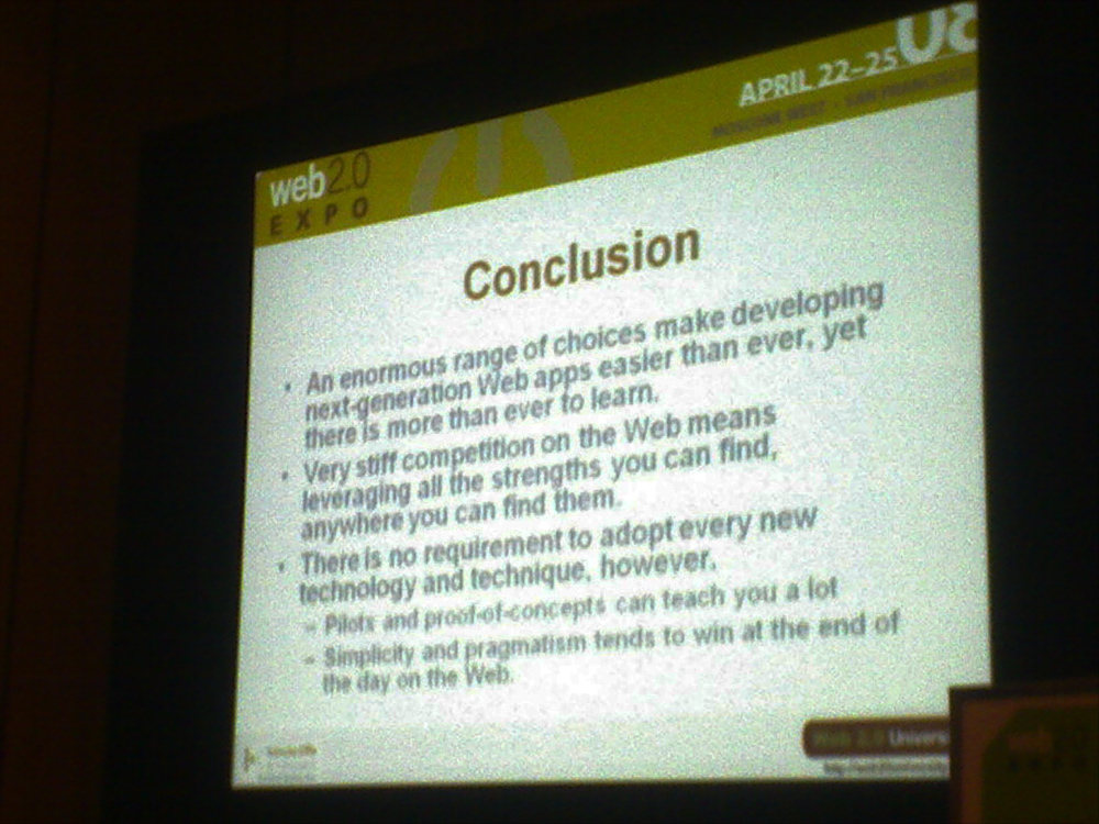
I am here in San Francisco at the Web2.0 Expo in Moscone West, just kicking off with the highly informative 'Building Next Generation Web2.0 Applications' workshop by Dion Hinchcliffe (See some of his slides below).
One of the points he made very clear is the value of data. Data is the new Intel inside as Tim O'Reilly so succinctly proclaimed in his seminal 2005 paper on 'What is web2.0'. The web is a platform. For NASA, its a platform for space exploration. Getting web2.0-ified seems not so much a question of how to gather a data class valuable to its users (after all, who doesn't like images like these, or looking through the eyes of our rovers on Mars, as seen from above), or getting everybody to become rocket scientists (although...mmm...;-), but more the other way around: how to leverage its vast data resources (after all, what are satellites other than data gathering devices) to get the public more engaged in NASA's mission and activities. Space is cool, and you know it. Its just too far away from our daily lives on the web. Give me space exploration, right here, right now, and we'll give you our database of space exploration intentions.
Building an open platform on the web where NASA can easily share all the great data it gathers is the anwser. Be there as the images pour in. Be there as the exploration takes place. NASA2.0 is all about getting NASA's data more available, usable and shareble on the web. Where possible in (near) real time please.
Which reminds me of this post over at the Institute Of The Future about post-scientific society. Well worth the read!
American innovators — with their world-class strengths in product design, marketing and finance — may have a historic opportunity to convert the scientific know-how from abroad into market gains and profits. Mr. Hill views the transition to “the postscientific society” as an unrecognized bonus for American creators of new products and services.And they just released today a new initiative called X2 about the future of science and technology.
A post-scientific society will have several key characteristics, the most important of which is that innovation leading to wealth generation and productivity growth will be based principally not on world leadership in fundamental research in the natural sciences and engineering, but on world-leading mastery of the creative powers of, and the basic sciences of, individual human beings, their societies, and their cultures.
Just as the post-industrial society continues to require the products of agriculture and manufacturing for its effective functioning, so too will the post-scientific society continue to require the results of advanced scientific and engineering research. Nevertheless, the leading edge of innovation in the post-scientific society, whether for business, industrial, consumer, or public purposes, will move from the workshop, the laboratory, and the office to the studio, the think tank, the atelier, and cyberspace.
A.C. Clarke died today
Posted on Wednesday, March 19, 2008
...(bbc news)
update: Google's Chief Evangelist Vint Cerf also says goodbye to Clarke in this post. It includes a nice video of Clarke recorded end of last year.
Space To The Rescue
Posted on Monday, March 3, 2008
- Need a good
excusereason to go to New York? Read this NYT review of the MOMA exhibition 'Design and the Elastic Mind'. Makes me wanna go! More at MOMA (via Google LatLon) - TED was on. Missed it. Next year. Here are a lot of good videos from it. Lots of buzz about Microsoft's new move vs Google Earth/Sky: World Wide Telescope. The TED video is here. Indepth reviews at OgleEarth and GoogleEarthBlog. Looking forward to a test drive, which will have to wait untill they release it this spring.
- Just learned that Google is running a www.google.com/space subdomain these days with the following overall statement:
There's nothing we love more than ambitious research with world-changing potential, and space exploration and research have long produced much of the scientific community's most ambitious, even audacious work.
We honor the work that's been done in the past, and want to foster and support that work today and in the future. By supporting space-related research and exploration, we hope to inspire a new generation of innovators to enter the fields of science, technology, engineering and mathematics. We believe that the same imagination and passion that fuels space research and drives those who meet the challenge of space exploration will also help advance research and development in fields closer to our own.
That's certainly a statement I can get my head around, especially coming from an IT/media company ;-)
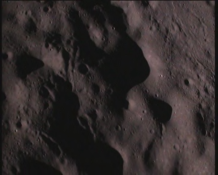
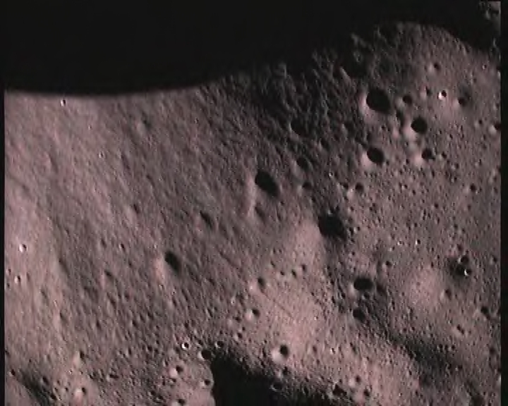
Btw, I learned about the subdomain here at Ames where Chris Kemp and Matthew Hancher (NASA's Planetary Content team Project lead) showed us the Google Street View equivalent on the Moon: Apollo panoramas...uhm...lunalocated (?). Quite impressive. Story telling is a big part of the overall picture, as both reviews (above) of the upcoming Google Sky competitor are right in mentioning. The possibility to re-live Apollo adventures in their appropriate context is excellent. Its still a bit text-heavy for now, but I am sure that that's gonna change as the platforms evolve. Btw2, for some reason this most recent release of Google Moon (think it was this post d.d. 13th September 2007 where it was announced) didn't make it up the list for me, which makes me wonder: is it time for a dedicated Google Space Blog?
Time to get on the bus
Posted on Wednesday, February 27, 2008
Ok, so its time to give a brief update on my (physical) whereabouts. Since last thursday I moved from Amsterdam to Mountain View, Silicon Valley to work with Chris Kemp and his collegues over at NASA Ames starting next monday March 3rd. Weehoo! Finally, a long held dream is coming true, taking part in the upcoming merger of outer space and cyberspace, right at the heart of where all things space are happening. Couldn't be better!
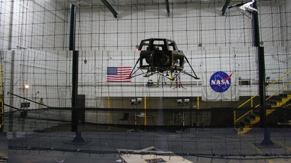
As for this blog, looks like I will be using it from now on to give you a personal insight in my personal and professional experiences here in the Valley. Sofar, these include a great arrival and first few days enjoying the Bay Area rainy season (yes, it can rain here...), a visit to the Vertical Motion Simulator on NASA Ames premises last friday (for photos have a look at this flickr album), my first NASA vrimibo with Ames director Pete Worden, Chris Kemp and several of my upcoming collegues (vrimibo is short for 'vrijdag middag borrel', Dutch for the traditional friday afternoon drink), a first counter-clockwise drive around the Bay Area, and writing off the first item on my wishlist of things-to-do-when-I-get-to-the-Bay-Area: attending a Long Now seminar in San Francisco (on which more in a follow-up post).
Immersive Video
Posted on Sunday, February 10, 2008
Via OgleEarth, 360 degrees immersive video delivered to you through the Internet. Impressive. And shareable, like the ones here below (hint: drag the arrow inside the videoscreen).
The Medium is the Mind
Posted on Saturday, January 19, 2008
Another good reason why to read below book, the following quote comes from the author's blog:
"The medium is the mind," I write toward the end of The Big Switch, arguing, as others have before, that the tools we use to gather, store, and analyze information inevitably exert a strong influence over the way we think. As the internet becomes our universal medium - what the director of the Annenberg Center for the Digital Future terms "a comprehensive tool that Americans are using to touch the world" - its technical characteristics also begin to shape, slowly but inexorably, the workings of our memory and our other cognitive processes.
A good way to spent a couple of days with the flu
Posted on Thursday, January 17, 2008
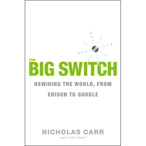
Read The Big Switch. Really, you won't regret it. Gave me the same inspiration as reading The Google Story a couple of years ago. What the future of the Internet has in store for us...
There goes another space based solution
Posted on Thursday, January 17, 2008
Just watching the keynote by SJ. As could be expected, there turns out to be a good reason why the iPhone doesn't carry a GPS receiver. There is a terrestrial way to get your position with less battery expenditure. Its Skyhook Wireless, they even call it WPS (Wi-Fi Positioning System). Combined with Google's triangulation of cellular network antenna's, the positioning is apparently considered to be accurate enough. There goes the market for Galileo. Reminds me of Iridium and the promises of cell phones by satellite, which was totally swepted away due to the proliferation of terrestrial networks.
Reality Mining
Posted on Thursday, December 20, 2007
Nicolas Carr diggs up another good story: Reality Mining. Some quotes from the TR article:
All this sort-of Web 2.0 stuff is nice, but you have to type stuff in.
and
You can really see things in a way that you never could before--a God's-eye view. One of the examples I've been stuck on recently relates to how transformative Google Earth has been. Imagine having something where you can see all the people moving around on a map. Think about SARS in Hong Kong. What if in a particular apartment building, nobody left for work that day? You could identify a major health problem in 12 hours instead of two weeks. Another example is the social health of communities. It's known that social integration, or how well people mix, correlates with whether or not a community is thriving. With reality mining, you can actually see social integration, as it happens or doesn't happen. Once everyone can see it, then you can start to have transparent political discussions. Why isn't the mayor putting more sidewalks and crosswalks in this area? Could more community events make the area more livable?
The Bible According to Google Earth
Posted on Wednesday, December 19, 2007
Via OgleEarth comes the following:
Sydney art collective The Glue Society produced a work that consists of retouched satellite imagery to depict biblical mythology. Says Glue Society’s James Dive: “We like to disorientate audiences a little with all our work. And with this piece we felt technology now allows events which may or may not have happened to be visualized and made to appear dramatically real. As a method of representation satellite photography is so trusted, it has been interesting to mess with that trust.”
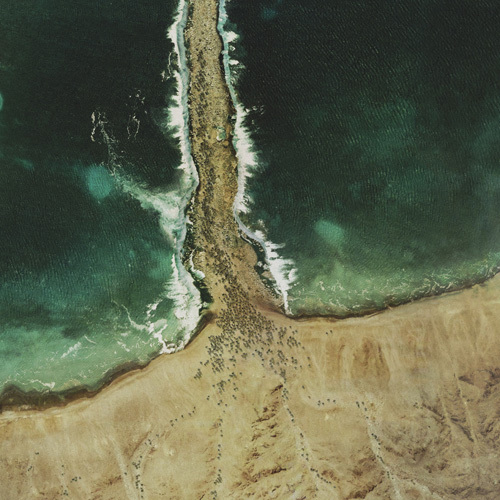
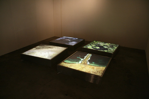
More at Creative Review. Reminds me of an exhibition on Solar Science Debra Solomon, me and Ricky Seabra developed a couple of years ago for ESA as ArtRaceInSpace Ltd. Nice to see Google Earth is entering the domain of contemporary art. Its gonna be a smiley day today. Anybody up for geo-referencing these scenes in Google Earth? ;-)
The Crucifixion
Adam and Eve in the garden of Eden
Noah's ark
Moses parting the Red Sea
DinnerTV: Vint Cerf @ Google Zurich 22nd Nov 2007
Posted on Friday, December 14, 2007
Its quite similar to his earlier talk at the Geoweb conference last July but he goes into some new domains from around 50min. into the video. (via Vint/Sogeti)
Augmenting Reality
Posted on Thursday, December 13, 2007
A couple of non-related items I came across today:
- Following a link on Google LatLong I came across this animation in Google Earth of a cosmic ray shower which was done by Leiden (NL) based Cosine Research (one of several companies surrounding the European Space Research Centre ESTEC here in Noordwijk). To view the animation in Google Earth, click the clock icon next to the time slider, set 'Restrict time to currently selected folder' and press the play button on the right of the time slider.
- This is where NASA's Mars research pays off.
- Nicolas Carr links to an article in The Economist about Augmented Reality. Recently I saw this video which tries to capture the idea of AR in video.
- TomTom and Vodafone are working together (in Dutch). Every car becomes a data point in the "realtime traffic jam sensor web". More at TomTom.
DinnerTV: Galileo
Posted on Monday, December 10, 2007
Belgeoblog links to an informative Belgian documentary about the Galileo project and its political and technological challenges. In a mix of Dutch, French, English and US English spoken languages and brought to you in 24 style. Well worth to watch!
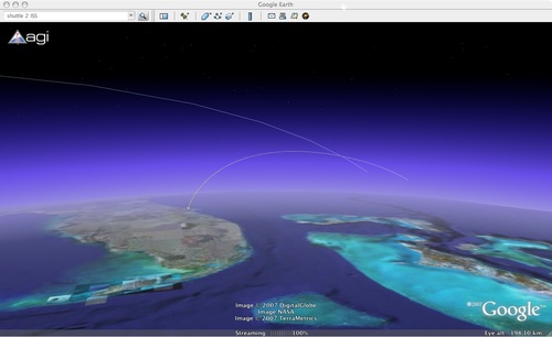
Shuttle launch in GE
Posted on Saturday, December 8, 2007
STK's AGI released a visualisation of the imminent shuttle launch to the ISS (via GEB)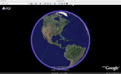
Google Earth and the Evolution of the User Interface to the Internet as platform
Posted on Wednesday, November 28, 2007
After wondering about GE's evolution myself yesterday, Techcrunch is now running a somewhat more blunt story of Google Earth heading towards extinction question mark:
Google has announced two new features for Google Maps that mimic features in Google Earth, begging the question: is Google Earth on borrowed time?The first new feature is the additional of terrain in Google Maps. The terrain fly over feature has long been available in Google Earth, but now you can fly over a map and see the contours of the land, all without the need to download Google Earth.
The second new feature mimics the community contribution feature of Google Earth. “Our Maps” brings wiki-style collaboration to Google Maps, with users able to annotate places and share those notes with friends or the greater public.
Google acquired Keyhole in October 2004 and it was immediately obvious as to why: Google wanted the satellite imagery to support their move into serious mapping. Keyhole provided Google Earth, a downloadable program that gave a then unprecedented view of the earth through the use of satellite imagery, but Google isn’t a software company, Picasa and a few small efforts aside. Google has integrated many of the functions from Keyhole into Google Maps whilst continuing to sustain Google Earth, but for how much longer? As Google Maps takes on more and more of the functionality of Google Earth the appeal of Earth must diminish. It also makes sense that Google would rather grow and sustain a web product over a software download. Google Earth will still be with us for some time to come, but how long is now up to Google, and I’m betting that Google is already looking at ending support sometime in the next year or two as Google Maps becomes everything Google Earth now is, but online and without the download.
Looks like Avi has the most sensible comment in there which deals with the topic at hand:
...As CPUs and browsers become more powerful, the features of the two applications will merge, as I’m sure was the plan all along.But since browser evolution has been so excruciatingly slow, I think it’s far more likely that we’ll see Google Earth become the defacto 3D web browser vs. Duncan’s prognostication.
ISU2
Posted on Tuesday, November 27, 2007
Erik Laan points me to this post about the ISU2 working meeting held at Ames Research Center yesterday and today:
The ISU-2 Working Meeting is being hosted by NASA Ames Research Center to bring together key individuals to brainstorm the concept of the International Singularity University (ISU2) and to answer certain fundamental questions and plan for a "Founders Conference" expected in Spring 2008 and an inaugural Summer Program in 2009 in the Bay Area.International Singularity University (ISU2) which would educate attendees on the history, current status, trends and projected futures of these technologies. ISU2 will facilitate students to form networks, study the implications of exponentially advancing technologies (nano, bio, AI, etc), the cross-disciplinary interactions, and legal, policy and societal implications which will result. ISU2 would be modeled on the concepts and practices pioneered by the International Space University (ISU) during its past 20 years of operation (1987 - 2007).
Date: 26-27 Nov 2007
Location: NASA Ames Research Center, Moffett Field, CA, US
Web Site Address: http://www.arc.nasa.gov
Way to go Ames! I am an alumni of ISU1, that is, the International Space University, where I participated in the '06 summer session Team Project dealing the impact of Micro & Nano Technologies for space so I am thrilled to see the ISU formula being applied to a topic that is close to my heart. In fact, I think I'd gladly follow the ISU-2 summer session cause it'll have a lot of interesting ground to cover. And Silicon Valley is the right place to be when it comes to the Singularity. ISU1 summer session 2009 is already scheduled to be hosted at Ames so '09 promises to become a truly remarkable summer over in Mountain View.
Google Earth in the browser window
Posted on Tuesday, November 27, 2007
I wonder how long we'll have to wait until we have a native Google Earth in a webbrowser (there is a third party plugin, but its not quite there yet). I find myself hardly using Google Earth these days cause its just too much to load the app and switch away from my browser (which has more or less become my default desktop by now). When I need to look up a place on a map I type 'maps' in the URL field and Google Maps is there in an instance. Having been an avid Google Earth user earlier this year, an important shortcut I find myself trying in Google Maps is shift-pagedown/up, the ability to tilt my view from the vertical to get a sense of perspective by rotating around a fixed position on the Earth. You know its there, outside the borders of the Google Maps iframe, the whole dataset of Google Earth/Maps, but it just isn't obvious to navigate 3D space having only the 3 translational dimensions. This page is getting close to the Google Earth experience, but still there is a strong limitation without the rotations.
These are some interesting videos to look at related to above remark, where here the emphasis is on what would happen if you'd add the 3rd dimension to the flat 2-d space of the desktop: (1) BumpTop and (2) SUN's desktop
Google Space Agency
Posted on Monday, November 26, 2007
A quick backlog of links related to the Google NASA coop. They're working on it down at Ames in what is called the 'Planetary Content Team' (nice title):
The Planetary Content Team at NASA's Ames Research Center develops software that makes it easier for scientists and engineers to publish and access Earth and planetary imagery and data via the Internet. This includes both educational/outreach content aimed at the general public as well as technical data aimed at the scientific community. Headquartered in the Intelligent Systems Division at Ames, the team also includes partners in other areas of the agency and elsewhere.
They do both the NASA Google Moon work (Google maps only sofar but they're working on a Google
“NASA’s objective is for Google Moon to become a more accurate and useful lunar mapping platform that will be a foundation for future Web-based moon applications, much like the many applications that have been built on top of Google Maps,” said Chris C. Kemp, director of strategic business development at NASA Ames. “This will make it easier for scientists everywhere to make lunar data more available and accessible.”That's gonna come in handy when the robots are going to land on the Moon in the decades to come.
View Larger Map
Digistuff
Posted on Monday, November 26, 2007
Alexander van Elsas points to a flickr set with some nice quotes. They're not all that great but enough are interesting to wade through. Here are a few of my favorites.
Rosetta looks at the Earth
Posted on Tuesday, November 20, 2007
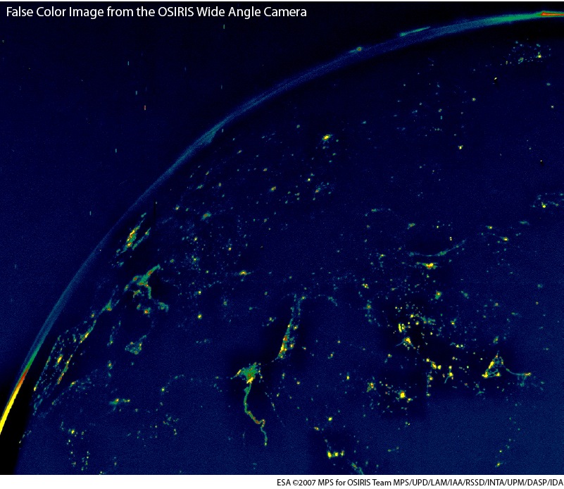
The first one is an oblique look at Europe with the Nile delta and Israel in the middle of the image. More about these images at ESA.
Some thoughts following the Space Explo Conference
Posted on Tuesday, November 13, 2007
Update 15 November: I was told at ESTEC today that videos of the conference will indeed be posted lateron once they are finished with the editing.
I went down to Berlin last week to attend an ESA/DLR conference on the future of Space Explo in Europe. A lot was said, presentations were abundant, and the various stakeholders (in particular politicians, space agencies and industry) gave their view on what Europe should be doing in the years to come on space explo. One of the main outcomes of the conference: the European Space Exploration Strategy has been reworded to the European Space Exploration Programme...he, these things can make a world of difference.
Interestingly enough, the M word, as in Moon, is still hard to pronounce by Mr. Sacotte of ESA as the agency has decided it should focus on the Mars. Seems this is a position they took when NASA was fully engaged with Mars exploration back in the early 00's. However, since then, Bush has redirected the NASA strategy towards bringing humans back to the Moon, and it seems hard for ESA to bring its strategy in line with this redirected global explo agenda. So while all countries pulling any weight in the space explo arena, China, India, the US of A, all have their focus on the Moon, Europe seems to be struggling with their lock-in in thinking about the Mars (the English pronounceation of native German speakers brings some funny mashups, as in talking about the Moon vs talking about the Mars). Germany however isn't fooled and recently announced its plans to develop a national lunar probe, something that was re-iterated at the conference by DLR Director of Space Programmes Mr. Dollinger.
There was a point where I got intruiged about the way they talked about the usual dichotomy between robotic (unmanned) and human exploration. Usually, this debate quickly ends in the trenches where the proponent on either side digs him/herself in with the usual arguments, leading nowhere. A first smart remark in this context I remember from US astronaut Jeffry Hoffman (of Hubble repair fame) who made the comment at ISU about the complementariness of humans and robots (I don't remember his complete argument, but given that he went up to space to repair a robotic explorer kind of paints the picture of his understanding). At this conference, there was the same question on the table. On itself an interesting question and space is one of the few places where this comes up all the time due to the shear costs involved in sending humans up. This time, it felt as if the conference participants, all human to my knowledge, where there to make a strong case for human exploration...because all of us attending were human. It seemed there was a stance in the robotic/human debate about us against them. Its the first time I interpreteted the debate this way, but it makes for an interesting perspective on where things might be going. The drive to explore doesn't change, its the means that are under scrutiny. Another argument in this context, one that I made together with an ISU collegue last year at a presentation was the following: the most efficient space suit is one without a human inside.
Another important topic which seemed to come up every 5 minutes during the conference was the need for communication of why Europe needs to take part in this global exploration agenda. Well, I guess its true then. The 'Artist as Space Explorer' space & the arts exhibition was nice in that respect but I had a strong deja vu of some 7 years ago when I was involved in a similar type of set up for ESA and the exhibition was mainly used as decoration around the bar with free champagne. Not that different here. Still, it appears there is a little seed taking root at ESA. Hope they'll let it grow...
If this were the web2.0 Summit held in San Francisco last month, the presentation videos would have been online by now. But this is a meeting of much less importance so no videos yet (space exploration...wasn't that something with Apollo?). I really hope they put some videos of the conference online, but given ESA's track record of keeping the walls high and dry, I have my doubts. I'll certainly address it when I get to ESTEC this week. Also in terms of putting the presentations online. If you're interested to put some faces to names, have a look at the flickr photoset I uploaded with the main talking heads. Below pictures were from a presentation by astrophysicist Hans-Joachim Blome about the Cultural Dimension of Human Spaceflight and Exploration. He managed to stay out of the usual paths and gave a glimpse at exploration from a scientific evolutionary point of view. I hope to receive his presentation later this week so I can post it here. 
Targeted advertising...or machine learning...?
Posted on Tuesday, November 6, 2007
Which of the two was it again? Who's teaching who? This insightful article Can Facebook feed its ad brains? on the imminent Facebook ad platform (and related industry) gives some clues. It still amazes me that this is the business model on which most of today's web2.0-ish Internet ventures thrive. Highly relevant advertising. Actually, when I think of it, the 'what other users liked who bought this book' feature over at Amazon is quite ok. Not that I immediately go out and buy all those books, but it provides a bit of context, and in that sense its not all that unuseful. These emerging data patterns still strike me as the Internet's equivalent to thoughts emerging, although I also immediately hear myself saying: "don't metaphor me in".
I had a very brief chat on Skype late last night with a friend over in Australia who was just about to go to work in the morning and who had this to say about it:
the 'machine' is the mechanism: the mechanism is the people. The 'machine taking over' is ultimatley a submission unto the hive of the people - it is a social demise as well as the literal manifestation of technology - and an avoidance of the self, the self will and self power of thought
DinnerTV: Its getting there, the Social API
Posted on Saturday, November 3, 2007
Aka OpenSocial. Below video gives a good intro.
DinnerTV: Adapt or Die
Posted on Sunday, October 28, 2007
Vint Cerf about Digital Economics at the Google Analyst Day 2007:
Darwin was right, you only have two choices: adapt or die
@23:16 he gives a quick update on the Interplanetary Internet.
DinnerTV: Web2.0 Summit videos
Posted on Friday, October 26, 2007
And yet another good one, this time about the Semantic Edge, the platform of platforms (recursion recursion...we didn't did invent language, and now we're only mapping it. its a nice user interface for sure). More after the weekend, first its time for a couple of days on the Edge of the Alps .
DinnerTV: Web2.0 Summit videos
Posted on Friday, October 26, 2007
Another good one, Google, Microsoft and TeleAtlas talking about one of the web's edges, i.e. mapping. Btw, if you experience some problems with scrolling through the videos (which is not allowed!?), you can also subscribe to the videos via iTunes and scroll through them that way.
DinnerTV: 30min. of the Google Guys @ Zeitgeist 2007
Posted on Sunday, October 21, 2007
Zeitgeist 2007 (below is the Youtube video). @ 9:54 Larry Page talks briefly about Google's involvement in the X-Prize, @ 17:32 Esther Dyson hints at inner space (i.e. healthcare) being a more interesting market than outer space:
Outer space is really cool but I am not sure how much Google can do with it.(via SearchEngineLand)
Vint Cerf on the Status of the Interplanetary Internet
Posted on Sunday, October 21, 2007
Found at SpaceDaily:
Internet preparing to go into outer space (nice title!)
After expanding across Earth, the Internet is now set to spread into outer space to reach parts no network has gone before, one of its co-creators predicted Wednesday.
Vinton Cerf said the proposed "interplanetary" Internet would allow people an ability "to access information and to control experiments taking place far away" from Earth.Expanding into the solar system would bring new rules and regulations too, he told an annual Seoul forum, saying he and other experts were working on a set of standards designed to guide space-era Internet communications.
"Finally, the Internet can take us where no network has gone before," said Cerf, who is Google's vice president and chief internet evangelist,
He said he and a team of engineers at the California-based Jet Propulsion Laboratory would complete a key part of the project -- establishing standards for space communications like those for Internet -- in three years.
Cerf told a separate news conference that new standards were needed because of the huge distances and time delays involved in communication across space.
He went on: "This effort is now bearing fruit and is on track to be space qualified and standardized in the 2010 time frame.
"Eventually we will accumulate an interplanetary backbone to assist robotic and manned missions with robust communication."
Virtual just another layer on top of physical
Posted on Friday, October 12, 2007
Tim has an interesting post up at O'Reilly Radar where he talks about the announcement of IBM and Linden Labs (creator of Second Life) that they're working together on interoperability of virtual worlds:
I look also for the 3D web to interoperate with location-based services. We shouldn't think of this interoperability as being just for virtual worlds. Ultimately, virtual is just another layer on top of physical. GIS folks don't think of maps per se, they think of map layers -- hundreds or thousands of levels of data overlaid on the world. Many of these layers are abstract and virtual. Aren't street addresses actually virtual? Might not other classes of data be anchored to the real world in some way? A company has a physical address, but they also have an address on the telephone network, an address on the web, and many others. Just as a skyscraper reaches into the sky from a single street address, housing thousands of souls at work or at sleep, might there not be virtual towers anchored to physical locations, embracing and extending our world?
There's quite a future ahead of us here. It's silly to try to recreate the wheel (or to own the wagon) when by working together we can build something that is so much bigger. Open standards are a winning strategy.
Finally: a peak inside online mapviewing behaviour
Posted on Thursday, September 27, 2007
What are we looking at in online interactive mapping systems such as Microsoft's Live Search or Google Earth/Maps? Interesting stuff to wonder about. All Points Blog thinks so too and links to a paper by Microsoft researcher Danyel Fisher entitled Hotmap, Looking at Geographic Attention (above image shows one of many intruiging images from the paper, this one depicting a bright spot at Latitude/Longitude (0,0)).
Evolutionary benefit from Space Explo
Posted on Thursday, September 20, 2007
Reading up on the Google Lunar X Prize at the BBC I come across this quote from Peter Diamandis, X Prize founder (and ISU founder):
"We are confident that teams from around the world will help develop new robotic and virtual presence technology, which will dramatically reduce the cost of space exploration," said Dr Peter Diamandis, chairman of the X-Prize Foundation in a statement.Working in the space business, one question that keeps me busy these days is trying to understand which of the technologies to be developed for the "space race to come" will influence society on the long run. Computer chips have gained evolutionary benefit from both the military (nuclear missile guidance systems) and the '60 space race (Apollo descent stage). If history accounts for anything, it is pretty clear spin offs from endeavours such as space exploration will play out in society in unexpected ways. With the X-prize's emphasis on robotic exploration and telepresence technologies, I bet you there will be more of this fusing into society in the decades ahead, the question is only how exactly. By the time space exploration gets anywhere, I doubt we will experience the world as we do today.
A launch US style
Posted on Wednesday, September 19, 2007
Somewhat different from the YES2 launch (earlier post), this Delta-2 rocket carrying WorldView-1 (soon in a GoogleEarth near you) follows the rocket all the way up to MECO, 2nd stage ignition and fairing separation. Quite an impressive video (via O'Reilly Radar)
Powers of Ten: still your best guide on what's coming
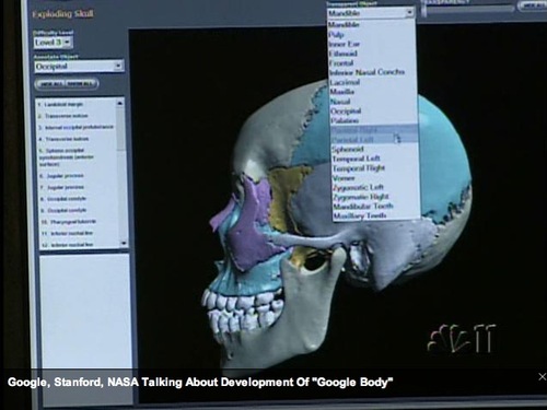
Posted on Tuesday, September 18, 2007
With Google Sky just released, the news of an upcoming Google Body (slideshow) makes me tempted to make a graph with all Powers of Ten from the 1977 movie and see at what level scientific research, government research agenda's and corporate interests are playing out (and not to forget: the military agenda!). Seems this Powers of Ten paradigm (often quoted as inspiration for Google Earth) is still your best bet at trying to understand and predict human progress these days, not only in terms of research but also in terms of accessibility of these non-human scales to average citizens through tools such as Google Earth.
This weekend I had another brief encounter with Google Sky after my initial confusion a few weeks ago from lack of reference while scrolling the skies. This time it was a lot better, although I still think an actual 3D representation, at least of the Solar System, would be way cooler than the MyFirstPlanets representations currently moving around Google's heaven (have you seen the demo tour in Celestia yet?). The current sky implementation feels more like a representation of how old civilisations once thought stars were holes in the black heaven sphere with fire behind it making them shine like they do. Its a good beginning, but they definitely need to catch up with 21st century cosmology.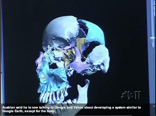
Google + X PRIZE = Lunar X PRIZE + Google Moon
Posted on Thursday, September 13, 2007
Update: more at Wired & CNN.
Just in: Google Sponsors Lunar X PRIZE to Create a Space Race for a New Generation. More at googlelunarxprize.org. At the same time, Google's LatLon blog announces an update to their version of Google Moon, an outcome of the collaboration between Google and NASA Ames.
Geoweb In The News
Posted on Sunday, September 9, 2007
'The world on Your Desktop' in The Economist, a fair read (with a good introduction over at OgleEarth) plus a first commentary on the article at TechConsumer (both via OgleEarth).
Google Earth and Google Sky Currently Don't Connect
Posted on Friday, August 31, 2007
Currently..? Above screendump shows a response by Googler ManoM on the KML Developer pages which caught my eye while doing my weekly checkup on new discussions and topics. Still no time to do a proper scope of all the new stuff that came out with kml2.2 and Google Earth 4.2 but this provides an interesting lead when I'll find that time.
Banking the Internet
Posted on Friday, August 31, 2007
Google in the economist tells us that Google's rapid ascent and its role in the market more resembles a bank than Microsoft (via), while O'Reilly Radar talks about infovis and similarities between web2.0 and financial markets. In essence, a quick friday afternoon post.
Art2.0?
Posted on Sunday, August 26, 2007

Nice how the EPFL lab below uses above image of Magritte for their lab (aptly named 'pic home.bmp').

Google Turns To The Sky
Posted on Thursday, August 23, 2007
If you haven't heard about Google Sky yet, well, than you're not reading Google LatLon, Google Research blog, the Official Google Blog (that's a lot of Googleblogs...), Google Earth Blog, OgleEarth, BBC NEWS and all the rest of the Blogosphere which has found their way to Google Sky. I'm a bit short on time so I'll just let the others do the first scoop of its features. I plan to come back with some personal insights when I find a chance to spent a good few hours with it. Diving in for the first time, above views I found quite intruiging as a universe kind of equivalent to the patchy Earth that is Google's Earth.
SciFoo
Posted on Thursday, August 9, 2007

Update from Duncan Hull (keep me posted Duncan!):
There is talk of EuroFoo, probably to be held in Cambridge. There will also be "bar camps" again, in Cambridge and soon in Manchester.
Man, I wish they'd bring SciFoo over to Europe, how cool is this ? To get a taste, have a look at this Flickr series ! Maybe a SpaceFoo? Probably a bit too exciting for ESA, but ISU perhaps?
User Generated Jobs
Posted on Wednesday, August 8, 2007
Google Blogoscoped drives home the point of increasing online behaviour in the real world (earlier post) by describing the hypothetical 2030 Google Robot FAQ's. A nice read ;) Meanwhile, in 2007, Google has on offer for you the role of Business Referral Representative.
DinnerTV: Vint Cerf on the architecture of the coming Geoweb
Posted on Monday, August 6, 2007
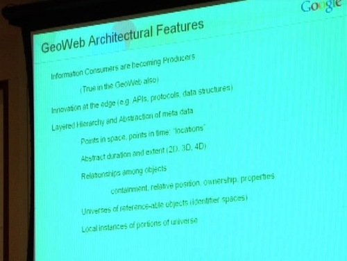
Thought provoking videos have come from the Geoweb2007 conference in Vancouver end of July (via). My shortlist:
Vint Cerf (a must-see)
Jack Dangermond (fresh view for me)
Michael Jones (always interesting)
I was especially struck by the conceptual insights of Vint Cerf where it comes to the architectural design of something as intangible as the virtual Geoweb. And of course his opening remarks to keep the Geoweb conceptually open for the eventual SolarSystemweb are music to my ears ;) Quote of the day comes from Michael Jones:
A map has become a searchable information landscape
DinnerTV: Using Google Earth for Near Real Time Natural Hazard...
Posted on Monday, August 6, 2007
Embedded below is an interesting video from Feb'07 about using Google Earth in the Earth sciences. Also here, I see the idea of "Real-life bots mapping the physical world" apply (earlier post), but in this case its not humans but satellites so the scale at which the mapping is done is quite a different one. The video is part of the indispensable Google Tech Talks, with this one unfortunately hosted on Youtube. I kinda liked Googlevideo better for these kinds of 30+ minute videos because of the option to download the entire video file to disk for later viewing in the stand alone player.
Dry Run on Earth
Posted on Monday, August 6, 2007
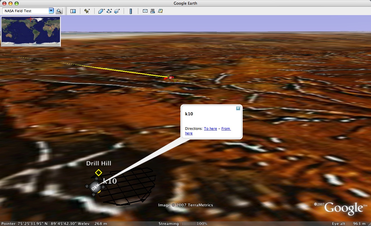
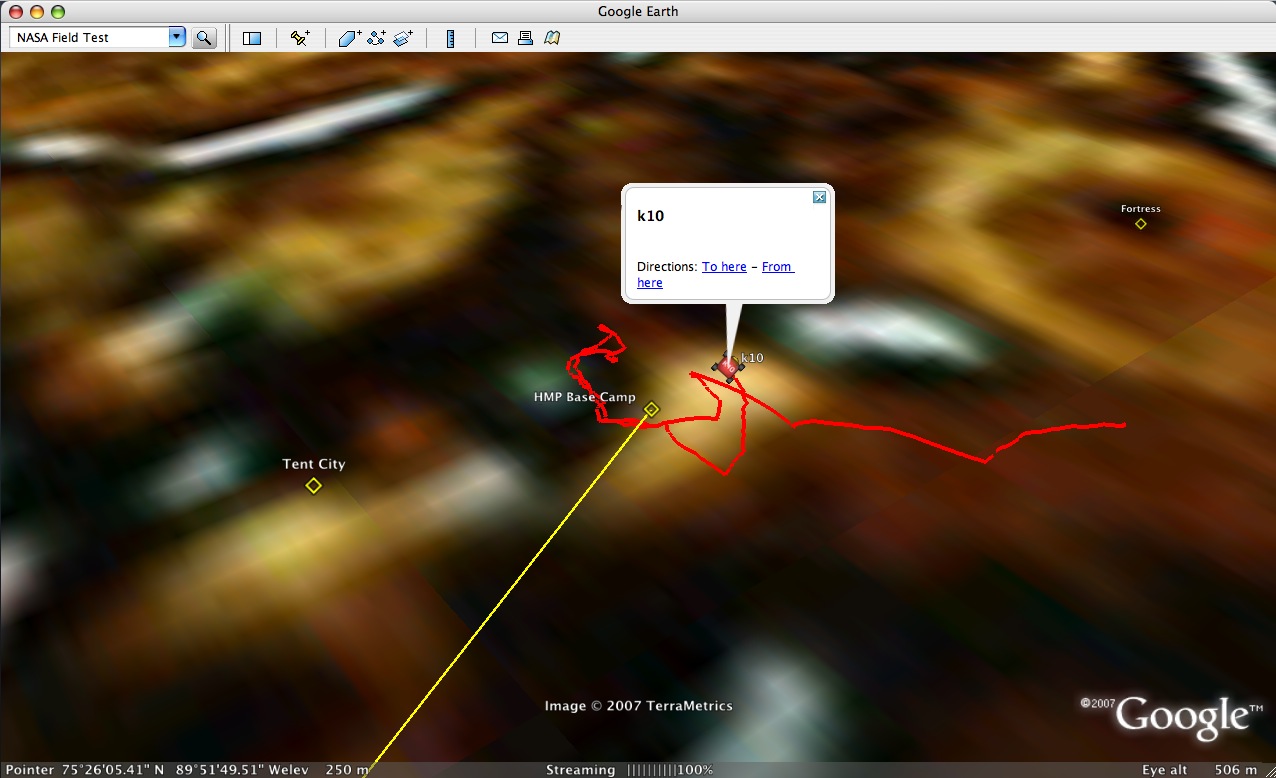
The NASA Ames Intelligent Robotics Group is using Google Earth as part of the communication of their robotic field test up in the Arctic region of Canada:
From July 10 through August 3, 2007, the Intelligent Robotics Group is conducting a robotic field test in Haughton Crater (Devon Island, Canada). Two NASA Ames K10 rovers, "Red" and "Black", will be used to perform surveys of several simulated lunar outpost sites, including a roughly 700m x 700m region called "Drill Hill." The rovers will carry ground penetrating radar to map subsurface structure and a 3D scanning laser to map terrain topography.For all I know it could be the real thing taking place on the Moon right now. And I just read that NASA on a slow month has some 4 million unique visitors to its portal...from the US alone.
RocketCam
Posted on Friday, August 3, 2007
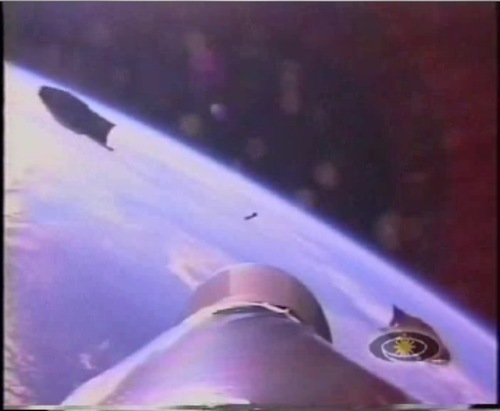
Another interesting 10-year anniversary: RocketCam (SpaceDaily post). Brilliant stuff (check this video!). Around the same time as Mars Pathfinder (earlier post), didn't know, but both firsts got me started on the space explo - cyberspace thing. Its the media stupid! Funny how nowadays everybody is zooming into the Earth from space, while these fragile rockets are trying to escape it...
Google NASA co-op update
Posted on Wednesday, August 1, 2007
Google Earth CTO Michael Jones gives a brief update on the Google-NASA co-op in this article 'Geospatial Democracy' (30th July 07):
Google and NASA have entered a partnership to make NASA’s information available on the Internet. How is the work progressing?JONES: There are technical challenges and logistical challenges. NASA is a federal agency with federal employees, and just the style of management is a little bit different than Google. It’s not better or worse. NASA is more like a real company, and we’re more like a bunch of graduate students.
We spent a honeymoon period just trying to figure out the tens of thousands of kinds of data that NASA has. Each of their researchers feels their data is the most important data in all of mankind. But which of that data is the most important? So we’ve had a lot of juried, refereed internal NASA panels deciding that historic pictures of the moon might be good, but the temperature of Pluto might not be.
So we’re working on that, and then we were working together on getting the data organized and marshaled so that it could be rolled out on Google Earth.
Data as architecture?
Posted on Saturday, July 28, 2007
Seeing these great images (and these) at DigitalUrban (like the one here below), I find myself thinking the same thing as their post title (Data as architecture) while looking at below image of DELL's website visit statistics in Google Earth (via Google Blog).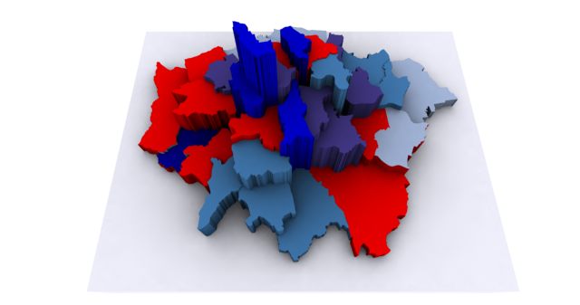
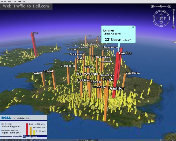
RoadmapHuman
Posted on Saturday, July 28, 2007
From AllPointsBlog comes the following quote:
The biggest threat facing the two competitors [NAVTEQ and Tele Atlas] in the future may be user-generated map content – a mapping equivalent of YouTube, as it were.
Following on below post, and reading these two articles in Newsweek and SignonSanDiego about how TeleAtlas and Navteq go about their business, I can't help but metaphor you in by comparing their on-the-road employees with the likes of GoogleBot, Technorati Searchbot, Tailrank Robot etc. Isn't it funny how we start mimicking behaviour from the virtual world into the real world. I wonder what other behaviour we might see emerging in the real world which has its origin online?
Humans r Sensors
Posted on Saturday, July 28, 2007
OgleEarth has an inspired and inspiring post up today on the coming human sensor web. If you have some time to spare, do check out his post and surf around on the links he provides in this article. You'll be in for an inspired weekend brief. Like always, Google Earth CTO Michael Jones has many interesting things to say on future prospects and more philosophical insights into where it all might be leading. Surfing on OgleEarth's original post, I found this audio recording (28min.) of a recent talk he gave at the Cambridge Conference (15-20 July). Sounds like a geospatial del.icio.us and Digg are in the making. I wonder though if there are any plans to share any future ad revenues Google would be making from all the user generated content and stories submitted by its users, and if so, how that would be done...
Northern lights in Google Earth
Posted on Thursday, July 26, 2007
My Spanish ain't what it used to be and I can't seem to find a kml/kmz file for it (its available at the blue GE button on the bottom of the post), but this seems to be a neat cyberspace-outerspace mashup: Aurora Borealis in Google Earth.
See the video here below:
Operating systems
Posted on Thursday, July 26, 2007
Just found this quote at A VC
...But what's important here is that the web is going to be an operating system...
Hmmm, gotta think this one through. Its been going around for a while (e.g. with Google Gears), but I hadn't made the jump yet...(via Battelle)
Twitter As The Sixth Sense?
Posted on Wednesday, July 25, 2007
I have some vague but strong memories of reading a book as a kid where on another planet a civilisation evolved to a state where they could communicate via telepathy. In my memory, this way of communication felt surprisingly natural, so natural even that I hardly took notice of the fact that it was actually way off from the way we normally communicated on this planet in the 20th century...
Fast forward to 2007: mixing up web2.0 with space explo (or the other way around) is being discussed at the participatory explo workshop at Ames. Reading this 26June Wired article 'How Twitter Creates a Sixth Sense', I can totally dig it. Consider walking around your local supermarket and getting twittered by your favorite Moon explorer having a picnic on the Moon with a view of the Earth. Now that's what I call stretching the mental picture. Preferably the Astronaut2.0 will also send me some live images of the Earth, but that's another story...Btw, do machines twitter? (via MarketingFacts)
Dressing up Amsterdam
Posted on Tuesday, July 24, 2007
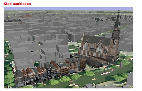
Meanwhile, down on Earth...Just got this link send to me by a collegue. The city of Amsterdam is offering its greyscale 3D representation in Google Earth (blogged about at GEB) to its citizens, offering us to dress up our own city. Its a pity they don't offer an English version of the page, but in short it explains a partnership between Amsterdam and Google and points to a manual on how to build and upload your own user generated buildings to the Google Warehouse. Over at my other blog I just posted a UGO visualisation of the tour of 10 building highlights that have already been modeled by the city's Geo division.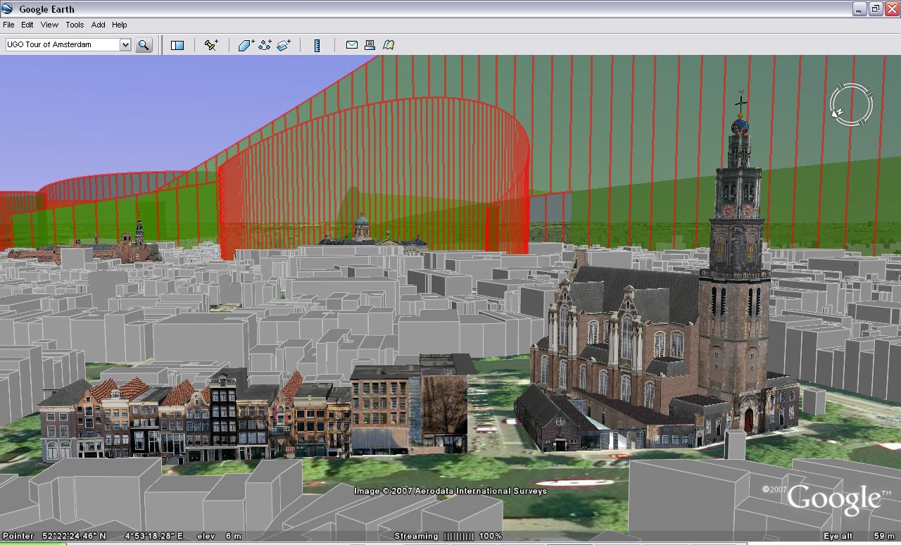
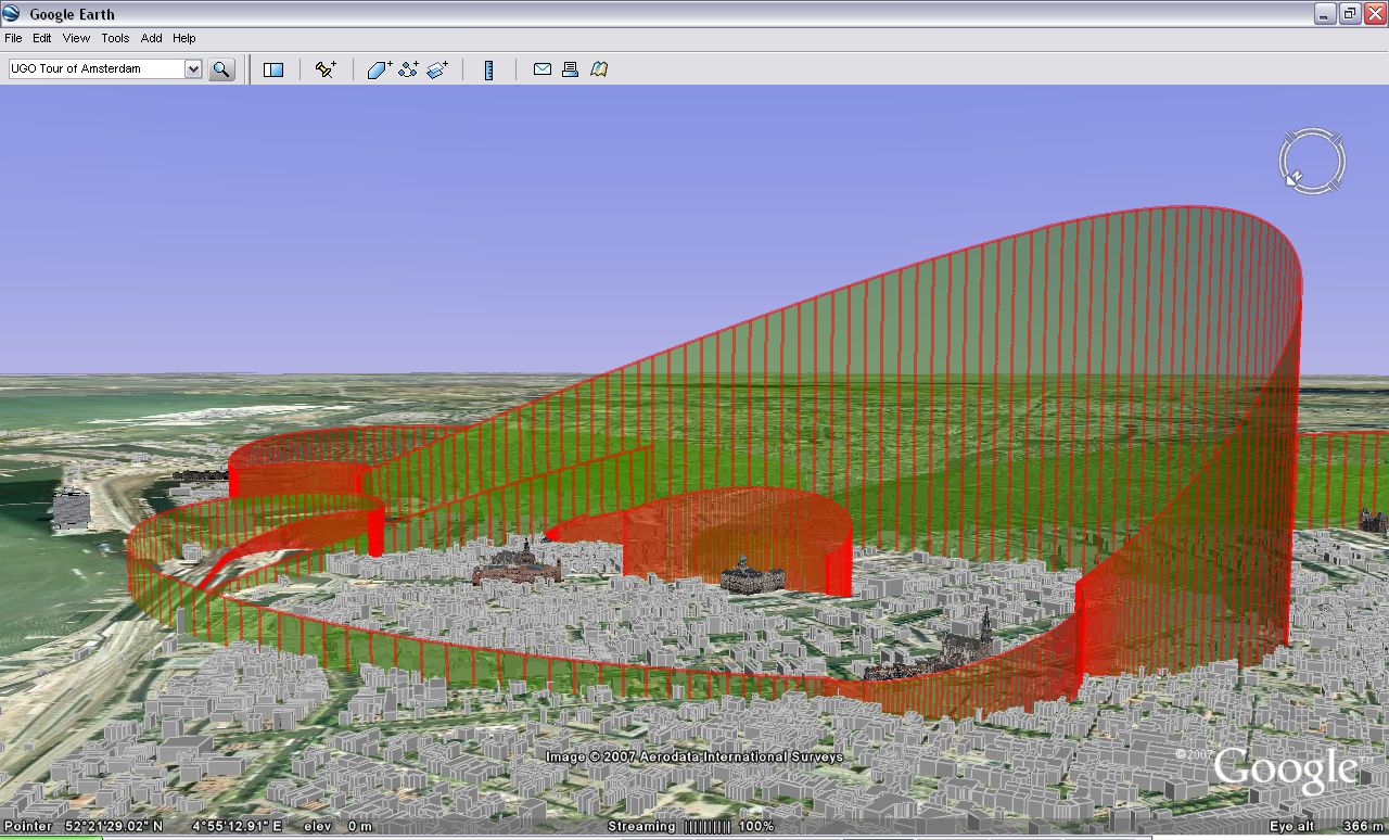
Catch up time
Posted on Tuesday, July 24, 2007
Bloggin' has been sparse these last few weeks, partially because of my latest dive into UGO development. Assuming you read OgleEarth and Google Earth Blog, you are pretty well covered on interesting news coming out these last few weeks. Just a few things worth (re)blogging:
- The Automated Transfer Vehicle (ATV) was transported from ESTEC to Kourou for launch to the ISS next year. There is a nice photo report at ESA, amongst which above photo. A Billion+ craft going through the Dutch canals ;)
- The first Metaverse Roadmap (MVR) is out. An inspiring read!
- NASA has now its own layer inside Google Earth. Still rather rudimentary, like the ESA layer, but a good start. (via Google LatLong blog)
- Barnabu blog posted two space related kml's showing the Moons and the planets in a solar system context (via GEB). Its latest addition, the Cosmic Microwave Background Radiation
- OgleEarth has been ogling Mars. And again. Looking at the word 'ogling' a couple of times, its about time to have a better understanding of what to ogle actually means. As a Dutchman I usually assume I have a comprehension of the English language, but most of the time I know I miss the subtleties of knowing the real English use of a term. For my own understanding, here is the Merrian-Webster dictionary explanation:
Aha! How about OgleMars.com Stefan? ;)
Happy Birthday Pathfinder
Posted on Wednesday, July 4, 2007
Wow, 10 years ago already. Almost forgot Mars Pathfinder landed on the 4th of July. Seeing the images over a 33k6 modem back then sure was a good inspiration while studying aerospace engineering. When I think of it, it actually got me into the direction which, 10 years later, resulted in the theme of this blog:
A blog about outer space, cyberspace, their common future, and all that is leading up to it...
Virtual Worlds Presentation by Mitch Kapor
Posted on Tuesday, July 3, 2007
Over the weekend I stumbled on this 1:42:04 video of Mitch Kapor (of Lotus fame and an early investor in SecondLife) giving a presentation and leading a panel at the MIT Virtual Worlds laboratory June 15 (just 2 weeks ago!). Interesting watch/listen! I am still a bit skeptical about all this virtual world stuff, but like he says, this seems more to do with the feeling of knowing there is something going on but that its hard to articulate what it exactly is. For everybody interested in getting a good introduction about virtual worlds, do watch/listen the whole video.
The panel discussion is also worth noting. I especially like the comment by Robert Gehorsham (with Forterra) at 1:22:23 into the video about the self-imposed limitation of 'only' rebuilding real3D into a virtual platform. Somebody throws in: 'locked into assumptions'. Good point. Lets use virtual worlds to flex our limits within the Powers Of Ten, not stick with the human scale only (there is enough of that around already). Here are two other interesting scribbles from watching the video: reality acquisition devices & ROI on mystical experiences. And not to forget, the quote of the day: Please don't metaphor me in!. Btw, there is a new 6min talk by MS Virtual Earth PM over at TED.com
Human-Machine-Nature interfaces
Posted on Monday, June 25, 2007
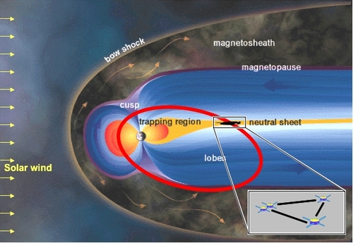
Quite some news recently about human-machine interfaces coming out. In particular the non-intrusive ones like this collaboration between Graz and University of London (check out this video ;). Not related, but OgleEarth is back at blogging, and he brings back some cool footage from ISDE5. Like he says, a possible hint at where things might be going with digital globes. Now what i'd like to see is a near real time vis of the Cluster data in one of these domes...magnetosphere storms as they happen...These four ESA satellites are up there now, so how difficult could that be?
Oh, and a quick note about an interesting conference coming up:
- The 11th International Conference on Information Visualisation from 2-6 July, interconnected with this Vizualisation summit
Participatory Exploration
Posted on Monday, June 25, 2007
Just in:
- An article about Pete Worden's talk at the ISDC through Second Life
- NASA Ames to Host Summit of Technology and Communications Experts
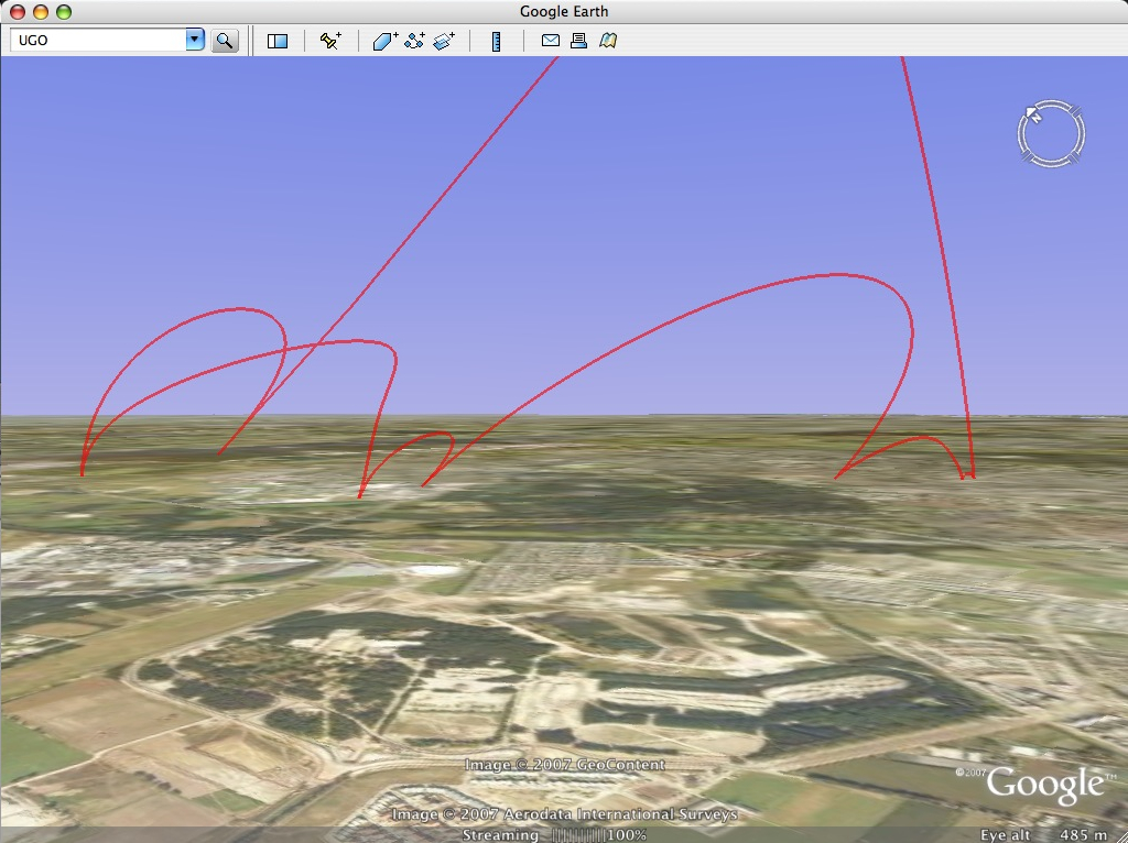
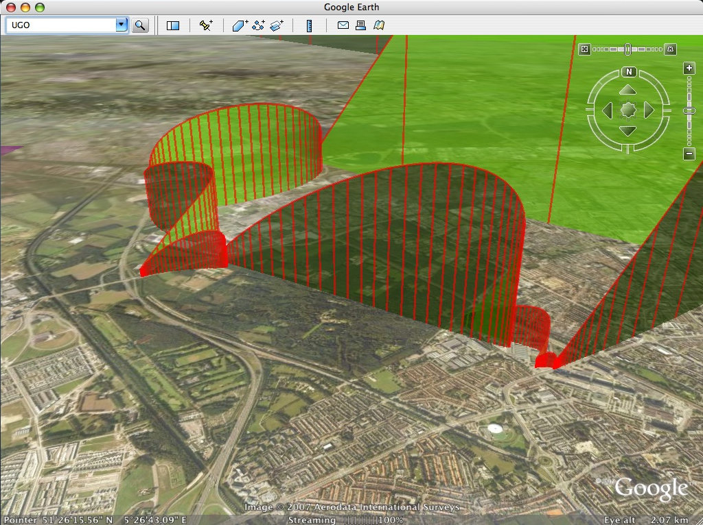
Google airplane & emergency response 2.0
Posted on Friday, June 15, 2007

- Brownian Emotion brings the news of an idea put into practice by Google that has been floating around for a while: Google Maps/Earth in airliners. His idea to put cameras on the outside of the plane is an idea I have been thinking of pitching to Virgin once a few years ago. Pretty simple to do...and very cool to have! ;)
- Here is a nice example of a webservice that could do with a "2GoogleEarth API"
API IPO
Posted on Friday, June 15, 2007
Looking at Google Earth again, I wonder if there is a Google Analytics API? If you can build on Facebook via an API (ie. use its social network database), I am sure you can build on an API of a statistics system. And while we are at it, why not then combine the Google Analytics API with the Google Earth API into a direct Google Analytics2Earth API. Realtime GIS...The only thing to wait for then is some good Google online identity in our hands...(combining a video at OgleEarth with this hint to a Google Books2Earth API). Its funny how they use phones in The Matrix ;)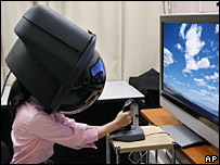

SimonPete Raymaker and other 2nd Life news
Posted on Monday, June 11, 2007
Coming back to Amsterdam after a long-deserved couple of days holiday at the beach in Knokke (.kmz), here is a brief overview of some interesting stories (IMHO):
- NASA Ames Director Pete Worden presents to the International Space Development Conference via Second Life. Now here is a retired US General who definitely gets it ;) A lot of interesting stuff is originating from Ames since he became center director (e.g. Google NASA partnership, NASA CoLab, Yuri's night @ Ames), and listening to this talk I am sure there is lots more coming!
- Following the Second Life meme, this is one of the most intruiging pieces of Second Life coverage I have seen sofar. Its the established political scene in Sweden getting introduced to a 21st century technology, including the cutting of a digital ribbon (well, sort of...;) OgleEarth has (a lot) more on the story (he was the cameraman).
- Something I noticed myself a week or so ago, and after reading this post, was reminded about it again: the stars seem to be moving in Google Earth. Is this the start of something new?
Google Developers Day 31st May 07
Posted on Thursday, May 31, 2007
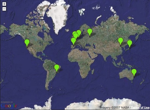
Disallow: bedroom
Posted on Thursday, May 31, 2007
Where2.0 is happening so lots to blog (e.g. Google Street View, KML 2.2 etc) but little time, so this one says it all for now:

(via spatially adjusted)
Here are a few other stories worth reading: RSS for the genes, Charlie's Diary: Shaping the future, The Final Days of Google, blog statistics are a drug (I can relate...)
Light posting ahead
Posted on Saturday, May 12, 2007
Haven't been very active on this blog lately, which is mainly due to my full focus on the development of my UGO project, making me less susceptible to reading my section of the blogosphere on all the news coming out on a daily basis. I haven't finished my first build yet, so this light posting will likely continue for the coming days/weeks untill I finalise a first UGO app. In the meantime, some interesting developments worth noting:
- Search Engine Land (definitely a good read)
- a joke
- Anil Dash post
- News.com
And of course there is the news of a new WorldWind JAVA release.
Some other news items I found
Posted on Monday, May 7, 2007
Some other new items I came across these last few weeks:
- An update on the Google NASA colab
- An upcoming technology that might change how you view photos (check out this video, even if its only for the fine choice of Bach music)
- Mouse brain simulated on computer
One of these weeks...
Posted on Friday, May 4, 2007
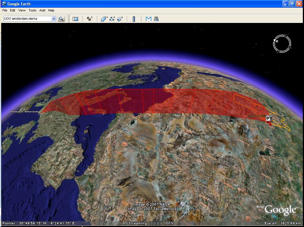
One thing that has intrigued me for some time is the possibility to visualise my flightpath while surfing around in Google Earth. With a background in aerospace engineering, I guess the idea of orbiting the Earth comes somewhat natural to me (at least in spirit), and I have always found it striking that the movement of navigating Google Earth resembles the path of spaceflight hardware, be it rocket launches, ICBMs, re-entry capsules, Low Earth orbiting satellites, the ISS, basically anything space related (near Earth). This is also the reason why I started experimenting with my little python script (earlier post). Being somewhat of a mac guy, the fact that I was coding python to interface with the Google Earth COM API (only available in windows) kind of felt akward because it would not allow me to implement my idea as a cross platform tool. Untill the cross-platform GE Sharing showed me the way...
The last few weeks were one of these weeks where everything seemed to come together in that respect. First there was the introduction of the Darfur layer in Google Earth on April 10th (an eye opener!), followed about a week later with the introduction of the GE-sharing application. Following my somewhat premature comment on the Darfur implementation (good point OgleEarth), and OgleEarth's comment on my little python visualisation script, I figured it was time to put my mouth where my money is.
So, to put a long story short, I basically started a 2-week coding trip (lots of pizza, little sleep), working my way through CGI programming, python, KML, and server-client architecture, aiming to put my python script to use in a similar fashion as had been done so cleverly by the GE Sharing guys. But just when I thought I was closing in on it last weekend, I ran into some issues (both KML/networklink related and python related) which made me come to a somewhat unanticipated halt...
Nevertheless, even though my objective of a cross platform Google Earth visualisation tool has not materialised (yet!), I have been having a lot of fun flying around in Google Earth, testing my algorithms, visualising a lot of different flightpaths, and learning about the nitty gritty details of coding python, KML and cgi by trial and error. Along the way I have collected a wide variety of screendumps logging my progress, and I like these images already well enough to wanting to share them. So with my aim to continue the development of my little app (which I dubbed 'UGO', for 'User Generated Orbit'), I started a new blog called UGO where I will post some of the progress I made sofar and will keep on posting my progress towards this goal.
ps. Following up on my comment v.v. Darfur (earlier post), one of the other ideas that came to mind about how to harnass the collective outcry would be for people to use something like my little app to upload their personal 'Darfur UGO' and then aggregrate them all into one big Darfur layer, showing our concern the 'Google Earth way' ;) Here is mine already: kmz file.
Updated blog feed
Posted on Tuesday, May 1, 2007
Mmm, turns out I already had a FeedBurner account with several subscribed readers to this blog (re: earlier post). Strange how things like feeds can get this complicated...;) Anyway, to keep things organised I decided to delete the new account and merge its feed with the already existing one. For those of you who subscribed to the new one in recent weeks, please visit my blog's webpage and (re)-subscribe one more time to the FeedBurner link on the right.
To check if you have the correct feed, the correct FeedBurner account should now have the following URL: http://feeds.feedburner.com/tobedetermined (for Safari on OSX this should read: feed://feeds.feedburner.com/tobedetermined)
Thanx again...
What else with Google Earth?
Posted on Wednesday, April 18, 2007
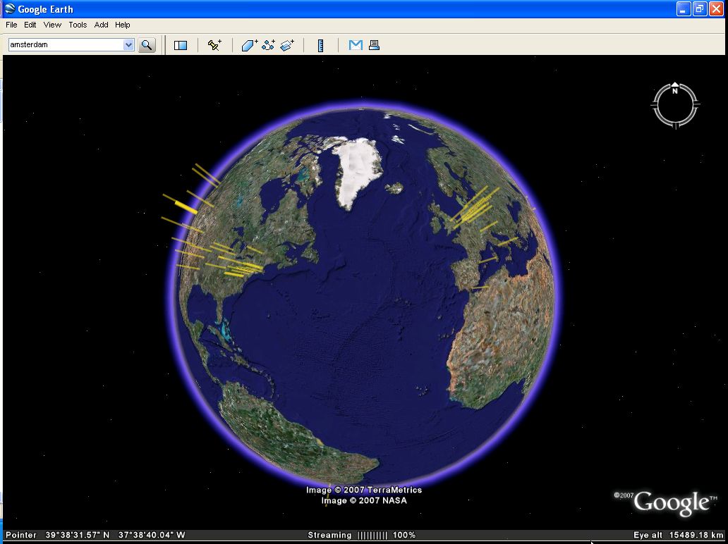
Click to Enlarge
Pondering this question, I stumble upon an old post over at Google Earth Blog (June '06) where above Analytics2kml is described. Basically, its a Google Earth mashup from Google Analytics web statistics right into Google Earth. Sweet...(why isn't this available straight from the Analytics page?).
Brings me to the next question: when will I have a KML RSS feed to my blog statistics? There seems to be something missing with Google Earth in sofar that currently I mainly end up in Google Earth through some KML link on a standard 2d website. When will be the time when I start up my Google Earth browser right from computer start up...even before I open Safari, Firefox or Mail...? Unype is nice, but it doesn't really do it for me (the fact that it uses a proprietary unype server to link up Skype with Google Earth feels...well...exposed...isn't sending my user stats to Google enough? Would be a nice gesture if Unype runs a statistics page with full disclosure of the data they log) What else? The embedded Google Earth in a website is interesting, but again, with what purpose...virtually flying...?
The last couple of weeks I have been entertaining myself writing a proof-of-concept python script to visualise ![]() my virtual travels in Google Earth in Google Earth. But also here...beyond a proof of concept, the killer app alludes me for the moment (not to mention that the updating of the position through the Google Earth COM API is too rudimentary for the moment to actually make a nice graphic).
my virtual travels in Google Earth in Google Earth. But also here...beyond a proof of concept, the killer app alludes me for the moment (not to mention that the updating of the position through the Google Earth COM API is too rudimentary for the moment to actually make a nice graphic).
(Update 20th May: this turned out to be related to my particular implementation in my python script. Check out my new UGO blog for a better use of the COM API)
Is that NY burning? Darfur in your face!
Posted on Sunday, April 15, 2007
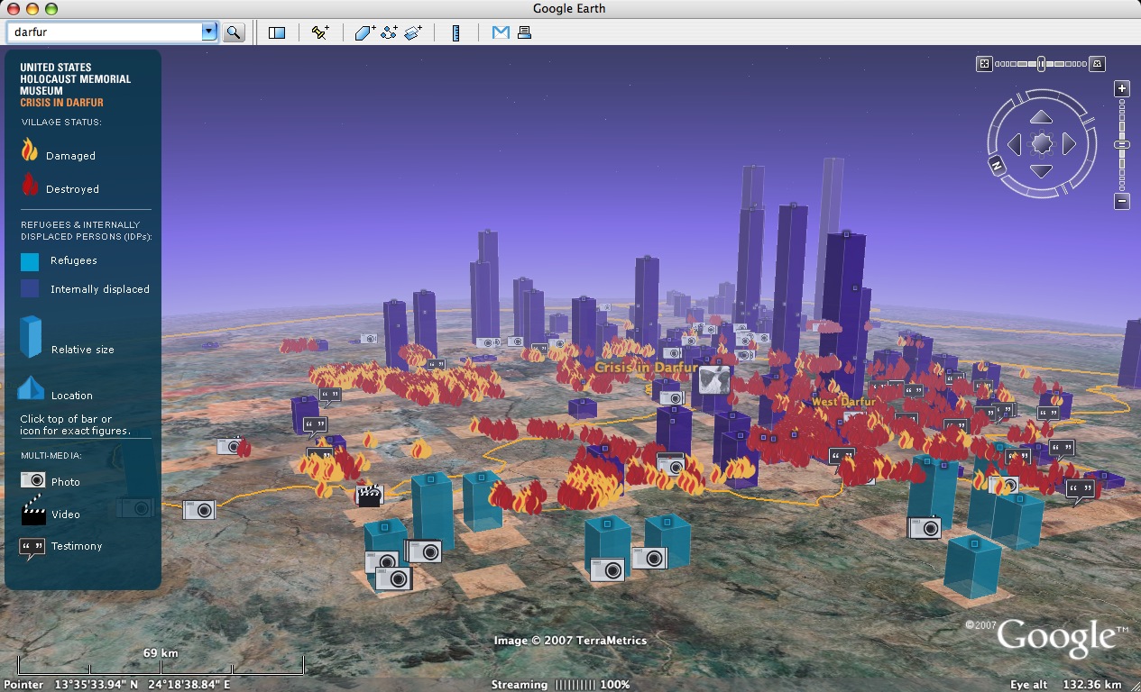
Click to Enlarge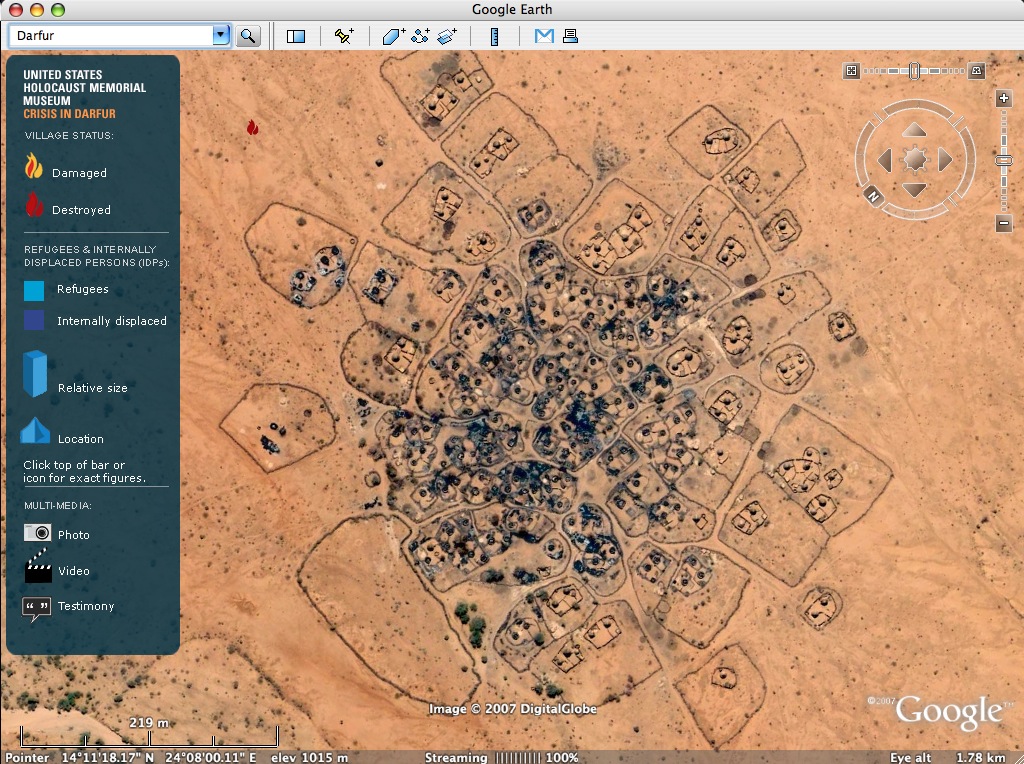
Click to Enlarge
Its been blogged about quite a lot already, nevertheless I have to blog this because putting Google Earth to use for this purpose is really the way to go. The one critique about this particular implementation where I believe there is room for improvement is the way they put the tool to use to harnasse the collective intelligence. Come on, there is a potential 200 million people out there who together can influence the future course of this collectively suppressed genocide. The #1 thing I should do according to the United States Holocaust Memorial Museum is sign up to a Genocide Prevention e-Newsletter...? Hell, that's not gonna make much of a difference for these people over in Africa!? Why not include a button in the Google Earth layer where I can immediately put my money where my mouth is (even if its a single Euro) in order to help the relief effort, or better, help rebuild the particular village I am looking at at this very instant in Google Earth.
And what about the statistics...Google says it will use this particular implementation of a Google Earth layer to learn about the actual visits and use of this tool to educate about these global issues:
Google plans to track whether use of the Darfur site sparks new community and political action on the internet, taking that as a measure of success.
Make them public...lets see what these statistics are!
FBTO gives its roof a paint job
Posted on Wednesday, April 4, 2007

Dutch insurance company FBTO took no risk and painted its corporate logo on its roof to show up in the next update of Google Earth (Via MarketingFacts, in Dutch). Here is a video entitled 'Google Kijkt Mee (Google Watches Along)' where FBTO marketing manager Paul Koopman explains the why and how (in Dutch). Wouldn't it be handy if Google had a listing online of its planned database updates, just like they did earlier this year down under. I have a pretty large roof myself, which I wouldn't mind decorating if only I knew when to do it.
Space xplo in virtual space
Posted on Sunday, April 1, 2007
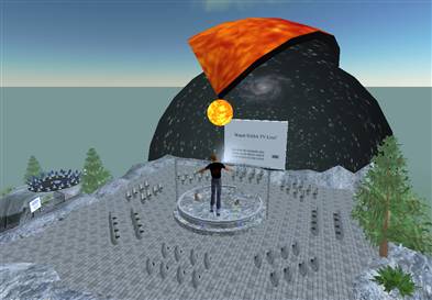
FeedBurner goes outer space...
Posted on Tuesday, March 27, 2007
Finally...where can I sign up for a feed from the Mars Exploration Rovers or, say, the International Space Station?
A couple of months ago I stumbled upon this ad by FeedBurner which I found kind of intruiging. Thinking about the convergence of user generated content, games like Spore, collective intelligence, NASA teaming up with Google, Google Earth becoming more mainstream, locative media art, blogjects, my project with Jeremy hight 'Floating points', The Internet of Things, advertisements 'in space' and satellites as blogging objects, it seemed they tapped into the right kind of nerve with this particular add. There won't be anybody blogging from Jupiter anytime soon, but considering that satellites have been blogging since the early days of Sputnik (audio), the idea of the blogosphere moving into outer space doesn't strike me as all too crazy (let alone the advertising dollars). The main question that strikes me is: what would somebody something near Jupiter blog about? Any thoughts?
(note: the above flash file was kindly provided to me by FeedBurner after some back and forth communication on my request to host the ad on my blog. Sofar, I haven't been able to make the click-through URL for this particular ad work, so in return I am happy to host their FeedBurner ads URL. Thanks Jessica.)
200,000,000 and counting
Posted on Tuesday, March 27, 2007
Google Earth hits 200 million 'unique user activitations' as of February (via MIT Advertising Lab)
Cyberspace or the metaverse?
Posted on Thursday, March 22, 2007
Update Monday 26th March: The lecture of Bruce Sterling is available here (649 Mb Quicktime)
Soon, here will likely be the online video of Bruce Sterling's talk tonight at 'Pakhuis 't Zwijger', 2nd in line, about an hour into the evening programme. Felt like he was off to a slow start, but had some pleasant rides along the way ;)
After this cyberspace revisit, I just uploaded a talk I found on my harddrive from Michael T Jones (Google CTO, must be from Where2.0 2006, but can't find it anywhere anymore online). For me, its the follow up on his other highly inspirational talk. And here's an interesting press release from Bruce Sterling's blog on a conference on locative media.
Eric Schmidt interview
Posted on Tuesday, March 20, 2007
An excellent and clear interview with Google CEO Eric Schmidt (blogged all over the place).
Updating your res in Google E
Posted on Saturday, March 17, 2007
Wanna get a better resolution of your house in Google Earth? Consider inviting Osama Bin Laden for tea.
Spore
Posted on Saturday, March 17, 2007
Update saturday March 17th: I thought this already happened a few weeks ago, but only now is there an official announcement that Google acquired AdScape, an in-game advertisement company. Seems to fit nicely with the objective of user generated game content...mix that with Spore and you get "Evolution, sponsored by Adsense".
Following a lead from a blogpost @ 3pointD on the SXSW conference, where Will Wright gave a keynote, I stumble upon a game currently under development which totally blows me away. Working title 'Spore'. Below are some videos where Will Wright demos the game. Its amazing: how could I have missed this one? The videos have had over 2 million views. Kind of brings the whole point of the merger of outer space and cyberspace home. Mission accomplished. Blog closed till further notice ;)
Interesting note on the first video is the commentary by Will Wright. Watching it from a distance, I am surprised how much the intonation of his voice resembles that of Google Earth CTO Michael T Jones in this seminal 2005 presentation on Google Earth (if you haven't watch this presentation, do...its definitely worth it). I wonder what happens if you overlay Will Wright's video with the audio track of Michael Jones...would anybody notice? Anyway, the concept implemented in Spore gives some interesting clues as to where the combination of collective intelligence, user generated content and space exploration might end up in the future (harnassing, leveraging etc, you know the drill). Oh, and btw, Will Wright is the guy from Simcity and the Sims in case you wondered. Here is an interview with Will Wright on Spore in Popular Science.
Spore gameplay video (February 2006)
Spore demo from E3 2006 (may 2006)
Computer liebe
Posted on Tuesday, March 6, 2007
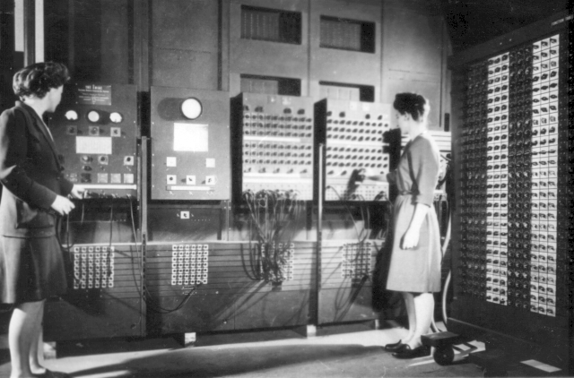
Via Jurryt Pietersma, did you know this (from an interview with J. Presper Eckert, co-inventor of the ENIAC):
Q: So it's a myth that ENIAC could only add, subtract, multiply and divide?Sweet...More at computerworld.com.
A: No, that's a calculator. ENIAC could do three-dimensional, second-order differential equations. We were calculating trajectory tables for the war effort. In those days. The trajectory tables were calculated by hundreds of people operating desk calculators -- people who were called computers. So the machine that does that work was called a computer.
Btw, for those of you in the Netherlands, I just discovered this series of lectures that could be of interest to you: cybersalvations. Here is the line-up:
March 21:
Bruce Sterling (science fiction writer, design visionairy) &
Peter Pels (anthropology, Leiden University)
Moderator: Sally Wyatt (Virtual Knowledge Studio, former president of the European Association for the Study of Science and Technology)April 11:
Rudy Rucker (science fiction writer, mathematics professor)
RU Sirius (founder cyberculture magazine ‘Mondo 2000’)
Moderator: Giselinde Kuipers (sociology, University of Amsterdam)May 2:
Brenda Laurel (virtual worlds and game designer)
Bruce Damer and Galen Brandt (virtual worlds developers and performers)
Moderator: Christian van ‘t Hof (Rathenau Institute)Location: Pakhuis de Zwijger, Piet Heinkade 179, Amsterdam
Start: 19.45 uur
Entrance: Free
The Earth pulse
Posted on Monday, March 5, 2007
Its not my normal routine to blog about Google Earth kml files. For one because Google Earth Blog and OgleEarth do a much better job than I ever could, and (2) because there are so many being released these days that it is hard to keep up (don't want to end up in the categories section of the geographic web...and now with kml search, that's no longer needed anyway).
This one I have to blog though. Reading through the kml specifications, I came across this time-lapsed serie ![]() of NASA Blue Marble imagery. Still puzzling over the idea of 'pattern recognition' as prophetised by Jeff Hawkins of Numenta (previous tbd post ::: just found out they released their first release of the Numenta platform for Intelligent Computing (NuPIC)), this serie of images displaying the appearance of the Earth through 1 orbit around the Sun gives food for some good pattern recognition thought. See for example the pulsating ice sheet coverage as seen from the North Pole (image above). Its quite extraordinary that everybody running a computer and an internet connection these days can have a look at these out-of-this-world patterns. And this is only just the beginning. Anytime soon now, we can all have a go at making our own personalised 'unconvenient truth' documentary ;)
of NASA Blue Marble imagery. Still puzzling over the idea of 'pattern recognition' as prophetised by Jeff Hawkins of Numenta (previous tbd post ::: just found out they released their first release of the Numenta platform for Intelligent Computing (NuPIC)), this serie of images displaying the appearance of the Earth through 1 orbit around the Sun gives food for some good pattern recognition thought. See for example the pulsating ice sheet coverage as seen from the North Pole (image above). Its quite extraordinary that everybody running a computer and an internet connection these days can have a look at these out-of-this-world patterns. And this is only just the beginning. Anytime soon now, we can all have a go at making our own personalised 'unconvenient truth' documentary ;)
But...but, where's the singularity?
Posted on Sunday, March 4, 2007
Vernor Vinge recently gave a talk at the Long Now foundation: What if the Singularity does NOT happen.
....It's 2040 and nerds in old-folks homes are wandering around, scratching their heads, and asking plaintively, "But ... but, where's the Singularity?"...As part of his excursion into possible future scenarios for humankind in case the singularity does not happen, he explores the importance of human space flight as a way to secure our long term future. His conclusions sofar:
Humankind's presence in space is essential to long-term human survival.
That is why I urge that we reject any major humans-in-space initiative that does not have the prerequisite goal of much cheaper (at least by a factor of ten) access to space.
Makes sense. Not so sure though if I agree with the idea of human spaceflight as being essential for our future survival, but that doubt is more to do with the notion of 'humans-in-space' compared to that of 'humankind's presence in space'.
KML Search explained
Posted on Sunday, March 4, 2007
Directions Magazine has an informative graphic explanation of KML search.
update Sunday March 4th: Another informative article on the same topic at internetnews.com (via OgleEarth).
Upper stage breakup in space
Posted on Tuesday, February 27, 2007
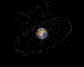
After hearing about it at the ISU symposium last friday, I am reminded about a new breakup in space, this time an unintended breakup of a Russian Breeze-M upper stage. BBC has the story. I wonder whether when we will see a Google Earth version this time...
traceroute Rosetta
Posted on Tuesday, February 27, 2007

Related to my previous post on Rosetta's view of Mars, I just read on Slashdot about the plan Vint Cerf is working on to expand the Internet into the Solar System:
Communication between a rover operator on Earth and a rover on Mars, via a relay orbiter, can't use standard Internet protocols end-to-end. That problem is at the root of a lot of the design work we're doing for the IPN... As part of the NASA Mars mission programme, the project aims to have by 2008 a well-functioning Earth-Mars network.An excellent read I must say, the Slashdot discussion, especially because only at the very bottom of the page does it actually start talking sense, the rest is just geeks getting off on geekjokes. Thought this one was quite to the point:
Parts of this planet we live on don't even have access to a broadband Internet connection, and now they want to plug Mars on the network? Talk about priorities...But then again:
parts of this planet are even more worthless than the lifeless Mars. Leave the stragglers behind..keep pushing forward. -they don't call it the human race for nothing
The idea to expand IP into the Solar System has been around for a while, and to me it obviously makes perfect sense. Evolution you might say. It has been working in Low Earth Orbit onboard an SSTL satellite for quite a while already (video @ Cisco), and Cisco is seriously interested to get deeper into the game.
KML search capability: hurricane+katrina
Posted on Tuesday, February 20, 2007
Click to enlarge
OgleEarth and Directions Magazine have the news of a KML search capability recently announced by Google on their maps API blog.
Leaving the discussion on the licensing of Google Earth @ work for a moment, here is an intruiging thought I like from Allen Doyle discussing the release:
But, hey! It's a start. The buzz is there. It's easy to post KML files. How hard would it be to post the entire metadata holdings of a large geospatial data provider like NASA or NOAA in KML? I bet a service like GCMD could post theirs in a week. At Where 2.0, we could be watching demos of Google Earth finding, and displaying, realtime remote sensing data.Makes me wonder what an HTM would have to say about the patterns?
Btw, below is what Google Earth now comes up with searching for 'hurricane+katrina'. Fairfield Inn by Marriot? Not exactly what I was looking for...although...mmm, maybe...if it were realtime data ;)
Click to enlarge
Mars rovers on Earth
Posted on Tuesday, February 20, 2007
Click to enlarge
Thinking about a project by c5 I read about in Jeremy Hight's text on Floating Points:
Now groups such as the C5 collective are doing work such as the GPS mapping of the entire great wall of china and then placing the coordinates in another location. This type of work creates a layered commentary and plays with form and semiotics as well as referencing the Situationists who developed absurd commentaries like a walk through the streets of Paris following a map of another city.
I had an idea: lets digitally translate the trajectories of the 2 Mars rovers to a suitable location on (Google) Earth.
On Intelligence
Posted on Sunday, February 18, 2007

Every now and then I gather a list of books I come across while doing research on the Net and order them via Amazon. The latest batch included a book called 'On Intelligence' by Jeff Hawkins, published in autumn 2004 (Amazon). I started to read it a couple of days ago and it completely captured my imagination. Finished it in 3 reads. If you are interested in state-of-the-art thinking on how the brain conjures up something like intelligence, and how this could potentially be implemented in machines, this is it.
Some of the most thought provoking points for me stem from his discussion on the potential of an Artificial Intelligence (AI) intelligent machine, or HTM (Hierarchical Temporal Memory) as he calls his model (.ppt), to make sense of the world through some as yet undefined exotic senses. For example, if he is right that the neocortex basically works on patterns, an intelligent machine based on HTM can learn to make sense of (and predict) global weather patterns using as exotic sense a widely distributed sensor web. Basically, any pattern can be used in this sense, be it Google user statistics, stock market fluctuations, satellites studying Solar Weather, genetic sequencing, hell, even the web itself is probably one big pattern if you have the right senses for it...we could be in for some pretty unexpected extensions of our reality, if we know how to translate them back to our human senses that is...
Doing some further background reading, I came across a couple of interesting video presentations by Jeff on his theory, potential applications and his future plans. In addition, I found this remarkably recent (feb '07) Business2.0 article on his current whereabouts at Numenta, the for-profit company he spun off from the Redwood Center for Theoretical Neuroscience to implement the model he described in his book 2 years ago. And here is a recent Science article about the same topic (Oct. '06).
- Jeff Hawkins presentation at the 2005 MIT Emerging Technologies conference (48 min.)
- Jeff Hawkins presentation 'How the cortex works' (Sep. '05, 54 min.)
- Jeff Hawkins presentation at IBM Almaden Institute (May '06, 64 min.)
- Business2.0 blogpost with brief video interview
Chinese ASAT test analysis in Google Earth
Posted on Sunday, February 18, 2007
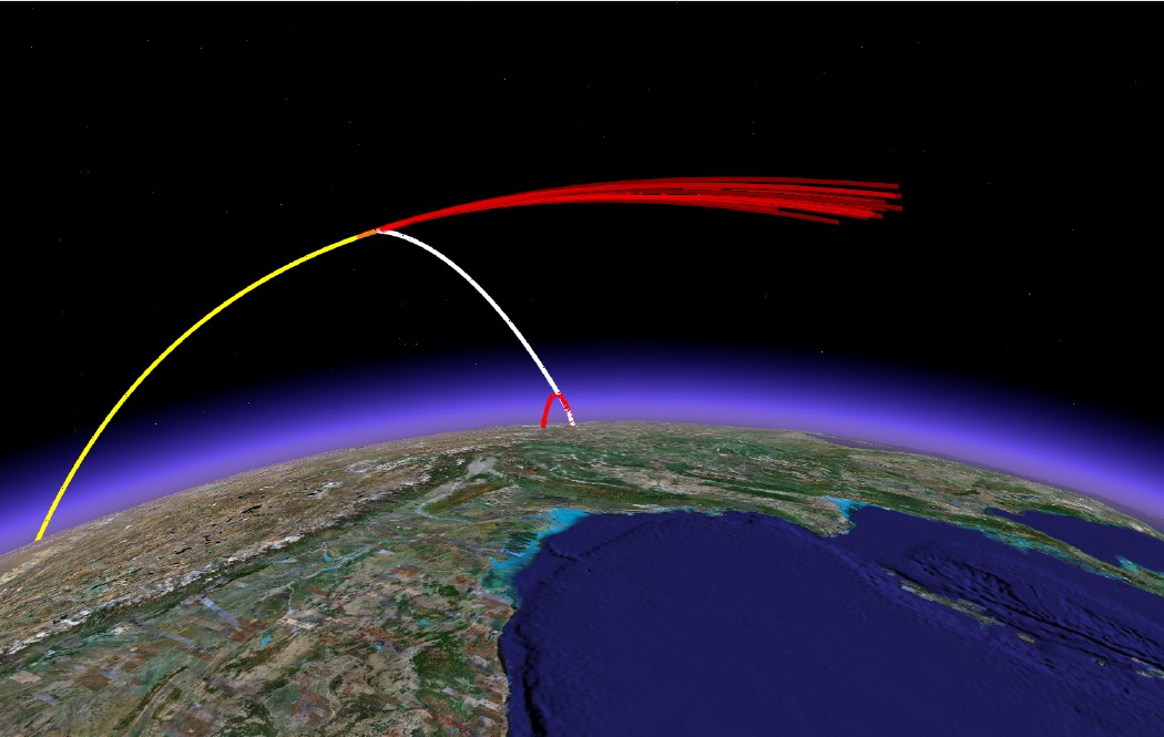
Click to enlarge
Catching up on my blog role after a week of virtually no second life activities (is that proper English?), I come across a post at OgleEarth on the Chinese Anti-Satellite test I blogged about last month. Turns out researchers at MIT's Science, Technology and Global Security Working Group did exactly what I was looking for: a visualisation of the satellite kill in Google Earth.
Apart from the kml file displaying above scene in Google Earth (which as yet appears to be a static visualisation only), they also issued a report on the same website which gives some further analysis of the event. It is here that I am happy to find the first (well, actually 2nd ;-) online evidence of the use of Google Earth for actual visualisation in the realm of space engineering and analysis beyond mere pretty images (see images at bottom of this post).
Scanning through the document, it seems the program they made the analysis with is a recently released stand-alone program to calculate ballistic missile trajectories which has a direct output to Google Earth. From their website:
GUI_Missile_Flyout is a stand-alone program running under Windows for simulating ballistic missiles with 1, 2, or 3 stages in a framework with a round, rotating Earth. Users can easily input all the necessary parameters in an intuitive graphical user interface (GUI). A modest number of quantities can be interactively plotted on the Interface but the complete trajectory can be saved as either an Excel or Matlab file for further analysis. The trajectory can also be directly displayed in Google Earth for visualization. The GUI can be used to optimize gravity turn parameters to maximize range or aim at a specific target (entered, as is the launch site) through latitude-longitude pairs. In addition to an introduction to using the program, this paper describes the integration of the three-degrees-of-freedom equations of motion and approximations made to the aerodynamic (such as a parameterized drag coefficient, Cd).Incorporating the option to directly output to Google Earth readible format is something that has been occuring on a frequent basis in the traditional GIS field but I haven't heard of it yet in the space arena. I wonder for example what STK's strategy is in this respect? They have their own AGI viewer, but as with all the different GIS viewers, who is interested to have all these different systems installed when Google Earth can handle them all at once, and on top of that is also cross-platform (which most sophisticated analysis tools are certainly not yet).
If you use this program for a publication, please reference: Geoffrey Forden, “GUI_Missile_Flyout: A General Program for Simulating Ballistic Missiles”, submitted to Science and Global Security. December 2006.
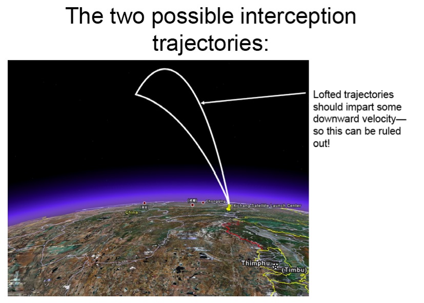
Click to enlarge
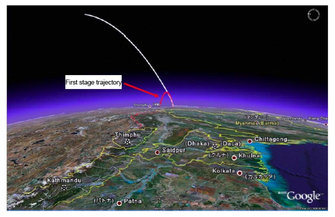
Click to enlarge
Nature's own GPS satellites
Posted on Sunday, February 11, 2007

Click to enlarge
Doing some research for a project I am collaborating on with Jeremy Hight, I just learned about DARPA's X-Ray Pulsar-based Navigation and Timing (XNAV) project, a likely candidate for future space navigation beyond the GPS/Galileo web. Seems the whole Solar System will become a location aware arena in the not too far future...
For a good intro, have a look at this DARPA project powerpoint. Some more information can be found at NewScientist (Sep. '06), and The Space Review (Dec. '06).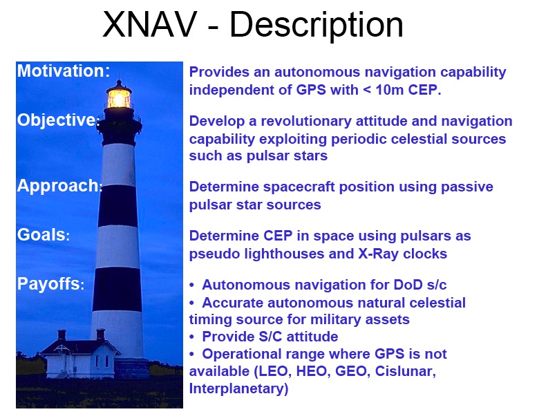
Click to enlarge
Google is coming to town
Posted on Friday, February 9, 2007
Well, not exactly Amsterdam, but the Netherlands at least: Google opens datacenter at Eemshaven (near Groningen) (in Dutch).
Here we go: locative media branding
Posted on Thursday, February 8, 2007
Advertisement in the virtual:
"The advent of Internet-based flight tracking technology enables an entirely new kind of skywriting. Gulfstream Aerospace sent up one of their $50M business jets today on an 8.5-hour test flight spanning 11 states for the sole purpose of leaving their mark on the Net in the form of a flight track that spells out 'GV' (the nickname of the Gulfstream V aircraft being flown) when viewed online."(via MIT's Advertising Lab blog)
On a similar note, at BoingBoing: Radar of corporate jets leaving the Superbowl
I hope we get to see some of this in space as well, before its too late...
You, Science and Recursion
Posted on Monday, February 5, 2007

Part of the video in my previous post corresponds to what Kevin Kelly talks about in this very interesting 1-hour presentation on the history and future of the Scientific Method:
Kevin Kelly
The Next 100 Years of Science: Long-term Trends in the Scientific Method (mp3)
Friday, March 10th 02006.
One of the main points he makes here is the importance of so-called 'recursion' for the Scientific Method. I haven't completely grasped his idea yet (need to listen to the podcast again), but it kind of gives a name to a phenomenon I was wondering about myself a couple of weeks ago. As an engineer, I know surprisingly little about marketing but as far as I can see, basically, with the markets now having become global, there is no 'outside' anymore when it comes to marketing. When we market, we (hypothetically) market to the entire world, that is, the entire human population. Which also includes ourselves...exactly this idea of recursion: the process looks back on itself. So does this mean the nature of marketing will change, and if so, what are the 'meta-models' that will come out of this recursion...? Seems to me virtual globes and alike convincingly portray this recursiveness (like the Apollo 8 did back in the '60) and therefore could play a role in this process. Seems also to have to do something with conciousness, but to make that claim I first need to read Godel, Escher, Bach ;)
Btw, more podcasts from Seminars About Long Term Thinking at The Long Now Foundation are available here.
Space Arms Race, Here we Come!
Posted on Wednesday, January 31, 2007

Click to enlarge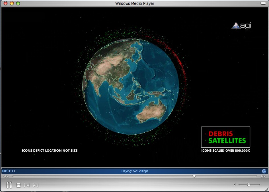
Click to enlarge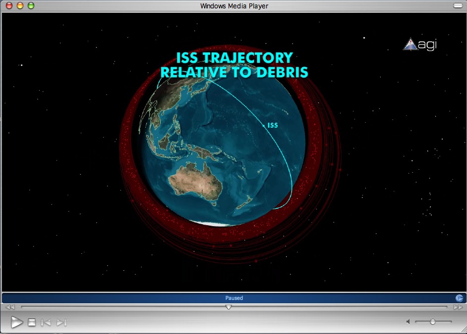
Click to enlarge
[Update Friday 2nd Feb 02:00 CET: The new space race has apparently already started. More news, including a STK visualisation of the debris cloud resulting from the kinetic kill, at AGI's Center for Space Standards & Innovation (CSSI) (via Spaceports blog)]
Excellent title of this space blog entry at the Lifeboat Foundation, following the Chinese Anti Satellite (ASAT) weapons test earlier this month:
Space Arms Race, Here we Come!It’s true - when one nation moves into space weapons, others are forced to follow just to keep up. It’s the Red Queen scenario, where you have to keep moving forward just to stay in the same place. Because preventing the weaponization of space is likely impossible, it looks like we will have to come to terms with it. One beneficial side effect of a space weapons could be the development of better space systems in general, which could eventually be used to create autonomous colonies.
The latter could actually be true. If so, what could be the emerging technologies out of this new weapons race, or out of the upcoming peaceful Moon race variant as described in this 2004 Space.com article:
Strategic target“The moon is the first step beyond low Earth orbit that any spacefaring nation is going to try to master,” said Mike Duke, a geologist at the Colorado School of Mines in Golden, Colo. The Europeans have passed that mark, he added, so their lunar missions are described as technology demonstrations.
Meanwhile, the Japanese are trying to display their technical prowess in instrumentation. “They need to demonstrate a reasonable launch capability to be considered a player in that arena. They’ve had some problems, so maybe the lunar mission is a driver to keep the rocket folks focused,” Duke said.
Duke said China and India have arrived at a place in their development where they can do lunar missions and gain in stature among spacefaring nations.
“I’m afraid that I don’t see that any of these really involve the moon as a strategic target for exploration, though everyone is looking for that strategic handle,” Duke said.
“I'm not sure what to make of it all in the grand scheme of things,” said Paul Spudis, a planetary scientist at the The Johns Hopkins University Applied Physics Laboratory (APL) in Laurel, Maryland.
A number of factors are stirring multi-nation lunar interests, Spudis said. For starters, in the quest to get beyond low Earth orbit, the moon is an easy first target. Then there’s the idea that, somehow, the moon’s history is intimately tied to that of the Earth. Lastly, there is the simultaneous emergence of space capabilities among industrialized countries, as well as coincidence.
“Which predominates? I’m not sure,” Spudis said. “I’d like to think that there is emerging recognition of the strategic value of the moon. But although I do think that is present, it’s not the principal driver,” said Spudis, who was a member of the President’s Commission on Implementation of United States Space Exploration Policy, which advised the White House on how best to move forward on a moon, Mars, and beyond human and robotic exploration strategy.
“In fact, as far as the [Bush] Administration goes, it is the principal driver of the vision, not a human Mars mission … in contradistinction [contradiction] to the intense belief of many who work at NASA,” he said.
Pointing to several nations that are hammering out lunar exploration plans, Spudis said he senses that India’s program is an attempt to promote space science and technology, and demonstrate that they are, indeed, a 21st century, industrial nation. China has similar goals, he said, but is focused more on servicing their “international inferiority complex” to help underscore “that they too are a great nation.”
The emerging technologies from some earlier military involvement in space included what...V2? Sputnik? microprocessors (as discussed in an earlier post)? Keyhole (aka Keyhole)? GPS? Its probably a bit too early to discuss now, but I can see it become part of this conference in the future.
Btw, I am curious to see the trajectory of the Chinese interceptor in Google Earth, anyone has a line to the Chinese military?...the American military perhaps? If so, drop me a note or leave a comment!
Communications & travel
Posted on Wednesday, January 31, 2007
From an interesting piece by Clay Shirky:
Jaron Lanier is the Charles Babbage of Our GenerationHere we arrive at the furthest shores of speculation. One of the basic promises of virtual reality, at least in its Snow Crash-inflected version, is that we will be able to re-create the full sense of being in someone's presence in a mediated environment. This has been a human desire at least since Shamash appeared to Gilgamesh in a dream. Re-stated in technological terms, this version of virtual reality is a belief that communications will finally become an adequate substitute for travel. We have been promised that this will soon be achieved with current technology since ATT demoed a video phone at the 1964 World's Fair.
I believe this version of virtual reality will in fact come to pass, someday. I do not, however, believe that it will involve a screen. Trying to trick the brain by tricking the eyes is a mug's game. The brain is richly arrayed with tools to detect and unmask visual trickery -- if the eyes are misreporting, the brain falls back on other externally focussed senses like touch and smell, or internally focussed ones like balance and proprioception.
Though the conception of virtual reality is clear, the technologies we have today are inadequate to the task. In the same way that the theory of computation arose in the mechanical age, but had to wait first for electrics and then electronics to be fully realized, general purpose virtual reality is an idea waiting on a technology, and specifically on neural interface, which will allow us to trick the brain by tricking the brain. (The neural interface in turn waits on trifling details like an explanation of consciousness.)
In the meantime, the 3D worlds program in the next decade is likely to resemble the AI program in the last century, where early optimism about rapid progress on general frameworks gave way to disconnected research topics (machine vision, natural language processing) and 'toy worlds' environments. We will continue to see valuable but specific uses for immersive environments, from flight training and architectural flythroughs to pain relief for burn victims and treatment for acrophobia. These are all indisputably good things, but they are not themselves general, and more importantly don't suggest rapid progress on generality. As a result, games will continue to dominate the list of well-populated environments for the foreseeable future, rendering ineffectual the category of virtual worlds, and, critically, many of the predictions being attached thereunto.
Just in: Google's virtual world
Posted on Thursday, January 25, 2007
Update: seems this meme touches a nerve, cause it is spreading to where I normally don't see any discussions on Google Earth or Second life, such as the blog by John Battelle.
The rumor continues...Google's Metaverse (via Google Earth Blog). Best comment sofar by Tom Churn:
If you work in this industry, you’re already living in Google’s Virtual World. At least, for about 10 hours a day…
As always, Brownian Emotion has an interesting perspective on things, like:
Rumors persist that Google is in the process of turning Google Earth into a virtual world. Well, I hate to burst anyone’s bubble, but GE already is a virtual world. It’s a virtual earth. It has all of the features of a virtual world (spatiality, point of view, presence, information modeling), minus a few we’ve come to expect from a game or socially-oriented space (seeing yourself, seeing other people, and directly interacting togther).
Reading his post, I was thinking the same thing as I just read on OgleEarth: it maybe so that for planet Earth Google Earth is a mirror world and not a virtual one, but what about all those other worlds out there? What about Mars for example? Is there any (evolutionary?) logic in allowing people to build a virtual world ontop of Mars imagery...I mean...no one is going to get there anytime soon except for some robotic explorers, so apart from the imagery, there is not really the chance of mixing up the 'real' world with a customly-designed virtual one. The only question is: what is the added value of building a virtual world as a mashup on another planet, instead of creating a completely user-generated SL type of virtual world?
Google Earth Panorama Viewer
Posted on Thursday, January 25, 2007
One more thingGUI: the Google Earth Panorama Viewer. This one is definitely here to stay and evolve to even more immersiveness. Its beautiful, even in its current 'crude' state. Created by Digital Urban, it has been making quite some furore in the blogosphere (like OgleEarth, Google Earth Blog and MAKE blog). Check out the above video (I am not so sure about the music...you might wanna turn it off ;-) and have a look at this tutorial and some other panoramas at the Digital Urban blog.
It ties in with the Gigapan camera project I learned about while over at NASA Ames last year in combination with Brownian Emotion discussing a possible next step for Google Earth, where these panoramas would be viewed not outside Google's Earth as a separate sphere but inside of it :
As a exercise, imagine yourself inside the Google Earth, assuming it’s hollow and the imagery you usually see sits on a thin glass shell that can be viewed from inside as well as outside the Earth. If you’re in the center of the sphere, what you’re seeing is essentially the same as a virtual panorama. The same mouse controls that let you spin the Earth now let you spin the panorama from the inside, grabbing that shell like you’d grab the ground. The main difference between this and flying up above the Earth, apart from the imagery and the source, is just the point of view of the observer.
Jeff Han's multi touch
Posted on Thursday, January 25, 2007
Its been around for a while already (in Internet terms that means what, a couple of days?), but for those of you who haven't seen it: a new video showing the next generation multi touch screen (via OgleEarth amongst others). Here is the article that goes with it.
Gibson on space travel
Posted on Thursday, January 25, 2007
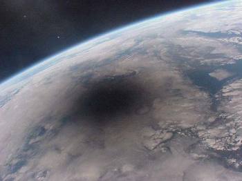
If the ideas of contemporary science fiction writers is anything to go by, here is an interesting interview with William Gibson from back in 1999, where amongst other things, he says the following:
While we were dreaming about spreading our chromosomes, the species was spinning this prosthetic nervous system for itself, and that's what's driving social change now. It's not legislation, it's not population pressures. Where we're going is the result of emerging technologies, and that's terribly rich ground for a science fiction writer.The above image of a Solar eclipse as seen from space is one of the last images made from the MIR station before it was brought down in 2001. In the interview, Gibson specifically refers to it, saying:
I was really deeply moved by one of the last photographs to come out of that station, an image of the Earth seen during the solar eclipse. I thought to myself, "we've never had that camera angle before.
Btw, if the space.com website is any hint at what the main internet portal to outer space will be like (its one of the more popular space related websites at the moment I believe), there is still lots of work to be done...the design is just...well...terrible...!
Project Excelsior
Posted on Sunday, January 21, 2007
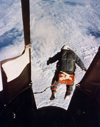
Too bad Joseph Kittinger wasn't carrying a GPS device at the time he jumped out of his balloon carriage back in 1960 (GPS, 1960?). Would be interesting to see his jump in Google Earth. Kind of a space tourism 0.1. Just saw his footage in a clip from Boards of Canada.
Highly relevant ads
Posted on Sunday, January 21, 2007
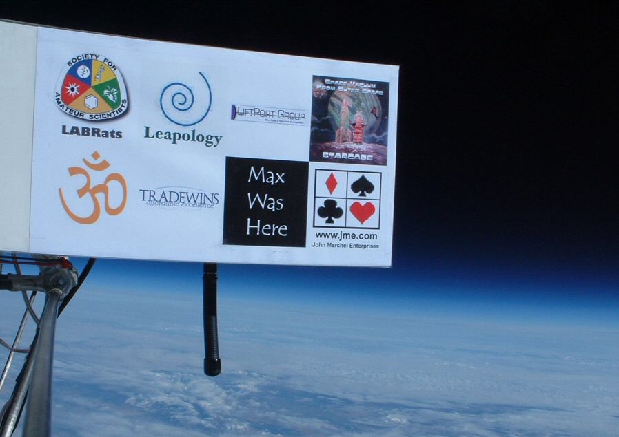
Click to enlarge
Following news on Google's possible acquirement of an in-game advertising firm (first read on OgleEarth), I finally found a reason to upload this image on advertisements in space...When will Google's next ad frontier (WSJ subscription) coincide with the final frontier, either real or virtual? Is there really anything against serving highly relevant ads once people start returning to the Moon? And would it be able to support some good space exploration initiatives? Or even better, some new Earth Observation missions following the warning from the US National Academy of Sciences that the US is underfunding its EO capabilities in the years to come (WSJ editorial: blinding ourselves in space). Its basically in our own interest to have these missions, so why not fund them through Google Adsense...
Tobedetermined finds...Agents of Evolution
Posted on Wednesday, January 17, 2007
Some catching up to do:
- Futurist Peter Schwartz introduces an interesting term new to me in this article: Agents of Evolution
- O'Reilly Radar: Measuring a virtual world and If Google were a restaurant
- How about one of the above cameras onboard the ISS?
- Back to the 50's: China destroys old weather satellite
- Google wants YOU! in Google Earth: Google's Australia Day 2007 aerial photography. Turns out, Microsoft is planning to do the same, with the oh, so Microsofty catchphrase 'Look Up and Smile this Australia Day'
- The archives: Google's Master Plan
Geostationary playground
Posted on Tuesday, January 16, 2007
Click to enlarge
Thinking about how 3 dimensional outer space could be represented inside virtual globe environments, I spent some time flying around the Solar System in Celestia. Incorporating some of the satellite plugins available at the Celestia Motherlode, I managed to get the Geostationary ring become visible with all its +100 telecommunication satellites. The nice thing about Celestia is that it allows you to lock onto any object you happen to pass by, so zooming into the individual satellites now visible, I circled the Earth by hopping from one satellite to the next. Funny enough, it actually did gave me a feel of being 'out there', looking down at the Earth from 35,786 km altitude.
Click to enlarge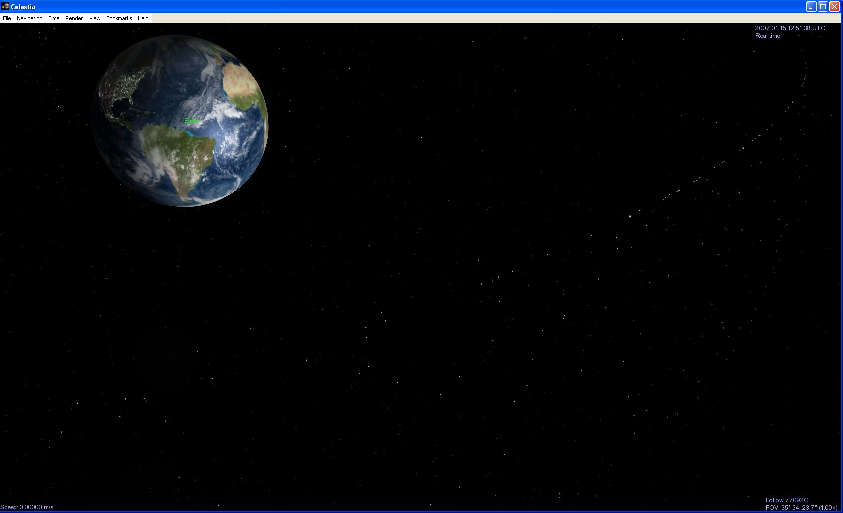
Click to enlarge
tobedetermined finds...
Posted on Monday, January 15, 2007
- Pasta & Vinegar posts on two Google Earth related stories which somehow seem related: (1) using Google Earth as a game interface (following this article on the game site Gamasutra), and (2) Google Earth and the roadmap to the metaverse (based on this story on CNN's Business2.0)
- The End of Cyberspace blog: Second Life avatar consumes as much electricity as a Brazilian
- Not only is 2007 the 50th anniversary of the launch of the first artificial satellite Sputnik, its also the 100th anniversary of Sergey Korolyov, Russia's key designer during the Space Race
- Asimo at CES2007
Google Earth used by terrorists?
Posted on Monday, January 15, 2007
update 16 january: the debate continues at OgleEarth (also check out the comments on the previous post)
OgleEarth has a throughly investigated post on an article appearing in UK's Daily Telegraph.
10 years later: MRO pinpoints Mars Pathfinder
Posted on Friday, January 12, 2007
NASA's Mars Pathfinder landed on Mars on July 4, 1997. Just under 10 years later, Mars Reconnaissance Orbiter (MRO) returns to what I recall as the web1.0 highlight of the ongoing merger between outer space and cyberspace. With its Google Earth look-from-above feel, I can hardly wait till this image is Mars-referenced available in Google Mars. More images and stories available at NASA's Mars Pathfinder Landing Site and Surroundings.
click to enlarge
Google's Earth anno 2007
Posted on Friday, January 12, 2007
Click to enlarge
Mmm, seems global warming really started kicking in last year (via GEB).
Google Earth zeitgeist
Posted on Friday, January 12, 2007
How about a Google Earth zeitgeist, served to you as a kml overlay, or, while we're at it, why not as a dedicated layer inside GE? One where we get to see the most popular places looked at in Google Earth, categorised by lat/lon, altitude and some other specifics? One advantage: there is no need to filter out such terms as sex and alike.
Another idea I just had, how about airlines providing GE-ready GPS trails of the flight you just got off from. You provide your email address while on the plane, and once you land its automatically send to your email box. Nice for some post-flight recollection of what exactly you saw in that twilight zone state when you opened your eyes those 5 seconds and looked out the window before finding another 'comfortable' position to fall back to sleep in. This happened to me on a flight to San Francisco last year where I have vague memories of seeing polar bears fly next to the plane when we passed over the American continent half way up the artic.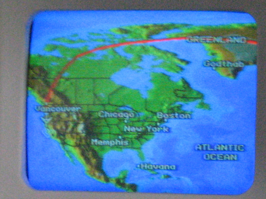
A live flight tracking is already available.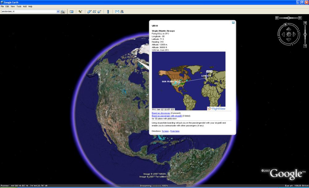
Click to enlarge
With a GPS trail, it could look something like GoogleEarthBlog's trip back from Las Cruces.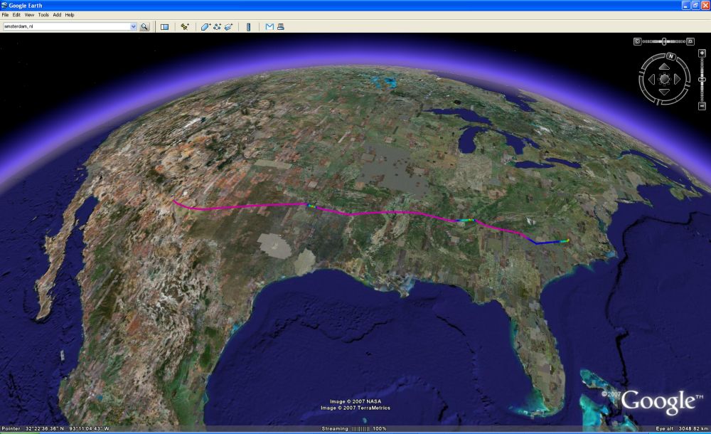
Click to enlarge
tobedetermined finds...
Posted on Monday, January 8, 2007
- Just in: Google teams up with a large group of universities, research institutions and private companies to become the archival experts for the Large Synoptic Survey Telescope (via OgleEarth). Makes sense to me ;)
- Backlog: OgleEarth shares some interesting reflections in this post on the possibilities following December's collaboration announcement between Google and NASA.
- This year is the 50th anniversary of the launch of the first articificial satellite Sputnik in October 4th 1957 (Listen to the sound of Sputnik as it passed over in those days). This weekend's M special of the Dutch newspaper NRC handelsblad is all about the Internet. Their introduction (my translation):
1 billion Earthlings connected to the Internet
50 years ago the Russians launched their Sputnik. The Americans got scared shitless and developed an invulnerable military information network which saw the birth of the Internet. Today, the net belongs to the massess. - ESA news: First 3D map of the Universe's dark matter scaffolding
- Google Earth Blog has the story of a French company Pict'Earth offering a remote control plane with camera capturing realtime images for Google Earth. OgleEarth picked up the story and expands on it
- Webcasts are available from the 2nd Space Exploration Conference in Houston 4-6 December last year. Unfortunately they're coded in Realplayer, so no offline viewing/listening
Navigating outer space
Posted on Friday, January 5, 2007
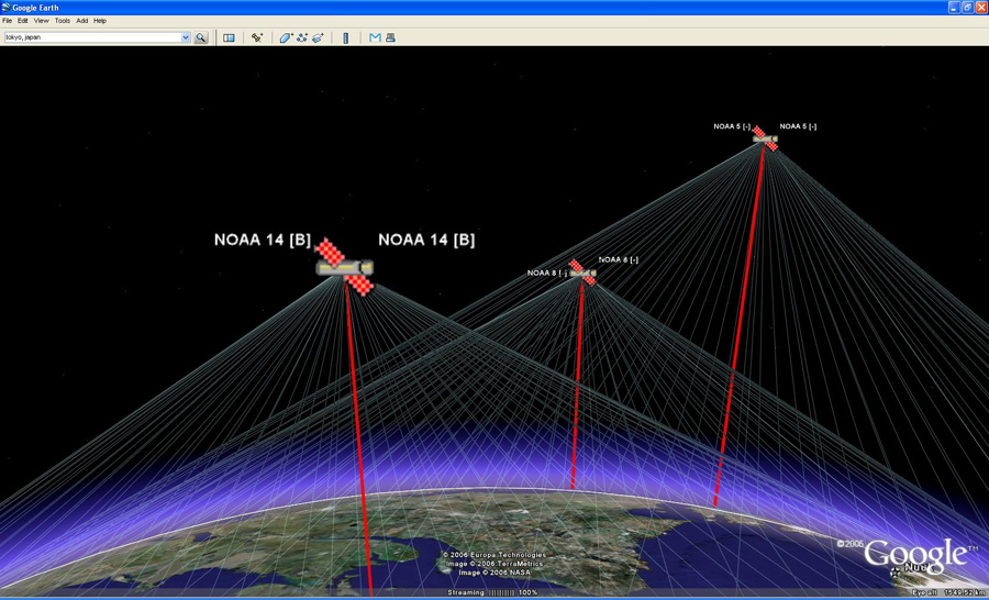
Click to enlarge
Update monday 8 January: I have edited most of below text yesterday after originally posting it on saturday evening. Reading through it again, I noticed how it touches upon a relevant aspect for me of the mediation of outer space through cyberspace: the interface to the planets and 3 dimensional outer space. This post might well be the start of a longer text on this topic.
As you probably noticed, I've been mostly away from the blogosphere the last 2 weeks, spending some enjoyable 1st life here in Amsterdam. As a result, I am now looking at a backlog of ideas, thoughts and interesting stuff out on the web related to this blog's topic which I hope to post about in the coming days & weeks (and a happy new year to all of you of course!). First on my list:
The SpaceNavigator™
I received mine from Germany earlier this week and it turned out even better than I expected. It really is an excellent tool for flying around and 'travelling' in Google Earth. For more indepth reviews of the device, see OgleEarth and GEB.
Using it brings back memories of when I was studying in Delft. It must have been around 1995 when I took a course in 3D modeling and virtual reality. At the time, I was heavily into all things cinema and especially Andrei Tarkovsky, so as part of the VR course I set out to model the cathedral from the final scene of his movie 'Nostalgia'...it was only a test case, and I unfortunately never finished it (the course was over before I could), but during the course I got my first flying lessons in virtual spaceland using one of these nifty interfaces (at that time they were called space mouse). I remember the pleasure of navigating with 6 degrees of freedom through 3 dimensional space, flying through my half finished cathedral. Using the SpaceNavigator now allows me to do (almost) the same stunts in Google Earth. Its a bit like I imagine real life cessna flying could be like if you do not live right under the ![]() airspace of one of Europe's major airports Schiphol.
airspace of one of Europe's major airports Schiphol.
The biggest surprise after firing up Google Earth with my new SpaceNavigator came from the possibility to look up, to look at the stars, away from the Earth, something which with normal keyboard navigation I never managed to do. Suddenly Google Space starts to make a lot more practical sense. Its like what Micheal T Jones (Google Earth CTO) talked about in his Google Earth talk a year ago, where he, refering to work by Tjalling Koopmans, discusses how we as humans are shaped by our tools (as in 'the medium is the message' by Marshall McLuhan).
Below image is one such example of a Google Earth view I never managed to get before my SpaceNavigator arrived (the Earth is somewhere below the screen). And I like the way Windows confirms plugging in my SpaceNavigator with "Found new hardware: USB human interface device" ;)).
Having been stuck with the Earth-centric view in all of todays digital globes out there (and/or Moon/Mars centric in the case of WorldWind), the opportunity to look away made me wish for more. I for one would like to navigate through outer space in Google Earth, to turn around and head for the Moon. Sofar, releasing my SpaceNavigator makes me instantly flip back to the Earth, as if my sticky eyeballs are glued to it.
I have seen navigating through 3 dimensional 'outer space' in Celestia, an open-source 3 dimensional space simulation available for free on the web. During the holidays, I played around with it again after seeing it on a big screen at the NASA Ames exploration Center last November where it was used to explain to the audience about the solar system and beyond. The interface is somewhat different from Google Earth and the others, but once you get the hang of it, its really enjoyable to navigate through the Solar System, have a close up view of the Jupiter moon system, take a warp drive outside our own galaxy and safely return back to our 'default' Earth.
tobecontinued...
Click to enlarge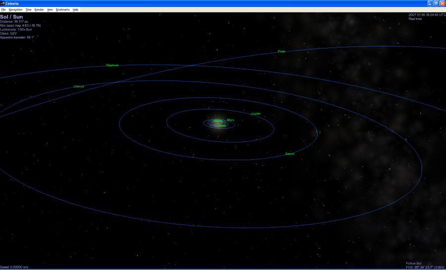
Click to enlarge
Terraforming cyberspace
Posted on Friday, December 29, 2006
What, such a nice term with no wikipedia entry: terraforming cyberspace ? Isn't that what is going on inside Google Earth, Microsoft Virtual Earth and Second Life? Or is it 'terraforming Earth for the agents' (e.g using the DARPA Agent Markup Language)?. Following this line of thought, I stumble upon an interesting Google Earth overlay displaying the global status of the Grid via this press release: Grid computing 'Mappa Mundi' unveiled in Florida
Visitors to Supercomputing '06 in Tampa, Florida this week will be the first to see a new interactive map that shows nine of the world's largest computing Grids. The map, developed by researchers from GridPP in the UK and the European particle physics laboratory, CERN, in Geneva, uses Google Earth to pinpoint Grid sites on six continents, showing more than 300 sites overall. Like the medieval 'mappa mundi', which showed what was known of the world at the time, this is one of the first attempts to show the whole scientific Grid world.More via physorg.com. And from the article on 'terraforming cyberspace':
Tomorrow’s world will be filled with agents embedded everywhere in the places and things around us. Providing a pervasive web of sensors and effectors, these agents will function as cognitive prostheses— computational systems that leverage and extend human intellectual, perceptual, and collaborative capacities, just as a steam shovel is a sort of muscular prosthesis or eyeglasses are a sort of visual prosthesis. Thus, the focus of AI research is destined to shift from artificial intelligence to augmented intelligence.
Now in order for the agents to offer augmented intelligence, they will first of all need to know the location and all that surrounds it...GPS gives it location...virtual globes its situational awareness...
nice combo...
Posted on Friday, December 29, 2006
They're both from CNN.com:
NASA's vision lost on Web generation (28 Dec. 06) v.v. Google teams up with NASA (18 Dec. 06)
And following up on Stefan Geens final bullet in his latest post, i'd say: it looks like Microsoft will win over Google, unless there is a way to make me build my own house (or anybody's else's...think: advertisement) in Google Earth...(or...what happens if Google buys Second Life)
tobedetermined finds on Christmas
Posted on Tuesday, December 26, 2006
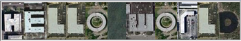
- Christmas day news: Google Earth embraced by geologists (via All Points Blog)
- Online video 'eroding TV viewing' (via franticindustries)
- Where Real Money Meets Virtual Reality (via 3pointd.com), including this line:
He went on to predict the eventual emergence of an "international law of virtual worlds" similar to international maritime law.
Now let international maritime law also often be quoted as an inspiration for the drafting of the outer space treaties back in the 60's ;)
Welcome to the real world
Posted on Sunday, December 24, 2006

Being relatively new to the blogging game, I am stupéfait about the sophistication of the Google ad machine...take the red pill and have a look at this introduction about Google Analytics. If you ever wondered about monetization of the database of intentions...
Gibraltar airport....
Posted on Friday, December 22, 2006
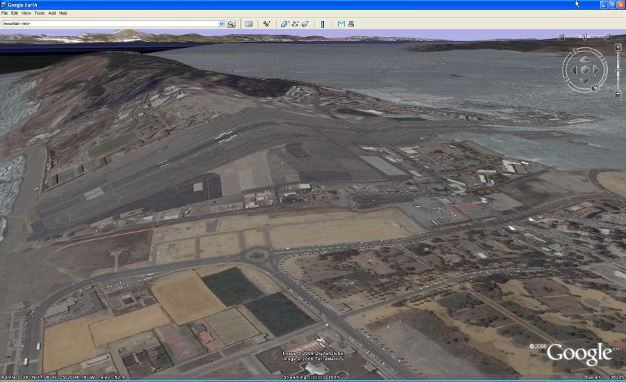
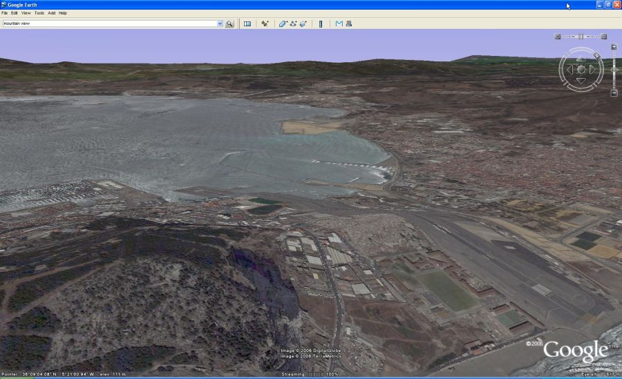
Wow, that's some ![]() runway to take off from...well, luckily(?) its not like that on the real planet Earth as the image below shows. Could be a nice landart hack though, taking this one a couple of steps further.
runway to take off from...well, luckily(?) its not like that on the real planet Earth as the image below shows. Could be a nice landart hack though, taking this one a couple of steps further.
NASA Google media briefing today
Posted on Monday, December 18, 2006
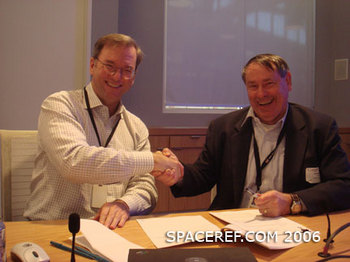
Update 01:43 CET: News is out. Here is Google news' listing of websites (178 and rising) describing the press release and media briefing. The two core Google Earth blogs OgleEarth and Google Earth Blog provide further insight. I'll try to put some thoughts on paper myself when I find the time (oh, and the image of Eric Schmidt (left) and Pete Worden (right) is courtesy of SpaceRef...in case you hadn't noticed).
Update 18:24 CET: NASA Ames has just issued a press release providing more details on the NASA Google collaboration (via Google Blogoscoped)
Today is the day of the media briefing at NASA Ames. It has been nice to see news about last friday's event and today's media briefing spread around the Internet, starting with the original post on NASA Watch. More when it comes in...here is a good start <-- update: this website (googlenasa.com) was taken down on monday after having been slashdotted and Chris C. Kemp responding to a request from Google to take it offline

Zooming out in Google Earth
Posted on Saturday, December 16, 2006
' 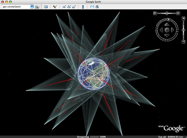
How long before Google Earth levels (and surpasses?) STK, the arcGIS of space...?
Above image is a screendump of one of the ![]() beautiful layers provided by Google Earth Community (GEC) member Paul Seabury (via Google Earth Blog). This
beautiful layers provided by Google Earth Community (GEC) member Paul Seabury (via Google Earth Blog). This ![]() particular one shows the GPS constellation in orbit around the Earth, together with a footprint of each individual satellite. Which reminds me of an earlier mash-up thought experiment I did by superimposing a Google Earth screendump with an image of the NASA J-Track 3D Java applet (see below). To get a feel of what that could be like, see instructions on the J-Track 3D opening page, click individual satellites to highlight their orbits, and drag the viewpoint around. Its a very light application and the combination of zooming and tilting the scene really 'gives handles' to the Geostationary orbit.
particular one shows the GPS constellation in orbit around the Earth, together with a footprint of each individual satellite. Which reminds me of an earlier mash-up thought experiment I did by superimposing a Google Earth screendump with an image of the NASA J-Track 3D Java applet (see below). To get a feel of what that could be like, see instructions on the J-Track 3D opening page, click individual satellites to highlight their orbits, and drag the viewpoint around. Its a very light application and the combination of zooming and tilting the scene really 'gives handles' to the Geostationary orbit.
Its a limitation of Google Earth I regularly run into: the limitation in the ability to zoom out. Currently, the furthest one can zoom out is to 'eye altitude 62355.98 km' (how does that work again?), not even enough to view the complete Geostationary ring, as is apparent in below image of ![]() Paul's Geostationary satellites layer (note zoom level of the two images is nearly identical).
Paul's Geostationary satellites layer (note zoom level of the two images is nearly identical).
NASA-Google collaboration kick-off event
Posted on Thursday, December 14, 2006
Update2: Ames issued a release on friday announcing a media briefing this monday to discuss the NASA-Google Agreement.
Update: SpaceRef has the story that the joint announcement on collaboration which was to happen at the kick-off event is delayed...
A NASA-Google collaboration kick-off event is being organised at NASA Ames tomorrow today (Friday 15th) (Ames/Google personnel only it seems, more at NASA Watch, OgleEarth and more). Too bad I had to go back to Europe last week. Good luck Chris!
Opportunity has left the rim...
Posted on Wednesday, December 13, 2006
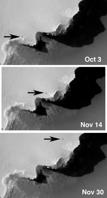
The Mars Reconnaissance Orbiter (MRO) keeps an eye out on the Mars Exploration Rovers as they scout the red planet. It has also found the landing sites of the two 1976 Viking Landers (more at NASA).
Virtual space exploration update
Posted on Saturday, December 2, 2006
Seen at a distance of 4.2 billion kilometers, NASA's New Horizons mission captured a glimpse of its final target Pluto late September. Last week, NASA's Mars Reconnaissance Orbiter (MRO) mission located the landing site of the Mars Exploration Rover Opportunity (via Nasa Watch). By now, MRO's HiRISE team is flooding Mars images over the Internet.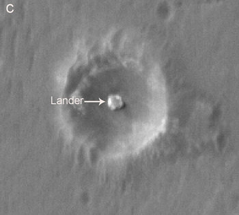

.jpg)
NASA moves into virtual worlds
Posted on Thursday, November 23, 2006

NASA is planning on building a virtual world for training and educational purposes. Its slashdotted here, which made it go around the world, like here at HighEarthOrbit, SlashGeo, Second Life News Network (SLNN) and KnowproSE. Daniel Laughlin, a project manager at NASA's Learning Technologies Office recently gave a presentation about it at the International Spaceflight Museum in Second Life (via OgleEarth). Here are some flickr images of the Museum.
'realtime view of the Earth' widget?
Posted on Sunday, November 19, 2006
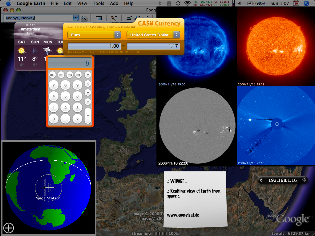
Just in: a demo video of Microsoft Virtual Earth 3D (which comes out blank on my macintosh btw) (via OgleEarth). Where do you want to go today? What about here:
(more at the SOHO website)
online identity: tobedetermined
Posted on Saturday, November 18, 2006
Just found out my name brings up my 'name' website if you do the Google on me...handy...reminds me of an interesting presentation on 'identity2.0'. Something else, how about these webstats for NASA...pretty impressive ;) (via Alexa)
YES2 Google Earth
Posted on Thursday, November 16, 2006
Here is another one of my older posts (May '06) which I managed to bring back from digital oblivion by specifically interrogating The Google about my domain name and looking at the cached pages (search string 'site:tobedetermined xxxx'). Its only good for text though, cause other stuff like images is not cached (thanks for the tip Jurryt).
Recovered post:
Following up on my suggestion about the resemblance between the 3D GoogleEarth implementation of the TWA flight-800 disaster and the 2.5D visualisation currently available in YES2's Re-Entry Simulator Tool (REST), Marco Stelzer of the YES2 team at ESTEC has done a great(!) job implementing a REST2GoogleEarth output file option in REST.
The REST simulator, which is part of the larger YES2 mission simulator YESSim, is currently under development for ESA's 2nd Young Engineers' Satellite in order to study and control the landing of the YES2 'Fotino' re-entry capsule. The educational YES2 mission is designed to return a small capsule from space to the Earth using a 30 km long tether. Its launch is currently sheduled for October next year from the Russian launch base Baikonur onboard the Foton M3 spacecraft.
One of the REST2GoogleEarth output files developed by Marco provides an elegant display of the re-entry trajectory as calculated by REST, starting in this case from an initial altitude of ~253 km. Clicking on one of the dots brings up the longitude, latitude, and altitude of the capsule at that particular time in the re-entry (Directions: To here - From here ;) ). In this simulation, the time from start at 253 km to landing of the capsule in Kazachstan takes ~30 minutes. Its not so visible in this particular simulation, but I remember from an earlier one that the influence of the wind (through implemented wind models) on the final stage of descent comes out very nice in the GE visualisation.
In another section of the simulation tool, this 2nd REST2GoogleEarth output file shows the outcome of a monte-carlo simulation of the proposed landing site of the capsule, where each little dot represents a calculated landing point of the capsule. If you zoom out, you start seeing the landing ellipse of the Fotino capsule, representing the 3-sigma chance distribution of the actual landing position of Fotino.
For more on YES2, see their YES2 website (update: which is currently down I believe after having been hacked and them not having the time to bother with a website while building a satellite...). Once its back on, here is a short movie I shot & edited back in 2003 called YES2 meets...Michiel Kruijff with a brief introduction to the YESSim simulator.
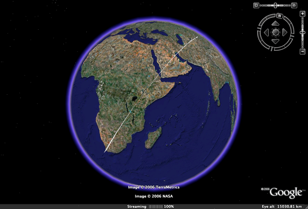
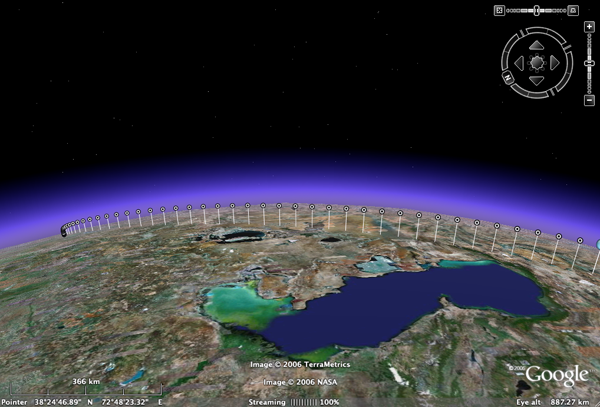
ESA teams with Google Earth
Posted on Thursday, November 16, 2006
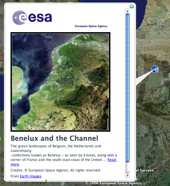
A couple of days after Frank Taylor from Google Earth Blog first noticed the addition of ESA imagery as a layer to Google Earth, ESA comes with a webstory. Nice to see that it gets around, like here, here and here. Btw, Frank makes a good point in stating that he is a bit dissapointed to see that the images are not directly overlayed on Google Earth but instead appear in a pop up window with a link to the image on the ESA web. Room for future developments i'd say ;)
tobedetermined finds...a Google data center
Posted on Tuesday, November 14, 2006
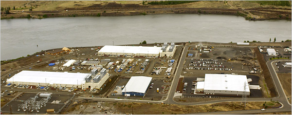
I'll sometimes bring back an image/video which was in one of my earlier posts I lost when my blog (March-July 06) was accidentally erased from the server while over at the ISU Summer Session Programme 2006 in Strasbourg. This one is from an earlier article in the NY times.
Ministry of transport
Posted on Tuesday, November 14, 2006

Its not related to the theme of this blog, or maybe in the way it looks very second life while being actually first life, a ministry in our 'outer space'...The merger of outer space and the digital space might be a copernican revolution in the making. A flip in perspective, instead of a merger (what would that do to the relation between outer space and our daily lifes here on Earth?) (via we-make-money-not-art).
Another way things might go instead of merge, is the subject of this blog: The end of cyberspace (with the excellent slogan 'Goodbye virtual world. Hello new world')
Google: you tube
Posted on Wednesday, November 1, 2006
An excellent post on recent developments at YouTube by John Battelle.
And its getting better. Here is a related article that I found in the comments to above blog post.
Google goals...
Posted on Friday, October 27, 2006
An interesting post with some of Google's objectives for 2006 (via John Battelle's Searchblog).
Amongst the goals, Google aims to '...be the best in search – no surprise here. To reach that goal, Google wants to have the world’s top AI research laboratory...'.
A nice link to this NASA press release issued today on 'A growing Intelligence Around Earth" (via KurzweilAI.net).
An interesting read...
Posted on Wednesday, October 25, 2006

I haven't had much chance (or better: chose not to spent the time) myself lately to dive into the Virtual Worlds (VW) of World of Warcraft (WoW), Second Life, Multiverse, etc (except for Google Earth maybe, but that's different...sofar...probably that will chance in the future). Come to think of it, I did once install Second Life on my macintosh about a year ago, and flew around for a couple of nights...interesting experience I remember, standing up, and then smoothly go into flying mode...but beyond that it didn't really do it for me...yet...or better: chose not to dive into it further...yet...
I did recently finish Snowcrash, a book by Neal Stephenson, frequently quoted as being an inspiration for Google Earth (then Keyhole) developers, and an influential book for everybody thinking about (or dealing with) virtual worlds.
Anyway, getting to a point, I try to stay up to speed on the blogs I follow (see on the right here), and I notice there is more and more news and stories coming out on VWs, especially Second Life, but also on all other activities taking place in the virtual worlds arena. One example is this article, which I found via one of the key blogs on this topic, 3pointD.com.
Of course, the subject of this blog is the future merger of the virtual world of the computer and the 'virtual' world of outer space...and when I think of it, it makes perfect sense...but its far from being there, which is ok cause it leaves some room for definition...
Btw, here I found another interesting text on the subject, an interview of Space.com with William Gibson, dating back to 1999.
Something else to check: emerging technologies...
Bush using The Google
Posted on Tuesday, October 24, 2006

More at Think Progress (via John Battelle's SearchBlog)
Google's business model?
Posted on Tuesday, October 24, 2006
Evolution in full effect: Building a Googley workforce (via Pasta&Vinegar).
Space Atlas and more...
Posted on Monday, October 23, 2006
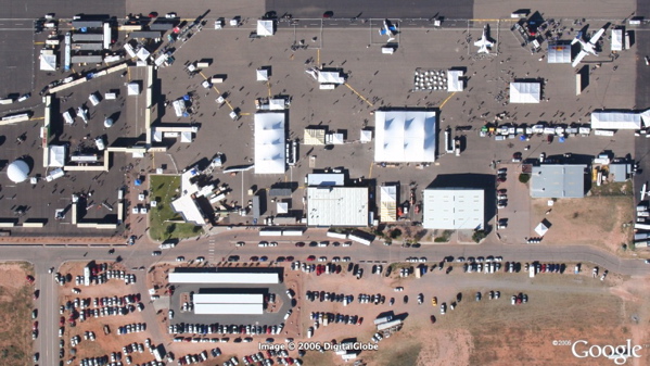
Some catching up to do. Frank Taylor at GoogleEarth Blog has been travelling to the X-Prize cup at Las Cruces Airport in New Mexico. Here are some of his posts on it:
- A Space Atlas layer in Google Earth.
- His flight to the event and back again, both displayed elegantly in Google Earth.
- An aerial photo he made of the exhibition, loaded into Google Earth the same day.
Nice!
Posted on Monday, October 23, 2006
Google buys SpaceShipOne replica (via John Battelle's SearchBlog).
Google Earth eyecandy
Posted on Monday, October 23, 2006
Following up from my earlier post on 'War from Space' (seems I got something going here...), here is one of the best layers I have seen sofar for Google Earth. It gives an overview of all the nuclear missile silos in the US. I already spent several nights zooming into all these little fenced off corners in the middle of nowhere USA. Brilliant!
Zoomed out to full US size its also a pretty sight. Brings back some wonderful childhood memories: these nukes are/were(?) well grouped together in specific states....
Will be interesting to see when the same data becomes available for the former USSR...As a good start, Belgeoblog has already blogged the location of some US nuclear weapons on the Belgium airforce base 'Kleine Brogel'.
The problem with/for Google (Earth)
Posted on Thursday, October 5, 2006
“Freedom of the press belongs to those who own one.” AJ Liebling
An article by Rich Gibson, co-author of Mappinghacks that makes you think about the good intentions of Google vs. their unavoidable lockdown into their own tools (via OgleEarth).
tobedetermined finds...
Posted on Sunday, September 24, 2006
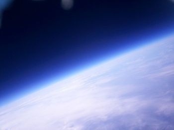
- Some recent finds:
- Update on the collaboration between Google and Nasa Ames.
- Google NASA collaboration entry point.
- Bejing secretly fires lasers to disable US satellites.
- A nice visualisation of a high altitude balloon flight in Google Earth (via OgleEarth).
- An article in MIT's Technology Review about Google Earth (via GoogleEarthBlog).
- Chaos by Design, an article in Fortune about the management style of Google.
- Keynote Speech by Dr. S. Pete Worden at AIAA Space 2006.
The future is process, not a destination
Bruce Sterling
Everything is ultimately becoming information technology
Ray Kurzweil
Data is the Intel inside
Tim O'Reilly
There is only one machine and the web is its OS
Kevin Kelly
The medium is the message
Marshall McLuhan