Zooming out in Google Earth
Posted on Saturday, December 16, 2006
' 
How long before Google Earth levels (and surpasses?) STK, the arcGIS of space...?
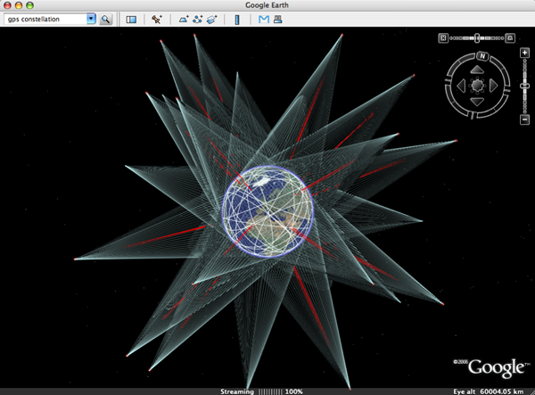
Above image is a screendump of one of the ![]() beautiful layers provided by Google Earth Community (GEC) member Paul Seabury (via Google Earth Blog). This
beautiful layers provided by Google Earth Community (GEC) member Paul Seabury (via Google Earth Blog). This ![]() particular one shows the GPS constellation in orbit around the Earth, together with a footprint of each individual satellite. Which reminds me of an earlier mash-up thought experiment I did by superimposing a Google Earth screendump with an image of the NASA J-Track 3D Java applet (see below). To get a feel of what that could be like, see instructions on the J-Track 3D opening page, click individual satellites to highlight their orbits, and drag the viewpoint around. Its a very light application and the combination of zooming and tilting the scene really 'gives handles' to the Geostationary orbit.
particular one shows the GPS constellation in orbit around the Earth, together with a footprint of each individual satellite. Which reminds me of an earlier mash-up thought experiment I did by superimposing a Google Earth screendump with an image of the NASA J-Track 3D Java applet (see below). To get a feel of what that could be like, see instructions on the J-Track 3D opening page, click individual satellites to highlight their orbits, and drag the viewpoint around. Its a very light application and the combination of zooming and tilting the scene really 'gives handles' to the Geostationary orbit.
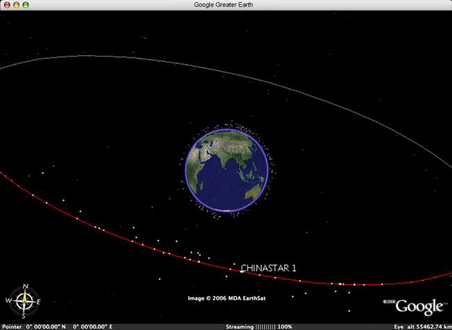
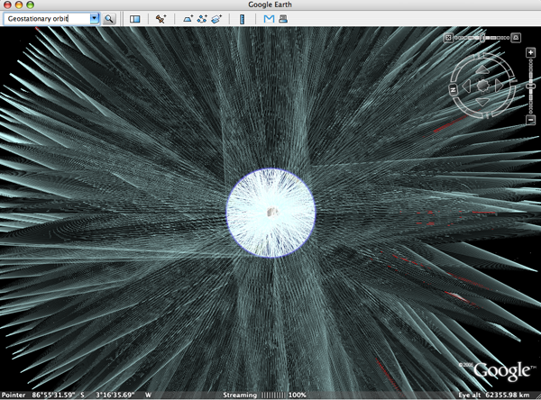
Its a limitation of Google Earth I regularly run into: the limitation in the ability to zoom out. Currently, the furthest one can zoom out is to 'eye altitude 62355.98 km' (how does that work again?), not even enough to view the complete Geostationary ring, as is apparent in below image of ![]() Paul's Geostationary satellites layer (note zoom level of the two images is nearly identical).
Paul's Geostationary satellites layer (note zoom level of the two images is nearly identical).