YES2 Google Earth
Posted on Thursday, November 16, 2006
Here is another one of my older posts (May '06) which I managed to bring back from digital oblivion by specifically interrogating The Google about my domain name and looking at the cached pages (search string 'site:tobedetermined xxxx'). Its only good for text though, cause other stuff like images is not cached (thanks for the tip Jurryt).
Recovered post:
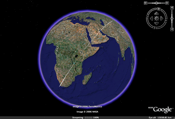
Following up on my suggestion about the resemblance between the 3D GoogleEarth implementation of the TWA flight-800 disaster and the 2.5D visualisation currently available in YES2's Re-Entry Simulator Tool (REST), Marco Stelzer of the YES2 team at ESTEC has done a great(!) job implementing a REST2GoogleEarth output file option in REST.
The REST simulator, which is part of the larger YES2 mission simulator YESSim, is currently under development for ESA's 2nd Young Engineers' Satellite in order to study and control the landing of the YES2 'Fotino' re-entry capsule. The educational YES2 mission is designed to return a small capsule from space to the Earth using a 30 km long tether. Its launch is currently sheduled for October next year from the Russian launch base Baikonur onboard the Foton M3 spacecraft.
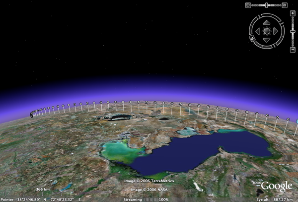
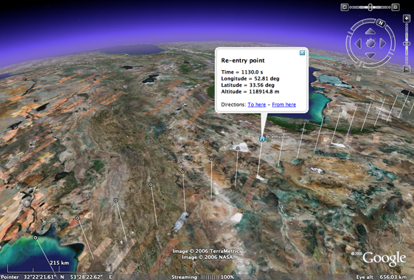
One of the REST2GoogleEarth output files developed by Marco provides an elegant display of the re-entry trajectory as calculated by REST, starting in this case from an initial altitude of ~253 km. Clicking on one of the dots brings up the longitude, latitude, and altitude of the capsule at that particular time in the re-entry (Directions: To here - From here ;) ). In this simulation, the time from start at 253 km to landing of the capsule in Kazachstan takes ~30 minutes. Its not so visible in this particular simulation, but I remember from an earlier one that the influence of the wind (through implemented wind models) on the final stage of descent comes out very nice in the GE visualisation.
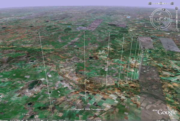
In another section of the simulation tool, this 2nd REST2GoogleEarth output file shows the outcome of a monte-carlo simulation of the proposed landing site of the capsule, where each little dot represents a calculated landing point of the capsule. If you zoom out, you start seeing the landing ellipse of the Fotino capsule, representing the 3-sigma chance distribution of the actual landing position of Fotino.
For more on YES2, see their YES2 website (update: which is currently down I believe after having been hacked and them not having the time to bother with a website while building a satellite...). Once its back on, here is a short movie I shot & edited back in 2003 called YES2 meets...Michiel Kruijff with a brief introduction to the YESSim simulator.