Chinese ASAT test analysis in Google Earth
Posted on Sunday, February 18, 2007
Click to enlarge
Catching up on my blog role after a week of virtually no second life activities (is that proper English?), I come across a post at OgleEarth on the Chinese Anti-Satellite test I blogged about last month. Turns out researchers at MIT's Science, Technology and Global Security Working Group did exactly what I was looking for: a visualisation of the satellite kill in Google Earth.
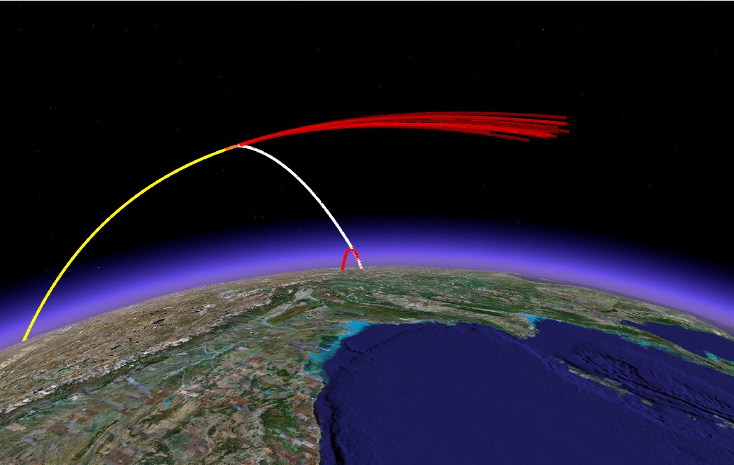
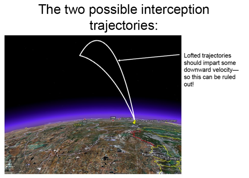
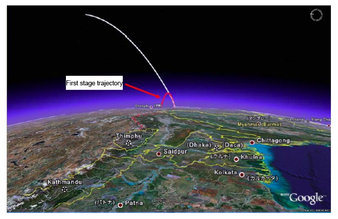
Apart from the kml file displaying above scene in Google Earth (which as yet appears to be a static visualisation only), they also issued a report on the same website which gives some further analysis of the event. It is here that I am happy to find the first (well, actually 2nd ;-) online evidence of the use of Google Earth for actual visualisation in the realm of space engineering and analysis beyond mere pretty images (see images at bottom of this post).
Scanning through the document, it seems the program they made the analysis with is a recently released stand-alone program to calculate ballistic missile trajectories which has a direct output to Google Earth. From their website:
GUI_Missile_Flyout is a stand-alone program running under Windows for simulating ballistic missiles with 1, 2, or 3 stages in a framework with a round, rotating Earth. Users can easily input all the necessary parameters in an intuitive graphical user interface (GUI). A modest number of quantities can be interactively plotted on the Interface but the complete trajectory can be saved as either an Excel or Matlab file for further analysis. The trajectory can also be directly displayed in Google Earth for visualization. The GUI can be used to optimize gravity turn parameters to maximize range or aim at a specific target (entered, as is the launch site) through latitude-longitude pairs. In addition to an introduction to using the program, this paper describes the integration of the three-degrees-of-freedom equations of motion and approximations made to the aerodynamic (such as a parameterized drag coefficient, Cd).Incorporating the option to directly output to Google Earth readible format is something that has been occuring on a frequent basis in the traditional GIS field but I haven't heard of it yet in the space arena. I wonder for example what STK's strategy is in this respect? They have their own AGI viewer, but as with all the different GIS viewers, who is interested to have all these different systems installed when Google Earth can handle them all at once, and on top of that is also cross-platform (which most sophisticated analysis tools are certainly not yet).
If you use this program for a publication, please reference: Geoffrey Forden, “GUI_Missile_Flyout: A General Program for Simulating Ballistic Missiles”, submitted to Science and Global Security. December 2006.
Click to enlarge
Click to enlarge