This was December 2006 | « November 2006 | Main | January 2007 »
Terraforming cyberspace
Posted on Friday, December 29, 2006
What, such a nice term with no wikipedia entry: terraforming cyberspace ? Isn't that what is going on inside Google Earth, Microsoft Virtual Earth and Second Life? Or is it 'terraforming Earth for the agents' (e.g using the DARPA Agent Markup Language)?. Following this line of thought, I stumble upon an interesting Google Earth overlay displaying the global status of the Grid via this press release: Grid computing 'Mappa Mundi' unveiled in Florida
Visitors to Supercomputing '06 in Tampa, Florida this week will be the first to see a new interactive map that shows nine of the world's largest computing Grids. The map, developed by researchers from GridPP in the UK and the European particle physics laboratory, CERN, in Geneva, uses Google Earth to pinpoint Grid sites on six continents, showing more than 300 sites overall. Like the medieval 'mappa mundi', which showed what was known of the world at the time, this is one of the first attempts to show the whole scientific Grid world.More via physorg.com. And from the article on 'terraforming cyberspace':
Tomorrow’s world will be filled with agents embedded everywhere in the places and things around us. Providing a pervasive web of sensors and effectors, these agents will function as cognitive prostheses— computational systems that leverage and extend human intellectual, perceptual, and collaborative capacities, just as a steam shovel is a sort of muscular prosthesis or eyeglasses are a sort of visual prosthesis. Thus, the focus of AI research is destined to shift from artificial intelligence to augmented intelligence.
Now in order for the agents to offer augmented intelligence, they will first of all need to know the location and all that surrounds it...GPS gives it location...virtual globes its situational awareness...
nice combo...
Posted on Friday, December 29, 2006
They're both from CNN.com:
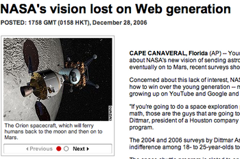
NASA's vision lost on Web generation (28 Dec. 06) v.v. Google teams up with NASA (18 Dec. 06)
And following up on Stefan Geens final bullet in his latest post, i'd say: it looks like Microsoft will win over Google, unless there is a way to make me build my own house (or anybody's else's...think: advertisement) in Google Earth...(or...what happens if Google buys Second Life)
tobedetermined finds on Christmas
Posted on Tuesday, December 26, 2006
- Christmas day news: Google Earth embraced by geologists (via All Points Blog)
- Online video 'eroding TV viewing' (via franticindustries)
- Where Real Money Meets Virtual Reality (via 3pointd.com), including this line:
He went on to predict the eventual emergence of an "international law of virtual worlds" similar to international maritime law.
Now let international maritime law also often be quoted as an inspiration for the drafting of the outer space treaties back in the 60's ;)
Outer space in Second Lie Life
Posted on Sunday, December 24, 2006
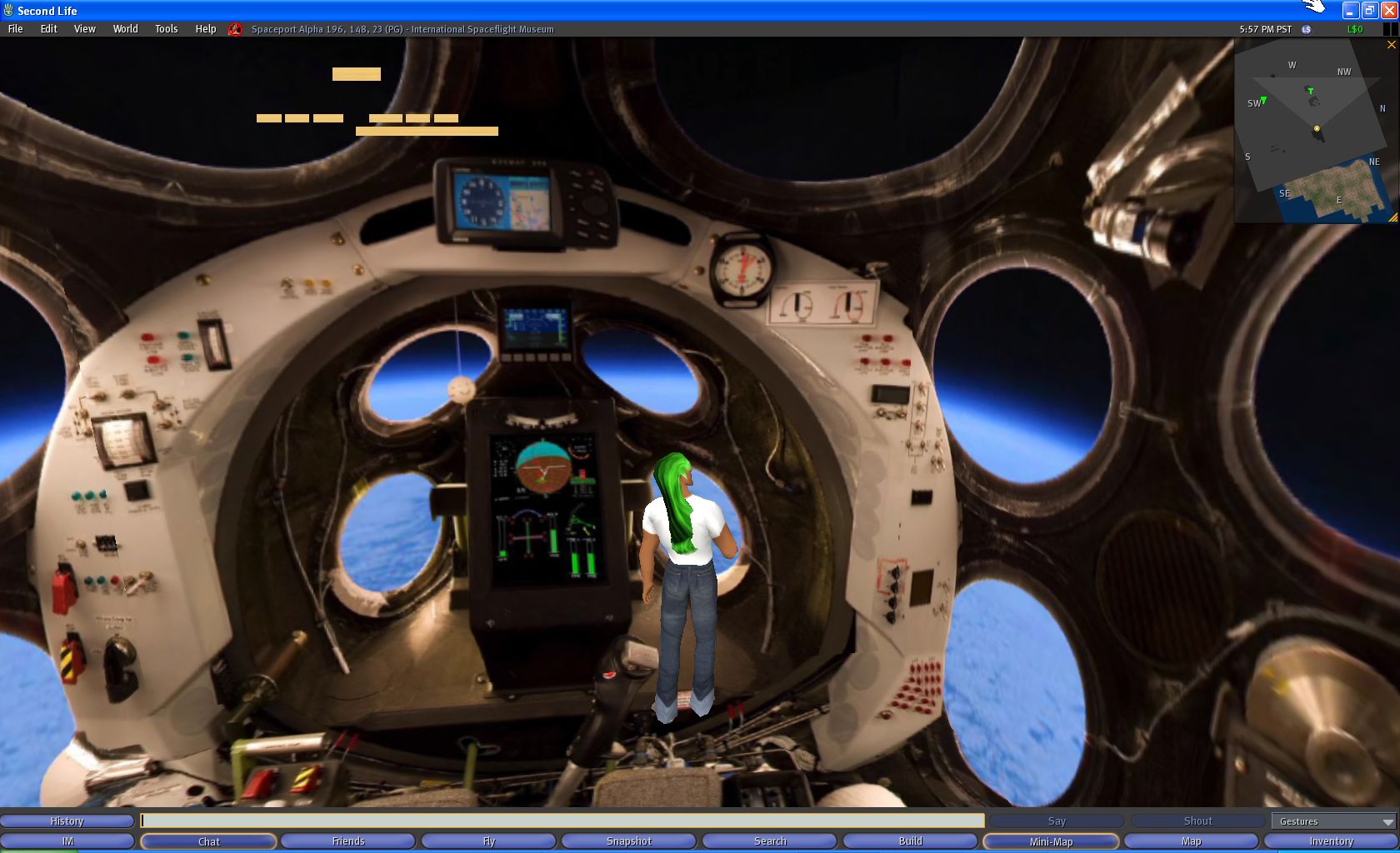
Click to enlarge
With the holidays and all, I had some time to spent looking for the International Space Museum (ISM) in Second Life. After having to complete the first test level (grrr), taking me more than an hour, I finally was allowed on the real playing field. Turned out the testing in the beginning was actually quite handy, cause I knew immediately how to get to the ISM as fast as possible...just type it in and search...boom....teleported and dazzled, I was throw out into the ISM piece of land...
btw, how you like my green hair? ;-) 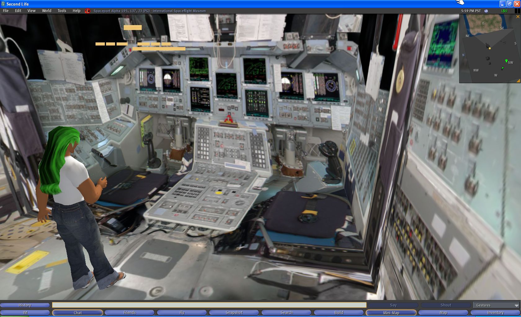
Click to enlarge
Welcome to the real world
Posted on Sunday, December 24, 2006

Being relatively new to the blogging game, I am stupéfait about the sophistication of the Google ad machine...take the red pill and have a look at this introduction about Google Analytics. If you ever wondered about monetization of the database of intentions...
Natural bridge on Mars
Posted on Saturday, December 23, 2006
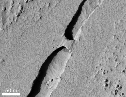
MRO continues to inspire (via Beyond the Beyond).
The home computer in 2004
Posted on Saturday, December 23, 2006

"Scientists from the RAND Corporation have created this model to illustrate how a 'home computer' could look like in the year 2004. However the needed technology will not be economically feasible for the average home. Also the scientists readily admit that the computer will require not yet invented technology to actually work, but 50 years from now scientific progress is expected to solve these problems. With teletype interface and the Fortran language, the computer will be easy to use."
Where do you want to sail to today...? (from urbanlegends.about.com)
Gibraltar airport....
Posted on Friday, December 22, 2006
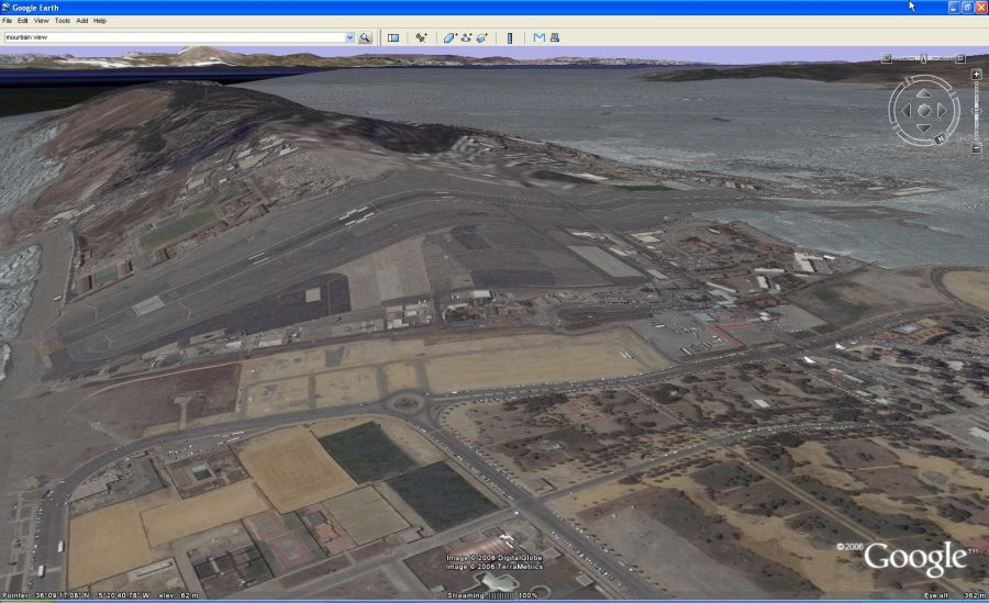
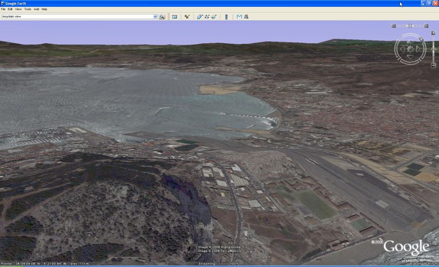
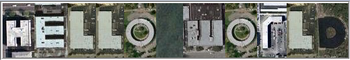
Wow, that's some ![]() runway to take off from...well, luckily(?) its not like that on the real planet Earth as the image below shows. Could be a nice landart hack though, taking this one a couple of steps further.
runway to take off from...well, luckily(?) its not like that on the real planet Earth as the image below shows. Could be a nice landart hack though, taking this one a couple of steps further.
NASA Google media briefing today
Posted on Monday, December 18, 2006
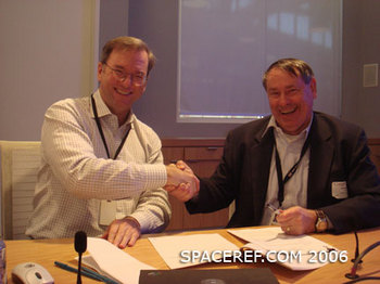
Update 01:43 CET: News is out. Here is Google news' listing of websites (178 and rising) describing the press release and media briefing. The two core Google Earth blogs OgleEarth and Google Earth Blog provide further insight. I'll try to put some thoughts on paper myself when I find the time (oh, and the image of Eric Schmidt (left) and Pete Worden (right) is courtesy of SpaceRef...in case you hadn't noticed).
Update 18:24 CET: NASA Ames has just issued a press release providing more details on the NASA Google collaboration (via Google Blogoscoped)
Today is the day of the media briefing at NASA Ames. It has been nice to see news about last friday's event and today's media briefing spread around the Internet, starting with the original post on NASA Watch. More when it comes in...here is a good start <-- update: this website (googlenasa.com) was taken down on monday after having been slashdotted and Chris C. Kemp responding to a request from Google to take it offline
Extra spacewalk for Christer Fuglesang
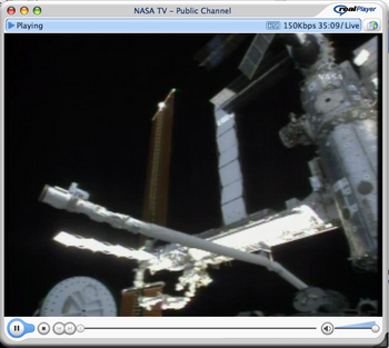
Posted on Sunday, December 17, 2006
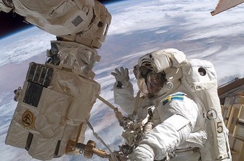
ESA has the news of a new spacewalk for ESA astronaut Christer Fuglesang, tonight at 19:47 CET. Follow it live via NASA TV.

Zooming out in Google Earth
Posted on Saturday, December 16, 2006
' 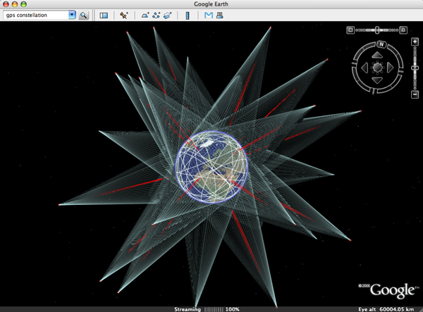
How long before Google Earth levels (and surpasses?) STK, the arcGIS of space...?
Above image is a screendump of one of the ![]() beautiful layers provided by Google Earth Community (GEC) member Paul Seabury (via Google Earth Blog). This
beautiful layers provided by Google Earth Community (GEC) member Paul Seabury (via Google Earth Blog). This ![]() particular one shows the GPS constellation in orbit around the Earth, together with a footprint of each individual satellite. Which reminds me of an earlier mash-up thought experiment I did by superimposing a Google Earth screendump with an image of the NASA J-Track 3D Java applet (see below). To get a feel of what that could be like, see instructions on the J-Track 3D opening page, click individual satellites to highlight their orbits, and drag the viewpoint around. Its a very light application and the combination of zooming and tilting the scene really 'gives handles' to the Geostationary orbit.
particular one shows the GPS constellation in orbit around the Earth, together with a footprint of each individual satellite. Which reminds me of an earlier mash-up thought experiment I did by superimposing a Google Earth screendump with an image of the NASA J-Track 3D Java applet (see below). To get a feel of what that could be like, see instructions on the J-Track 3D opening page, click individual satellites to highlight their orbits, and drag the viewpoint around. Its a very light application and the combination of zooming and tilting the scene really 'gives handles' to the Geostationary orbit.
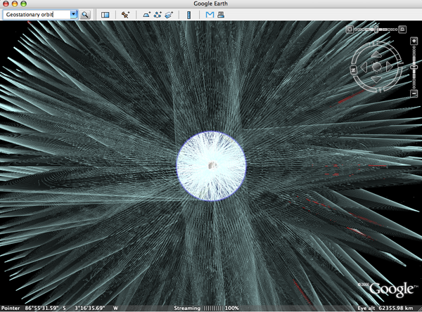
Its a limitation of Google Earth I regularly run into: the limitation in the ability to zoom out. Currently, the furthest one can zoom out is to 'eye altitude 62355.98 km' (how does that work again?), not even enough to view the complete Geostationary ring, as is apparent in below image of ![]() Paul's Geostationary satellites layer (note zoom level of the two images is nearly identical).
Paul's Geostationary satellites layer (note zoom level of the two images is nearly identical).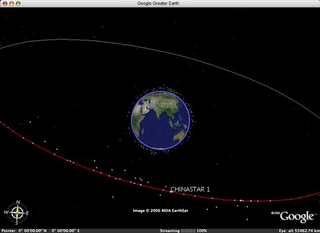
Arpanet of the future
Posted on Saturday, December 16, 2006
Here is a video I posted before about the early days of the Internet (Arpanet). Watching it again, its funny to see how the original ideas apply to the upcoming web as discussed in this Web2.0 Summit videocast between Eric Schmidt and John Battelle.
NASA-Google collaboration kick-off event
Posted on Thursday, December 14, 2006
Update2: Ames issued a release on friday announcing a media briefing this monday to discuss the NASA-Google Agreement.
Update: SpaceRef has the story that the joint announcement on collaboration which was to happen at the kick-off event is delayed...
A NASA-Google collaboration kick-off event is being organised at NASA Ames tomorrow today (Friday 15th) (Ames/Google personnel only it seems, more at NASA Watch, OgleEarth and more). Too bad I had to go back to Europe last week. Good luck Chris!
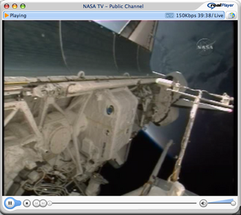
Christer Fuglesang out for a walk
Posted on Thursday, December 14, 2006
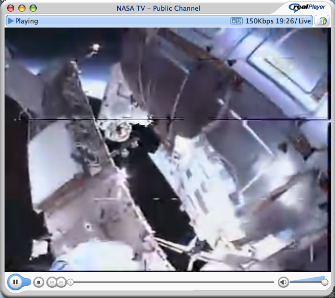
Update: they are back inside (01:21 CET)
For those of you connected to the Internet right now, Christer Fuglesang is out taking a walk.
YES2 is bloggin' again
Posted on Thursday, December 14, 2006
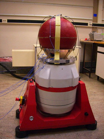
After a couple weeks offline due to an unfortunate hack, the YES2 website is back...as a blog! Yes, satellites also blog...
Finally we get to see some of the testing presently taking place on YES2 at ESA/ESTEC in order to deliver the flight hardware to ESA early next year. YES2 is scheduled for launch onboard Foton-M3 in September 2007. Keep up the great work guys...and keep that satellite bloggin'...
Stormy space weather ahead
Posted on Thursday, December 14, 2006
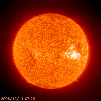
Update 18-12-06: Solar storm disrupts satellites
(via NASA Watch)
Opportunity has left the rim...
Posted on Wednesday, December 13, 2006
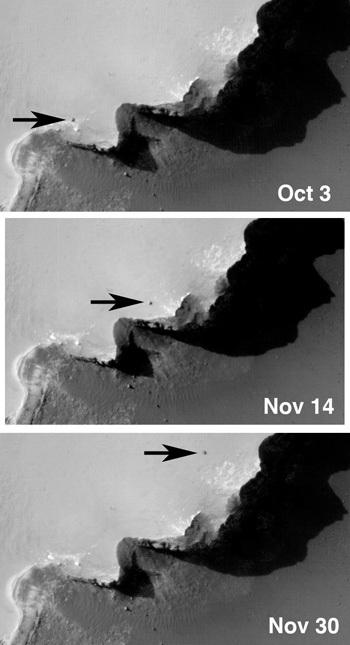
The Mars Reconnaissance Orbiter (MRO) keeps an eye out on the Mars Exploration Rovers as they scout the red planet. It has also found the landing sites of the two 1976 Viking Landers (more at NASA).
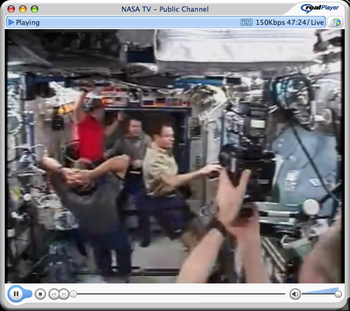
Big Brother ISS
Posted on Tuesday, December 12, 2006
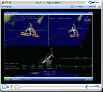
Just tuned into NASA TV (back after a couple of days offline illness), just in time for the live coverage of the hatch opening of the Space Shuttle Discovery to the International Space Station...'hatch opening...5:54 central time...6:54 Eastern' speaks the voice over...watching the two crews welcome eachother, and seeing the inside (and outside) of the space station from different camera positions, I start to wonder where I saw this before...
Its an expensive one, but its Big Brother allright...and quite an interesting one too...the only thing missing is the audio...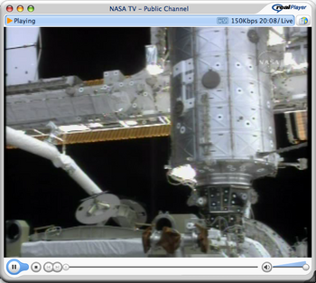
AIAA Space Exploration Conference
Posted on Tuesday, December 5, 2006
...started today in Houston. Read up-to-date blogging news from the conference at NASA Watch. One of the interesting comments sofar:
Replacement for TDRSS - and development of a comm system around the moon and then at Mars.
The Internet of things out there
Posted on Sunday, December 3, 2006
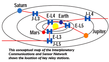
Doing some online research, I suddenly remember reading a fairly recent and interesting NASA Technical Memorandum (April 2004) on the thinking about the Interplanetary Communications Architecture and how it is to be developed. Ties in with earlier stories such as the Interplanetary Internet Project, which later went dormant and changed to the Delay Tolerant Network Research Group according to this wikipedia entry on Interplanetary Internet. Above image is taken from the NASA Computing, Information, and Communications Technology Program brochure where a project is described to:
"design the Interplanetary (or Solar System) Communications and Sensor Network. (page 10)
DinnerTV: Kurzweil, Gelernter, Dawkins & more
Posted on Saturday, December 2, 2006
- Ray Kurzweil and David Gelernter debate machine conciousness (2:43:30)
- Richard Dawkins on "The big Question: Why are we here?" (23:34)
- Geoserver Tech Talk at Google (54:10)
- NASA To the Moon and beyond (03:56) (is that animation done in Second Life or what?) (via brownian emotion)
Virtual space exploration update
Posted on Saturday, December 2, 2006
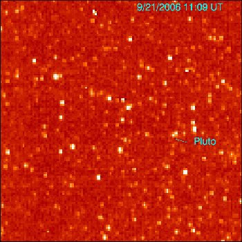
Seen at a distance of 4.2 billion kilometers, NASA's New Horizons mission captured a glimpse of its final target Pluto late September. Last week, NASA's Mars Reconnaissance Orbiter (MRO) mission located the landing site of the Mars Exploration Rover Opportunity (via Nasa Watch). By now, MRO's HiRISE team is flooding Mars images over the Internet.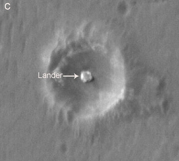
The future is process, not a destination
Bruce Sterling
Everything is ultimately becoming information technology
Ray Kurzweil
Data is the Intel inside
Tim O'Reilly
There is only one machine and the web is its OS
Kevin Kelly
The medium is the message
Marshall McLuhan