This was May 2007 | « April 2007 | Main | June 2007 »
Google Developers Day 31st May 07
Posted on Thursday, May 31, 2007
Disallow: bedroom
Posted on Thursday, May 31, 2007
Where2.0 is happening so lots to blog (e.g. Google Street View, KML 2.2 etc) but little time, so this one says it all for now:

(via spatially adjusted)
Here are a few other stories worth reading: RSS for the genes, Charlie's Diary: Shaping the future, The Final Days of Google, blog statistics are a drug (I can relate...)
Quick post
Posted on Friday, May 25, 2007
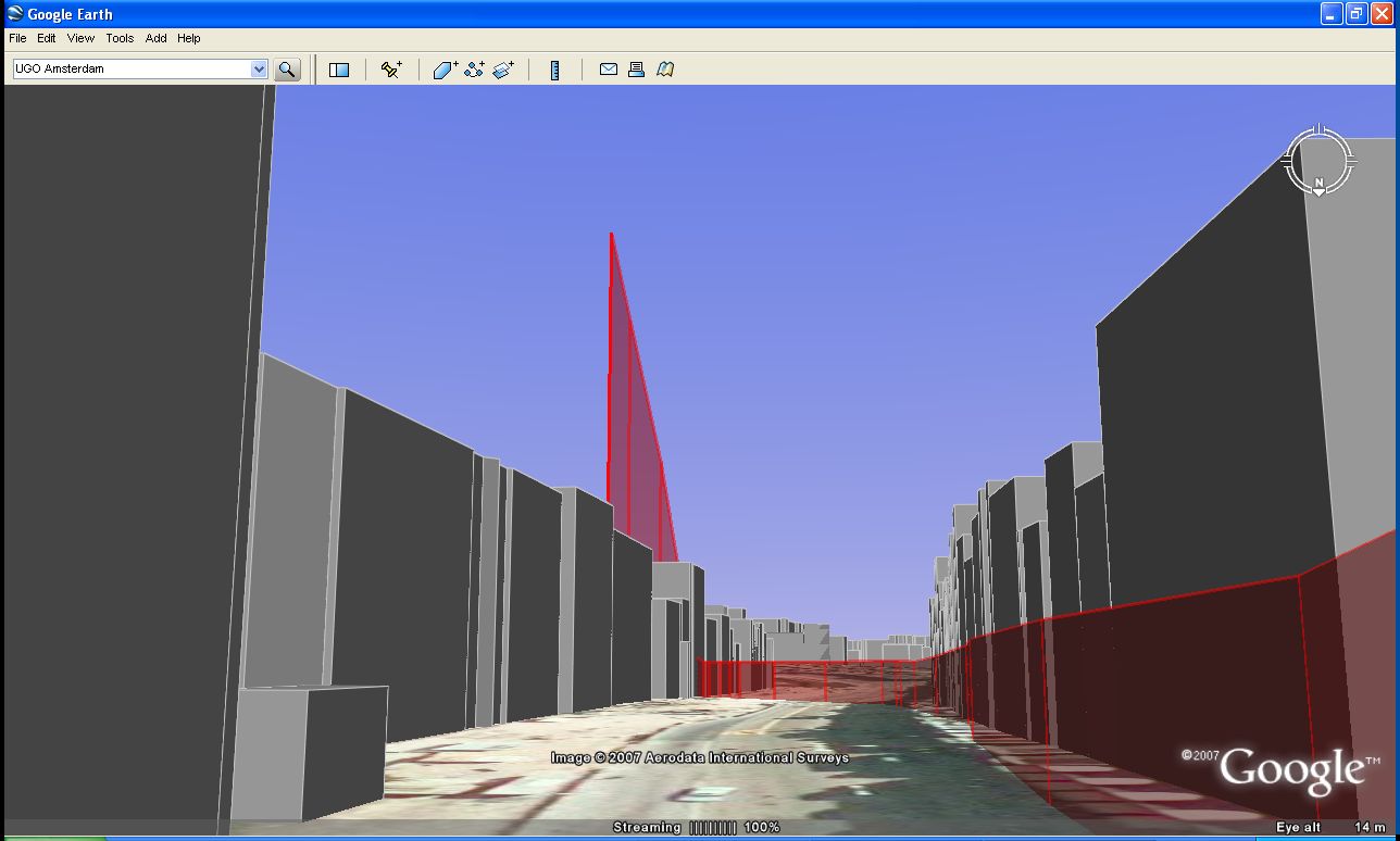
Light posting continues. A quick note to say that I will be moving servers over the coming days so there might be a brief interval where the blog appears funky. A quick look at the blogosphere brings up the news of Amsterdam being one of the first cities in Europe which is now included in the 3D Buildings layer of Google Earth. Cool! And a nice coincidence with my UGO testing ;).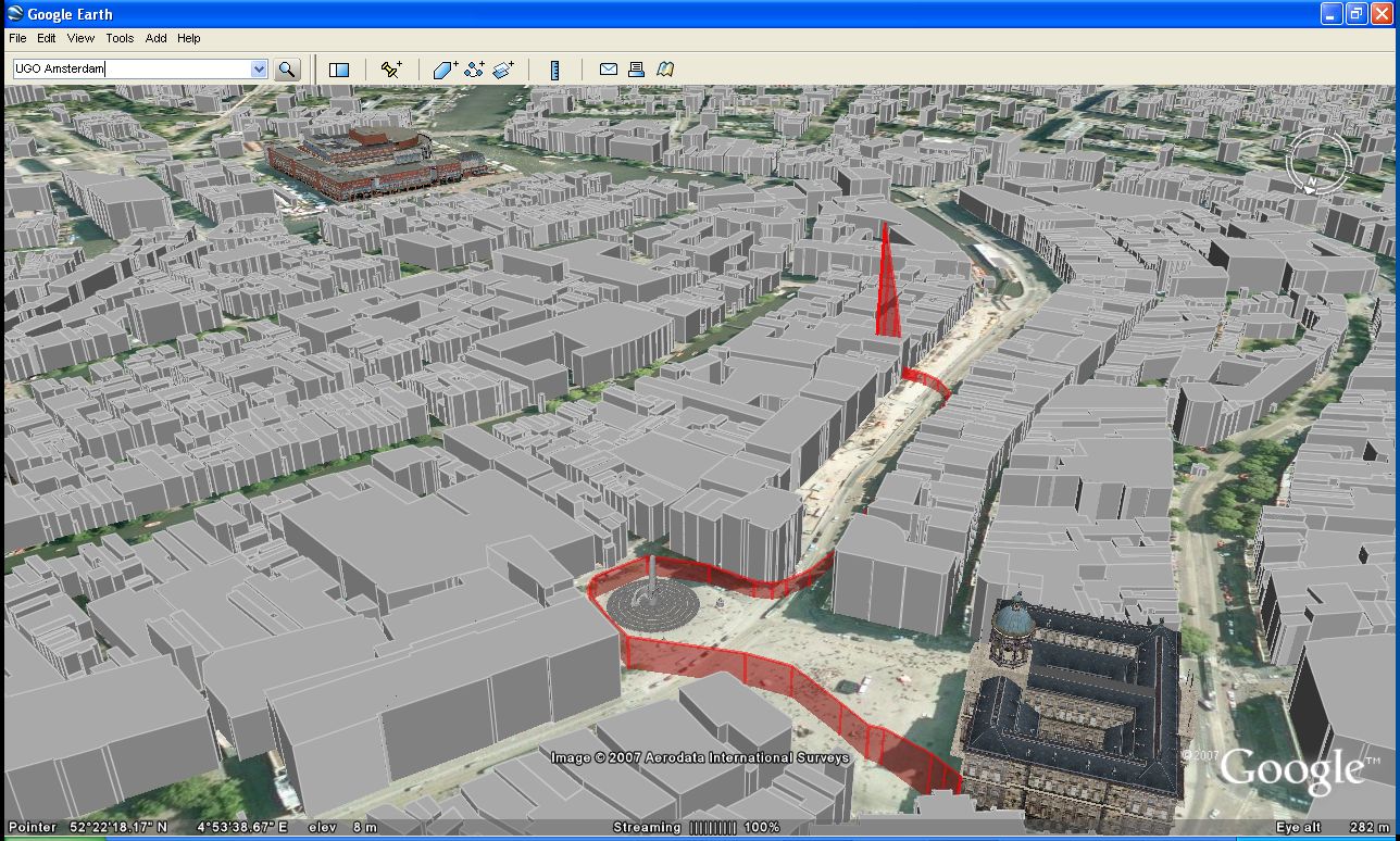
Hybrid World Lab
Posted on Sunday, May 13, 2007
Now this is a workshop I would have loved to go to, but missed unfortunately. Some powerpoints in pdf are available from Nicolas Nova and Timo Arnall. And here is a reader for the workshop (which just finished last friday...).
Light posting ahead
Posted on Saturday, May 12, 2007
Haven't been very active on this blog lately, which is mainly due to my full focus on the development of my UGO project, making me less susceptible to reading my section of the blogosphere on all the news coming out on a daily basis. I haven't finished my first build yet, so this light posting will likely continue for the coming days/weeks untill I finalise a first UGO app. In the meantime, some interesting developments worth noting:
- Search Engine Land (definitely a good read)
- a joke
- Anil Dash post
- News.com
And of course there is the news of a new WorldWind JAVA release.
Some other news items I found
Posted on Monday, May 7, 2007
Some other new items I came across these last few weeks:
- An update on the Google NASA colab
- An upcoming technology that might change how you view photos (check out this video, even if its only for the fine choice of Bach music)
- Mouse brain simulated on computer
One of these weeks...
Posted on Friday, May 4, 2007
One thing that has intrigued me for some time is the possibility to visualise my flightpath while surfing around in Google Earth. With a background in aerospace engineering, I guess the idea of orbiting the Earth comes somewhat natural to me (at least in spirit), and I have always found it striking that the movement of navigating Google Earth resembles the path of spaceflight hardware, be it rocket launches, ICBMs, re-entry capsules, Low Earth orbiting satellites, the ISS, basically anything space related (near Earth). This is also the reason why I started experimenting with my little python script (earlier post). Being somewhat of a mac guy, the fact that I was coding python to interface with the Google Earth COM API (only available in windows) kind of felt akward because it would not allow me to implement my idea as a cross platform tool. Untill the cross-platform GE Sharing showed me the way...
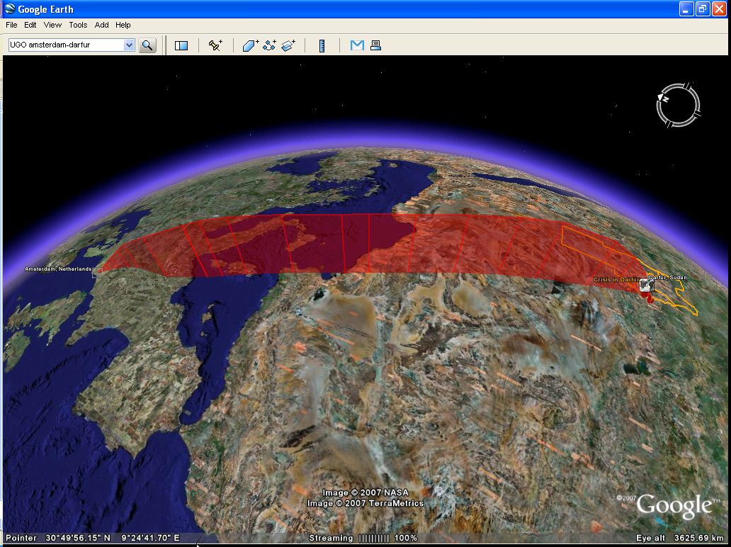
The last few weeks were one of these weeks where everything seemed to come together in that respect. First there was the introduction of the Darfur layer in Google Earth on April 10th (an eye opener!), followed about a week later with the introduction of the GE-sharing application. Following my somewhat premature comment on the Darfur implementation (good point OgleEarth), and OgleEarth's comment on my little python visualisation script, I figured it was time to put my mouth where my money is.
So, to put a long story short, I basically started a 2-week coding trip (lots of pizza, little sleep), working my way through CGI programming, python, KML, and server-client architecture, aiming to put my python script to use in a similar fashion as had been done so cleverly by the GE Sharing guys. But just when I thought I was closing in on it last weekend, I ran into some issues (both KML/networklink related and python related) which made me come to a somewhat unanticipated halt...
Nevertheless, even though my objective of a cross platform Google Earth visualisation tool has not materialised (yet!), I have been having a lot of fun flying around in Google Earth, testing my algorithms, visualising a lot of different flightpaths, and learning about the nitty gritty details of coding python, KML and cgi by trial and error. Along the way I have collected a wide variety of screendumps logging my progress, and I like these images already well enough to wanting to share them. So with my aim to continue the development of my little app (which I dubbed 'UGO', for 'User Generated Orbit'), I started a new blog called UGO where I will post some of the progress I made sofar and will keep on posting my progress towards this goal.
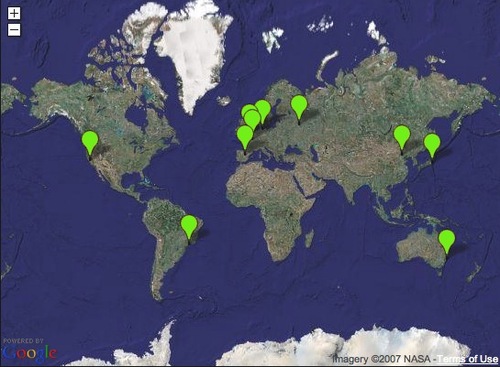
ps. Following up on my comment v.v. Darfur (earlier post), one of the other ideas that came to mind about how to harnass the collective outcry would be for people to use something like my little app to upload their personal 'Darfur UGO' and then aggregrate them all into one big Darfur layer, showing our concern the 'Google Earth way' ;) Here is mine already: kmz file.
Updated blog feed
Posted on Tuesday, May 1, 2007
Mmm, turns out I already had a FeedBurner account with several subscribed readers to this blog (re: earlier post). Strange how things like feeds can get this complicated...;) Anyway, to keep things organised I decided to delete the new account and merge its feed with the already existing one. For those of you who subscribed to the new one in recent weeks, please visit my blog's webpage and (re)-subscribe one more time to the FeedBurner link on the right.
To check if you have the correct feed, the correct FeedBurner account should now have the following URL: http://feeds.feedburner.com/tobedetermined (for Safari on OSX this should read: feed://feeds.feedburner.com/tobedetermined)
Thanx again...
The future is process, not a destination
Bruce Sterling
Everything is ultimately becoming information technology
Ray Kurzweil
Data is the Intel inside
Tim O'Reilly
There is only one machine and the web is its OS
Kevin Kelly
The medium is the message
Marshall McLuhan